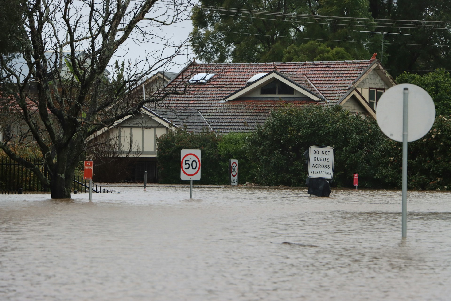
How Elevation Certificates Affect Your Flood Insurance Rates

flood insurance rates

Flooding can become a significant concern, especially in areas like Florida where hurricanes and heavy rains are common. When it pours, the damage can range from minor to catastrophic. Homeowners and property managers constantly face the challenge of finding the right insurance to protect their property investments. Elevation certificates play a crucial role in this process. These documents serve as critical go-betweens for property owners and insurance companies, ensuring everyone understands the property’s risk level.

Why does it matter, you ask? The better you understand your property’s elevation, the better you can manage your flood insurance premium. That’s because elevation certificates detail the specific measurements of a building’s risk regarding potential flood damage. By offering a detailed perspective on the relationship between your property and possible flood levels, these certificates provide clarity for both insurers and property owners.

Understanding Elevation Certificates

An elevation certificate is a snapshot of your property’s risk factors concerning flooding. It provides several key details that insurance companies use to determine your flood insurance rates. Think of it as a report card, but instead of grades, it lists how your property stands up to potential floods.

Components of an elevation certificate typically include:

  1. Building Elevation: This is the most crucial part, measuring precisely how high your property’s lower floor is compared to the base flood elevation.
  2. Location Details: Including maps and photographs that show the general location of the property.
  3. Key Infrastructure: The certificate also marks important structural details like floor and basement elevations, which play significant roles in flood risk evaluation.

Each of these elements helps to form a complete picture of a property’s vulnerability to flooding. By highlighting any flood risk concerns, the certificate becomes a valuable tool for assessing potential impacts on insurance rates. It bridges the gap between what insurers need to calculate premiums and what property owners need to ensure their coverage is right-sized.

So, why the fuss about elevation certificates? Imagine you own a home in a low-lying part of town. If your property’s elevation certificate shows it’s above the baseline flood elevation, your insurance rates might be more favorable. Conversely, being below means a higher risk, and likely, a heftier premium. Either way, knowing where your property stands gives you the upper hand in negotiating or validating insurance rates.

How Elevation Certificates Affect Flood Insurance Rates

Flood insurance is like that trusty old raincoat; you might not need it every day, but when you do, it’s invaluable. In Florida, having the right coverage is even more vital due to the state’s susceptibility to floods. Elevation certificates directly influence these insurance rates by providing essential data about a property’s flood risk.

Here’s how it works:

  • Risk Assessment: An elevation certificate helps assess how likely it is for your property to experience flooding. The higher your property sits compared to the floodplain, the lower the risk.
  • Premium Calculation: Insurance companies rely on this risk assessment to decide how much they’ll charge for coverage. Lower flood risk often means lower insurance costs.
  • Coverage Decisions: Some insurers may decline to provide full coverage if the certificate shows a high flood risk, affecting your decision-making for purchasing or improving the property.

Understanding these connections will guide you in making informed decisions about your property. By obtaining an elevation certificate, you gain valuable insights into how your insurance premiums are set, enabling you to take proactive steps to ensure adequate and cost-effective coverage.

Steps to Obtain an Elevation Certificate

Getting your hands on an elevation certificate is a straightforward process, but it does require some specific steps to ensure everything goes smoothly. First, you’ll need to reach out to a licensed surveyor or an engineer who is familiar with creating these documents. Their expertise is important because they know how to properly measure elevations and document everything that an insurance company might need to know.

Here’s a quick rundown of how to get an elevation certificate:

  1. Contact a Professional: Find a local surveyor or engineer with experience in floodplain management. They’ll be your go-to resource for accuracy and compliance.
  2. Schedule the Survey: Arrange a time for the surveyor to visit your property. Make sure they have access to all parts of your property that need assessing.
  3. Receive the Certificate: Once the surveyor completes their work, they will provide you with the elevation certificate, outlining all relevant information.
  4. Review the Details: Look over the certificate carefully. Ensure there are no discrepancies between the paperwork and your property’s actual layout.

Hiring a trained professional ensures that your certificate will meet the standards required by insurance companies. Plus, with expert help, you’re less likely to encounter errors that could cost you money or raise your flood insurance rates.

Maintaining and Updating Your Elevation Certificate

The responsibility doesn’t end once you have the certificate. Over time, changes to your property or surrounding areas can affect your elevation information. It becomes important to keep this document updated so that your insurance remains accurate and reflective of your real flood risk.

Some scenarios might prompt you to update your elevation certificate:

  • Renovations: Adding new structures or altering existing ones can change the elevation profile.
  • Natural Changes: Shifts in land due to erosion or other environmental factors.

By updating your certificate, you ensure that your insurance premiums stay in line with your actual risk, potentially saving you money if your risk decreases or keeping you properly covered if it increases.

If updates are needed, repeat the steps to hire a surveyor or engineer to reassess your property. Staying proactive about these changes not only protects your property but also keeps you financially sound against unforeseen flood risks.

Protect Your Investment with Will’s Service Group

Flood insurance plays a big role in protecting your home and finances from natural disasters. And while the process of obtaining and updating an elevation certificate might seem like an extra step, it’s a valuable one. This document helps make sure you’re not paying more than necessary for insurance while still keeping your property safe.

By trusting the expertise of a professional during this process, you ensure that your certificate will meet all necessary standards. These investments of time and resources go a long way in minimizing the chances of unpleasant surprises related to insurance and flooding.

To make sure your property in Florida is well-protected against flooding risks, consider getting an elevation certificate with the help of Will’s Service Group. Our team of skilled surveyors will provide you with the accurate documentation you need to keep your flood insurance rates fair and your home safe. Trust us to navigate the process smoothly and provide peace of mind for your future.

Unexpected Issues Revealed by Elevation Certificates in Florida

house flood

Dealing with flood risks is a key part of property ownership in Florida, underscoring the necessity of elevation certificates for both owners and potential buyers. An elevation certificate provides essential information regarding a property’s elevation relative to the base flood level. This document influences decisions about flood insurance and property assessments, which are vital for protecting investments in the Sunshine State.

In Florida, where hurricanes and tropical storms frequently pose a threat to coastal and low-lying areas, an accurate elevation certificate is more than a mere formality. It plays a pivotal role in determining a property’s flood zone status, directly impacting insurance premiums and even the feasibility of certain development or renovation projects. Understanding the value and function of an elevation certificate allows property owners to avoid unexpected surprises and plan more effectively for the future.

Common Issues Revealed by Elevation Certificates

Despite their importance, elevation certificates can sometimes uncover unexpected issues that complicate property ownership. One common challenge involves discrepancies in elevation data. If the elevation of a property is inaccurately reported or misunderstood, it can alter flood zone determinations, affecting insurance costs and potentially leading to compliance issues if the property’s actual flood risk is greater than initially assumed.

Consider a scenario where you’re preparing to renovate a beachside home, only to discover afterward that it’s situated in a higher-risk flood zone than anticipated. This could necessitate more extensive modifications to meet safety standards, escalating costs beyond your original budget. Discrepancies often arise from outdated data or errors in previous surveys, highlighting the need for regular updates with accurate surveys.

Here’s how inaccuracies in elevation data can impact:

– Insurance Premiums: Incorrect data can lead to underestimating or overestimating flood risk, skewing insurance premiums.

– Property Values: If the true flood risk of a property becomes known, it could negatively affect its resale value.

– Legal Compliance: Incorrect elevation data might result in unintentional violations of local floodplain management laws.

These issues emphasize the need for precise and regular elevation surveys, ensuring that data is accurate and current to avoid insurance, compliance, and unexpected expenses headaches. Taking these steps helps manage immediate risks and guards against potential future challenges.

The Importance of Accurate Elevation Data

Accurate elevation data is crucial for compliance with local regulations. Florida faces unique challenges due to its flood susceptibility, making precise elevation measurements necessary. Without accurate data, property owners might unintentionally violate floodplain management rules, resulting in hefty fines or legal issues.

From a financial perspective, incorrect elevation data can have serious repercussions. If a property’s flood risk is misrepresented, unexpected expenses may arise. An overestimated risk could lead to unnecessarily high insurance premiums, while underestimating might leave an owner without adequate coverage. This lack of understanding can complicate and make costly what seemed to be a secure investment.

How to Address Issues Found in Elevation Certificates

Discovering an issue in an elevation certificate doesn’t have to spell disaster. Once identified, these issues can be addressed by taking the right steps:

– Review the Certificate: Begin by thoroughly reviewing the current elevation certificate for any possible errors or outdated information.

– Consult with Professionals: Engaging a professional surveyor to reassess and verify the data on the certificate is essential. They have the expertise to ensure accuracy and can identify discrepancies that might have been missed.

– Update the Certificate: If discrepancies are found, promptly update the elevation certificate to reflect accurate, up-to-date information.

By taking these steps seriously, property owners can mitigate risks and avoid potential legal or financial pitfalls.

The Role of Professional Surveyors in Florida

Professional surveyors are essential for managing complex elevation data issues in Florida. With their deep understanding of local geography and regulations, they provide insights beyond simple data gathering. Their expertise ensures that elevation certificates are not only accurate but also comply with local laws.

Qualified surveyors help avoid compliance issues. They use advanced techniques to deliver precise measurements, significantly reducing error chances that can lead to costly consequences. Relying on these experts allows property owners to protect their investments and navigate Florida’s regulatory landscape more easily.

Having a professional handle these details keeps property owners informed and confident, knowing their decisions are based on reliable information. This kind of knowledge provides peace of mind, enabling smarter planning and management of property assets in Florida’s unique environment.

Wrap up your property management with confidence by addressing elevation issues promptly. Trust the team at Will’s Service Group to ensure your elevation certificate accurately reflects your property’s status. To get started or learn more about the benefits of having an accurate elevation certificate in Florida, visit us today. Let’s protect your investment together.

Issues That Elevation Certificates Can Highlight Before Building

Elevation Certificates

Before starting a construction project in Florida, obtaining an elevation certificate is a smart move. An elevation certificate is a document that provides detailed information about a property’s elevation relative to the base flood elevation of the area. It’s vital for identifying how vulnerable a property might be to flooding, and it can significantly influence building plans and insurance rates. In a state like Florida, where water-related issues are common, understanding elevation is not just beneficial but often necessary.

Securing an elevation certificate is a key step in the planning process because it provides crucial data that helps ensure your building complies with local regulations. Building in a flood-prone area without understanding these risks can lead to costly mistakes and potential harm to the property. Elevation certificates offer peace of mind by highlighting potential issues before they become problems. Simply put, they provide a clear picture essential for making informed decisions when it comes to building on your land.

Identifying Flood Risk Areas

One of the main advantages of having an elevation certificate is its ability to highlight flood-prone zones. Florida is known for its beautiful but sometimes unpredictable weather, making flood risk a significant concern. These certificates offer a bird’s-eye view of a property’s layout, showing exactly how the land’s elevation relates to surrounding flood-prone areas.

Understanding whether part or all of your property lies in a high-risk flood zone is crucial. By identifying these areas beforehand, you can take steps to mitigate risks or even reconsider building plans if a site is deemed too dangerous. Knowledge of flood risks can also prove invaluable when it comes to planning drainage systems and positioning your building to minimize exposure to potential hazards.

Beyond safety, knowing your flood risk can have financial implications as well. Insurance companies use risk levels determined by elevation certificates to assess how much you should pay for flood insurance. Properties with a higher risk of flooding generally come with higher premiums. Being well-informed about your property’s elevation reduces surprises when dealing with insurance and ensures you’re not paying more than necessary.

An elevation certificate isn’t just a precaution; it’s a proactive tool that guards your investment and keeps your future property and its inhabitants safe. With it, you get the clarity required to make strategic, safe, and cost-effective choices for your building project.

Determining Proper Building Elevations

An elevation certificate serves as an invaluable guide for setting the proper building elevations for your property. It gives you precise data about how high above the base flood elevation your home or structure needs to be. This information is like having a map that tells you the safest and most compliant way to proceed with your building plans. Without it, you could be building a home that’s vulnerable to flooding or not in line with local codes.

Elevations play a key role in meeting building codes promptly. Florida, for instance, has strict guidelines aimed at minimizing flood risks and ensuring structural safety. When your building’s elevation is correctly set, you align with these requirements and avoid costly changes later. An elevation certificate thus becomes a cornerstone, helping you lay a solid foundation that meets all necessary standards from the start.

Influencing Insurance Rates

Another significant benefit of an elevation certificate is its impact on flood insurance premiums. It’s no secret that insurance can become a major expense if your property is in a high-risk flood zone. However, an elevation certificate might just be your ticket to more manageable rates. Seeing the detailed elevation data, insurance companies can better assess how likely it is for your property to flood and adjust your premiums accordingly.

By ensuring your building is constructed at the appropriate elevation, you might keep those insurance costs in check. You’re showing that you’ve taken all necessary steps to mitigate flood risk, and insurance companies often reward this level of preparedness. In simpler terms, a small adjustment in elevation could lead to larger savings on your annual insurance bills.

Ensuring Compliance with Regulations

Staying on good terms with local regulations is essential when you’re building. Here, elevation certificates again prove their worth. These documents help ensure that your project complies with both state and local rules. This is not just about following the law; it’s about avoiding potential headaches in the form of fines or project delays.

Non-compliance can bring construction to a grinding halt, adding unexpected costs to your budget. Worse still, it might lead to having to tear down and rebuild parts of your structure to meet the codes. An elevation certificate acts like a checklist item that you can mark as complete, knowing you’re on the right path.

Enhancing Property Value and Safety

Securing an elevation certificate doesn’t just help you while building; it enhances the property’s value and safety for the future. By proving that your home or building is less prone to flooding, you make it more appealing to potential buyers. People want peace of mind, and knowing a property is safeguarded against flood risks adds a layer of security that buyers appreciate.

Beyond financial value, an elevation certificate also translates to long-term safety. It ensures the building is designed to endure what Mother Nature might throw at it. For both homeowners and investors, this means less worry about structural damage during severe weather, keeping your property—and those in it—safe.

Protecting Investments and Peace of Mind

In the journey of building a home or commercial space, an elevation certificate might seem like a small piece of paper, but it’s so much more. It forms the backbone of a secure, compliant, and cost-effective building process. Knowing that you’ve anticipated potential flooding and adhered to regulations ensures that your investment is well protected.

This proactive step not only guards your property but also reassures you that you’re ready for anything. With an elevation certificate in hand, you can rest easy knowing that your building is constructed to last and your investment is secure against future challenges. It’s a little effort now, paving the way for big rewards down the road.

Building with the right elevation is smart not only for the immediate safety and financial benefits but also for the long-term value of your property. If you’re planning a construction project in Florida and need guidance, securing an elevation certificate with Will’s Service Group can make all the difference. This step will not only ensure your project’s compliance with local regulations but also offer you peace of mind that your investment is protected.

Why an Elevation Certificate Is Important for Your Home

elevation certificate

Understanding the importance of an elevation certificate can save you time, money, and effort when it comes to your home. An elevation certificate is a document that provides crucial information about the elevation of your property relative to the base flood elevation. 

This certificate is vital for homeowners, especially those living in areas prone to flooding. Read on to know what an elevation certificate is and why it’s important and essential for every homeowner, especially in flood-prone areas.

What Is an Elevation Certificate?

An elevation certificate is an official document that details the specific elevation of a property in relation to the base flood elevation (BFE). The BFE is the computed elevation to which floodwater is anticipated to rise during a major flood event. Knowing how high or low your home sits compared to this level is crucial for flood risk assessment.

Insurance companies often require this certificate to determine your flood insurance rates. It provides essential data such as the location of the building, the elevation of different parts of the structure, and the flood zone in which the property is situated. This document is typically prepared by a licensed surveyor, engineer, or architect.

The elevation certificate helps both homeowners and insurance companies in making informed decisions. For the homeowner, it spells out flood risks and the need for protective measures. For the insurer, it offers a clear picture of the potential risk, which directly influences the cost of your flood insurance.

Key Components of an Elevation Certificate

An elevation certificate consists of several crucial sections, each providing valuable information about your property and its flood risk. Here are the key components:

1. Property Information: This section includes details such as the property address, legal description, and owner name. It also notes the type of building and its specific location on the property.

2. Building Characteristics: Information about the structure of the building, including the number of floors, type of basement, use of crawlspaces, and elevation of the lowest floor. These details help assess the flood risk more accurately.

3. Elevation Data: Perhaps the most critical part is that this section provides the elevations of various points on the property. It includes the height of the lowest floor, the next higher floor, and the lowest elevation of the machinery and equipment servicing the building.

4. Flood Zone Information: This section identifies the flood zone in which the property is located. It also indicates the base flood elevation as determined by local flood maps and ordinances.

5. Certification: The final part includes signatures and credentials of the surveyor, engineer, or architect who prepared the certificate. This ensures the accuracy and legitimacy of the document.

When and Why You Need an Elevation Certificate

You need an elevation certificate in several scenarios, each of which underscores its importance. One primary reason is acquiring flood insurance. Insurance companies require this document to price your flood insurance premiums accurately. Without it, your premiums could be based on assumptions, potentially leading to higher costs.

Another key reason to obtain an elevation certificate is when buying or selling a home. Potential buyers often want to see it to understand any flood risks associated with the property. Providing this document can expedite the sales process and make your property more attractive to buyers who are concerned about flood risks.

Local building authorities may also require an elevation certificate before issuing permits for significant renovations or new constructions. This helps ensure that any new building work complies with floodplain management and building code requirements. 

How to Obtain an Elevation Certificate for Your Home

Obtaining an elevation certificate is a straightforward process if you know the steps involved. Here’s a simple guide to help you get started:

1. Hire a Professional: The first step is to hire a licensed surveyor, engineer, or architect. These professionals have the expertise and credentials needed to accurately complete your elevation certificate.

2. Site Visit and Data Collection: The chosen professional will visit your property to measure the elevations of various key points. This includes the lowest floor, any equipment servicing the building, and other relevant spots.

3. Prepare the Certificate: After collecting the data, the professional will fill out the elevation certificate form. This document will include all necessary elevation data, building characteristics, and flood zone information.

4. Review and Verify: Before finalizing, review the certificate to ensure all details are accurate. Mistakes can lead to issues with insurance and compliance, so it’s crucial to verify all information.

5. Submit to Relevant Authorities: Once the elevation certificate is complete and verified, you can submit it to your insurance company, local building authorities, or any other relevant parties. Keep a copy for your records as well.

Conclusion

Obtaining an elevation certificate may seem like a complex process, but it boils down to hiring a skilled professional, conducting an accurate site visit, and reviewing the collected data. This preparation ensures that your elevation certificate is correct and beneficial for its intended purposes.

For comprehensive services and expert assistance in obtaining an elevation certificate in  Florida, Will’s Service Group is here to help. Contact us today to ensure your property is accurately assessed and compliant with all necessary regulations.

How Elevation Certificates Impact Your Flood Insurance

elevation certificates

Flood insurance can be a significant part of owning a property, especially if you live in a high-risk area. To determine your flood insurance rates, the Federal Emergency Management Agency (FEMA) and insurance companies heavily rely on elevation certificates. These documents provide detailed information about your property’s elevation relative to a base flood elevation, helping insurers assess flood risks accurately.

Understanding what an elevation certificate is and how it impacts your flood insurance can save you money and ensure you have the right coverage. Elevation certificates include vital data about your property’s location, its lowest points, and other features that could affect flood risks. This data is crucial for both insurance companies and property owners who want to protect their investments effectively.

Acquiring an elevation certificate might seem complicated, but it’s a straightforward process that involves hiring a qualified surveyor. Once you have this certificate, you can potentially lower your flood insurance premiums and have peace of mind knowing that your property is better protected against flood damage. 

So, let’s explore what elevation certificates are, why they are essential for flood insurance, how to obtain one, and the benefits they offer to property owners.

What is an Elevation Certificate?

An elevation certificate is a document that provides detailed information about a property’s elevation relative to a base flood elevation (BFE). Surveyors use specialized equipment to measure the elevation of various parts of the property, such as the finished floor, the ground near the building, and the lowest points like basements or garages. This data helps determine the property’s risk of flooding.

Elevation certificates include important details such as the property’s address, a detailed sketch or map, and precise elevation measurements. The certificate also lists the flood zone designation and other relevant notes about the property’s flood risk. These measurements and information help both homeowners and insurance companies assess how vulnerable the property is to flooding.

Having an accurate elevation certificate can significantly impact many aspects of property management and risk assessment. It’s an essential tool for making informed decisions about flood insurance and understanding the true flood risk of your property. Plus, it ensures that any construction or remodeling meets local floodplain management regulations.

Why Elevation Certificates Matter for Flood Insurance

Elevation certificates play a crucial role in determining flood insurance rates. Insurance companies use the data from these certificates to assess how likely a property is to flood. Properties with lower elevations in high-risk flood zones may face higher insurance premiums, while those with higher elevations might qualify for lower rates.

Here are some key reasons why elevation certificates matter for flood insurance:

1. Accurate Risk Assessment: They provide precise data about your property’s elevation, helping insurers accurately assess flood risk and set appropriate premiums.

2. Potential Premium Reduction: If your property is elevated above the base flood elevation, you may be eligible for lower flood insurance rates. An elevation certificate is essential for proving this elevation.

3. Compliance with Regulations: Elevation certificates help ensure that your property meets local zoning and floodplain management regulations, which can affect insurance eligibility and premiums.

4. Peace of Mind: Knowing exactly where your property stands in relation to potential flood risks provides peace of mind. It helps you understand if you need additional protection measures.

5. Aid in Disaster Recovery: In the event of a flood, an elevation certificate can speed up the insurance claims process by providing insurers with accurate, necessary data.

Elevation certificates are invaluable for anyone looking to manage their flood insurance costs effectively. They offer a clear picture of flood risks and ensure that premiums reflect the true vulnerability of the property.

How to Obtain an Elevation Certificate

Getting an elevation certificate is a relatively straightforward process, but it does require some steps and coordination. Here’s how you can obtain one:

1. Hire a Professional Surveyor: The first step is to hire a licensed land surveyor, architect, or engineer who is qualified to perform the elevation survey. They will use specialized tools to take accurate measurements of your property’s elevation.

2. Schedule the Survey: Once you’ve selected a professional, schedule a time for them to come to your property. They will need access to various parts of your property, including potentially hard-to-reach areas like basements or crawlspaces.

3. Conduct the Survey: The surveyor will measure the elevation of key points on your property, such as the lowest floor and any attached garages. They might also take pictures and notes to document the process.

4. Receive the Certificate: After the surveyor completes their work, they will compile the data into an official elevation certificate. This document will include all necessary measurements, flood zone information, and any other relevant notes.

5. Submit to Insurer: Once you have the certificate, submit it to your insurance company. They will use the information to calculate your flood insurance rates accurately.

Having a detailed and accurate elevation certificate can make a significant difference in your flood insurance premiums and provide valuable peace of mind.

Key Benefits of Elevation Certificates for Property Owners

Elevation certificates offer several benefits for property owners, especially those in flood-prone areas. Here are some of the main advantages:

1. Lower Insurance Premiums: If your property is elevated above the base flood level, you may qualify for lower flood insurance rates. An elevation certificate proves your elevation status to insurers.

2. Accurate Risk Assessment: Knowing your property’s exact elevation helps you understand your true flood risk. This can be crucial for planning renovation projects or making other property improvements.

3. Increased Property Value: Properties that are less vulnerable to flooding are often more attractive to buyers. An elevation certificate can serve as a selling point, showing that the property is at a reduced risk.

4. Regulatory Compliance: Elevation certificates help ensure your property meets local building and zoning regulations. This is especially important if you plan to build an addition or make other changes.

5. Disaster Preparedness: With precise elevation data, you can better prepare for potential flooding. This knowledge allows you to take preventative measures to protect your property.

6. Peace of Mind: Knowing your property’s elevation and flood risk can give you confidence in your insurance coverage. It ensures you are properly protected against potential flood damages.

The Importance of Elevation Certificates in Determining Flood Insurance Premiums

Understanding and obtaining an elevation certificate is crucial for any property owner concerned about flood risks. These certificates provide detailed information that insurance companies use to assess flood risks and determine premiums. By obtaining an elevation certificate, you can potentially lower your flood insurance costs, ensure regulatory compliance, and better prepare your property for possible flooding.

If you’re looking to get an elevation certificate in Florida or have questions about how it affects your flood insurance, contact Will’s Service Group. Our expert team is here to help you navigate the process and ensure your property is well-protected!

Elevation Certificates: Why They Matter and How They Benefit Property Owners

Elevation Certificate

Natural disasters, such as floods, can cause devastating damage to properties, leading to costly repairs and emotional distress for property owners. Managing flood risks has become increasingly essential as communities grow and climate change continues to bring unpredictability to weather patterns. Authorities and the National Flood Insurance Program (NFIP) have established regulations to protect properties within flood-prone areas and ensure the safety and well-being of communities at large. One critical aspect of these regulations is the requirement of an elevation certificate for certain properties.

As expert land surveyors, we have extensive experience in providing elevation certificates for residential and commercial property owners. We understand how crucial they are in delivering accurate, reliable information about flood risks and their potential impact on properties. In this detailed blog post, we aim to demystify elevation certificates, discuss their importance in floodplain management, and explain how they can benefit property owners.

1. Understanding Elevation Certificates: A Key Tool in Floodplain Management

An elevation certificate is an official government document that provides critical information about a property’s elevation in relation to the base flood elevation (BFE) of a particular area. The BFE is the level to which floodwaters are anticipated during a base flood event, typically referred to as the 100-year flood. Elevation certificates serve as a valuable tool in floodplain management, as they help determine potential flood risks, ensure compliance with local floodplain regulations, and aid in planning construction and property improvements.

2. The Role of Professional Land Surveyors: Providing Accurate Elevation Certificates

When it comes to obtaining elevation certificates, property owners must rely on the expertise of licensed land surveyors, as they possess the knowledge, skills, and tools necessary to perform this specialized service accurately. Here are the essential steps and procedures involved in acquiring an elevation certificate:

Property Inspection

Land surveyors initiate the process by thoroughly inspecting the property, taking into account its unique features, such as the building structure, foundation type, and the presence of any flood protection mechanisms.

Elevation Measurement

Utilizing state-of-the-art tools and equipment, such as GPS receivers, electronic levels, and data collectors, land surveyors conduct precise elevation measurements on various points of the property. These measurements are critical in determining potential flood risks and establishing the property’s compliance with local floodplain regulations.

Documentation

Once the land surveyor has captured all necessary information, they proceed to complete the official elevation certificate form, which includes details about the property’s elevation, building characteristics, flood protection measures, and flood zone classification.

Submission and Verification

Upon completion, the land surveyor provides the property owner with the certified elevation certificate, ready for submission to the responsible government agency, insurance company, or any other relevant authority requiring the document.

3. Benefits of Elevation Certificates for Property Owners

Elevation certificates serve several crucial purposes, offering valuable benefits to property owners within flood-prone areas. Some of these benefits include:

Flood Insurance Coverage

Most mortgage lenders and insurance providers require an elevation certificate for properties within designated flood zones. This document plays a vital role in obtaining the necessary insurance coverage for flood damage, as it helps insurers determine the appropriate flood insurance premium based on the property’s specific flood risk.

Informed Decision-Making

For property owners planning new construction projects or property improvements, an elevation certificate is indispensable in making informed decisions. It provides valuable insights into potential flood hazards, enabling property owners to evaluate their construction options more effectively and implement flood-resistant designs.

Flood Risk Mitigation

Armed with accurate information on a property’s elevation and potential flood risks, property owners can take proactive steps to mitigate potential damage. This may involve raising the property to a sufficient height above the BFE, installing floodproofing measures, or implementing proper floodplain management practices.

Compliance with Local Floodplain Regulations

By obtaining an elevation certificate, property owners increase their chances of maintaining compliance with local floodplain regulations, which may require specific construction techniques or property modifications to minimize flood risks. This ultimately contributes to the overall safety and well-being of the community affected by flooding events.

Protect Your Property with an Elevation Certificate

In today’s climate, understanding your property’s flood risk and adhering to floodplain management guidelines is more critical than ever. Elevation certificates play a vital role in assessing flood risks and ensuring compliance with local regulations, ultimately contributing to a safer, more resilient community.
If you require a professional elevation certificate for your property, reach out to our team of experienced land surveyors at Will’s Service Group. We are dedicated to providing accurate, timely, and reliable elevation certificates in Florida to help you protect your most valuable asset – your property.

Elevation Certificates: The Essential Guide for Residential Flood Insurance and Risk Management

land surveyor

Floods are among the most common and destructive natural disasters worldwide, with the potential to cause significant damage to our homes, properties, and quality of life. As a responsible homeowner, it’s important to take action to minimize the risk associated with floods, including securing appropriate flood insurance coverage. A key component in obtaining flood insurance and effectively managing risk is the elevation certificate, an often-overlooked but essential document. As land surveyors with extensive experience in providing elevation certificates, we understand the vital role they play in maximizing property protection.

In this comprehensive guide, we will delve into the world of elevation certificates, discussing their primary function, the process of obtaining one, and how these documents can help you better understand and manage potential flood risks for your residential property. We will also address the importance of working with a skilled, knowledgeable land surveyor to ensure the accuracy and reliability of your elevation data and share the ways an elevation certificate contributes to responsible, proactive flood risk management.

Elevation Certificates: An Overview

An elevation certificate is a vital document that provides important information about the elevation of a residential property’s structure in relation to the base flood elevation (BFE). The BFE represents the anticipated water level a property may experience during a major flood event, also known as a 100-year or 1% annual chance flood. Obtaining an accurate elevation certificate is crucial, as this information is used by insurance companies to calculate the appropriate flood insurance premiums for a property, ensuring proper coverage in case of a flood event.

The Process: Obtaining an Elevation Certificate

To obtain an elevation certificate, it is essential to partner with a professional land surveyor. Here is an outline of the process involved in securing an elevation certificate:

  • Hiring a Land Surveyor: Engage a competent, reliable surveyor with experience in conducting elevation certificates to ensure accuracy.
  • Property Assessment: The land surveyor will visit your property to assess key elevation elements, including determining the location of flood zones, the BFE, and identifying the lowest and highest points of your property’s structure.
  • Data Recording: The surveyor will accurately record measurement data on an official elevation certificate form, which adheres to the guidelines and requirements set by the Federal Emergency Management Agency (FEMA).
  • Submission and Review: Submit the completed elevation certificate to your insurance company, where the information will be used to determine your flood insurance premiums.

The Importance of Accurate Elevation Certificates

An accurate elevation certificate is paramount for several reasons, including:

  • Flood Insurance Premiums: Insurance companies rely on elevation certificate data to determine the appropriate flood insurance premiums for a property. Accurate data helps ensure that premiums accurately reflect the property’s flood risk.
  • Regulatory Compliance: Local building codes and floodplain management requirements may necessitate elevation certificates for new construction or property modifications. Accurate elevation data ensures compliance with these requirements and helps protect the property from flood damage.
  • Informed Decision-Making: Understanding a property’s elevation data can facilitate strategic decisions regarding property improvements, such as adding flood-resistant features or planning potential property alterations.

The Role of a Professional Land Surveyor

Working with an experienced, knowledgeable land surveyor is essential for obtaining a precise and reliable elevation certificate. When selecting a surveyor, consider the following factors:

  • Experience and Expertise: Choose a surveyor with a proven track record of delivering accurate, high-quality elevation certificates. Look for reviews, testimonials, or recommendations from others in the community who have used their services.
  • Local Knowledge: A surveyor with experience in your local area will have a better understanding of local flood zones, BFEs, and any unique characteristics that may affect your property’s elevation data.
  • Regulatory Familiarity: A qualified surveyor will be well-versed in FEMA guidelines and local building code requirements, ensuring that your elevation certificate meets all necessary standards.

Unleash the Power of Elevation Certificates

Elevation certificates play a critical role in residential flood insurance and risk management. By securing an accurate elevation certificate, homeowners can take advantage of benefits such as proper flood insurance protection and compliance with local building codes. As expert land surveyors, we are committed to offering the most accurate elevation certificates to empower homeowners in navigating flood insurance and minimizing their flood risk.

When you’re ready to take a proactive approach to flood risk management and insurance, contact Will’s Service Group to obtain an elevation certificate for your property. By partnering with experts like us, you can have peace of mind knowing that your home is protected with the appropriate level of flood insurance coverage, and that you are armed with the best information for managing potential risks. Our team is dedicated to providing precise elevation data and empowering homeowners to protect their investments for years to come.

Decoding Elevation Certificates: What Residential Homeowners Must Know

residential property

Water is a powerful force of nature, and when it comes to residential properties, it can have the potential to cause significant damage in the form of flooding. As a result, homeowners need to take necessary precautions and secure proper insurance coverage to mitigate the financial impact of such events. One critical component in obtaining appropriate flood insurance is the elevation certificate, a document that verifies the elevation of your property in relation to the base flood elevation (BFE) in your area. As experienced land surveyors, we understand the value of this crucial document and its role in not only securing accurate insurance coverage but also complying with local regulatory requirements.

In today’s comprehensive guide, we will explore the importance of elevation certificates for residential homeowners, shed light on the process of obtaining one, and emphasize the significance of partnering with a professional land surveyor to ensure reliability and precision. Additionally, we will discuss the broader implications of elevation certificates, from protecting your property and financial well-being in the face of potential flood events to contributing to a more resilient community as a whole.

The Importance of Elevation Certificates for Residential Homeowners

Elevation certificates hold crucial importance for residential property owners for several reasons. Primarily, they serve as a vital tool for obtaining accurate flood insurance coverage, ensuring that homeowners are safeguarded against potential flood events. Key aspects of elevation certificates and their significance include:

1. Flood insurance accuracy: Elevation certificates enable insurance companies to assess your property’s flood risk accurately, allowing them to provide appropriate coverage and premium rates.

2. Regulatory compliance: In many jurisdictions, elevation certificates are required to comply with local floodplain management ordinances, particularly for properties situated within high-risk flood zones.

3. Property development and improvement planning: Elevation certificates can play a role in the design and permitting process for home improvements or new construction, helping property owners and builders plan for potential flood risks and mitigate adverse impacts.

Understanding the value of elevation certificates is essential for residential property owners looking to protect their homes, belongings, and financial security in the face of potential flooding.

The Process of Obtaining an Elevation Certificate

Enlisting the services of a qualified land surveyor is critical for obtaining a reliable, accurate elevation certificate. The process typically involves the following steps:

1. Selecting a professional land surveyor: Choose a land surveyor with proven experience in performing elevation certificate services for residential properties, ensuring that they possess essential skills and knowledge for accurate documentation.

2. Site visit and data collection: The land surveyor will visit your property and gather necessary elevation data, including measurements of the lowest floor, machinery, and equipment servicing the building.

3. Data analysis and certificate completion: After analyzing collected data, the surveyor will complete the elevation certificate form, verifying key information and providing essential documentation for flood insurance applications, property improvement projects, or regulatory compliance purposes.

Elevation Certificates and Flood Insurance Requirements

Flood insurance is a critical consideration for residential property owners, particularly those located in high-risk flood zones. When discussing elevation certificates’ role in flood insurance requirements, it is essential to understand the following key factors:

1. National Flood Insurance Program (NFIP): As part of the Federal Emergency Management Agency (FEMA), the NFIP provides affordable flood insurance to property owners in participating communities across the United States.

2. Flood Insurance Rate Maps (FIRMs): These maps are utilized by the NFIP and insurance providers to determine flood risk and appropriate insurance rates for properties within specific geographical areas.

3. Rate adjustments: Elevation certificates supply the necessary data to calculate flood insurance rates accurately, allowing for adjustments based on property-specific flood risk factors.

By obtaining an accurate elevation certificate, property owners can ensure their flood insurance coverage reflects their property’s true flood risk, providing essential financial protection and peace of mind.

Partnering with an Experienced Land Surveyor

Choosing a knowledgeable, experienced land surveyor is vital for obtaining accurate elevation certificates and complying with regulatory requirements. When selecting a surveyor, consider the following criteria:

1. Expertise and experience: Opt for a land surveyor with a solid track record in providing elevation certificate services for residential property owners, ensuring they possess the necessary skills and understanding for precision documentation.

2. Reputation: Seek recommendations from friends, family, or industry professionals, and review online testimonials or ratings to confirm the surveyor’s history of delivering successful, high-quality elevation certificate services.

3. Timeliness and professionalism: Choose a surveyor who is responsive, attentive, and respectful of your time and priorities, ensuring an efficient and pleasant experience throughout the elevation certificate process.

Seek Expert Guidance for Elevation Certificate Success

Elevation certificates are an essential component for securing accurate flood insurance coverage and complying with regulatory requirements for residential property owners. Partnering with a professional land surveyor like us ensures you obtain reliable, precise elevation certificate documentation, protecting your property and financial well-being in the face of potential flood events.

Contact us at Will’s Service Group today to learn how our elevation certificate services can help you safeguard your home, belongings, and financial future. Let our expertise in land surveying and elevation certificate processes guide you toward flood risk preparedness, resilience, and peace of mind.

A Complete Guide to Obtaining Elevation Certificates for Your Residential Property

residential property

Residential property owners in flood-prone areas experience unique challenges when it comes to protecting their homes from potential flood damage. One crucial piece of documentation involved in this process is an Elevation Certificate, which plays a vital role in determining proper insurance rates and compliance with local floodplain regulations. As experienced land surveyors, we understand the specific requirements and procedures for obtaining an Elevation Certificate, and we are committed to guiding you through each step in obtaining this essential document for your property.

In this comprehensive guide, we will demystify the Elevation Certificate process by discussing its purpose, the steps necessary to obtain one, and the value it brings to residential property owners. Additionally, we’ll share expert insights on the importance of working with a professional land surveying firm to ensure the accuracy and compliance of your Elevation Certificate.

What Is an Elevation Certificate and Why Do You Need One?

An Elevation Certificate (EC) is a crucial document that determines your property’s elevation in relation to the Base Flood Elevation (BFE) and serves as a basis for determining flood insurance premiums under the National Flood Insurance Program (NFIP). It is typically required by insurance companies when a property is located in a high-risk flood zone. The primary functions of an Elevation Certificate are:

1. Insurance Rate Determination: ECs provide information necessary for flood insurance companies to assess the risk level of a property and set appropriate premiums for coverage.

2. Compliance with Floodplain Regulations: Local authorities use ECs to ensure that newly constructed or substantially improved properties in flood-prone areas meet minimum elevation requirements, reducing the potential impact of flooding.

3. Verification of Elevation: For homeowners seeking to contest or update their property’s assigned flood zone designation, an Elevation Certificate may provide the essential data required by FEMA to reevaluate the property’s risk.

Obtaining an Elevation Certificate: The Key Steps

To obtain an Elevation Certificate for your residential property, you must follow a series of critical steps that ensure the accuracy and compliance of the document:

1. Hire a Professional Land Surveyor: Engage the services of an experienced land surveyor who is licensed to conduct elevation surveys and complete Elevation Certificates. This expert will ensure that all measurements and procedures comply with the requirements set forth by FEMA.

2. Conduct an Elevation Survey: The land surveyor will then visit the property, take accurate elevation measurements, and determine its relationship to the BFE. This process may involve assessing the lowest and highest adjacent grades, measuring the elevations of key structural elements, and recording the location of flood vents, if applicable.

3. Complete the Elevation Certificate Form: After collecting the necessary data, the land surveyor will fill out the Elevation Certificate form, providing details on the property, its location, the zone in which it is situated, and the elevation measurements obtained during the survey.

4. Submit the Elevation Certificate: Once the Elevation Certificate is completed, the land surveyor will share it with you—the property owner. You can then submit the document to your insurance company for rate determination or to local authorities for compliance purposes.

Ensuring Accurate and Compliant Elevation Certificates

Working with an experienced land surveyor is crucial in obtaining an accurate and compliant Elevation Certificate. Doing so offers several key benefits:

1. Accuracy of Measurements: Licensed land surveyors possess the knowledge, skills, and equipment needed to accurately determine a property’s elevation, reducing the likelihood of errors.

2. Avoidance of Common Errors: As experts in elevation surveys, experienced land surveyors can identify and avoid common mistakes in the Elevation Certificate process, such as outdated forms or incomplete data.

3. Compliance with Regulations: A professional land surveyor understands local and federal floodplain regulations, ensuring that your Elevation Certificate will be in full compliance with all requirements.

The Importance of Ongoing Elevation Certificate Maintenance

It’s essential to note that Elevation Certificates have no expiration date and remain valid until significant changes to the property occur, such as significant structural alterations or new floodplain regulations. However, it’s crucial to revisit your Elevation Certificate periodically to ensure its continued relevance and accuracy. Factors that may prompt the need to obtain an updated Elevation Certificate include:

1. Property Renovations or Improvements: If you make significant changes to your property, such as elevating the structure, adding flood vents, or building an addition, you may need a new Elevation Certificate to reflect these alterations.

2. Updates to Flood Maps: When FEMA updates its flood maps or BFEs, it’s essential to have your Elevation Certificate revisited to ensure it reflects these changes accurately.

3. Changes in Local Regulations: Abide by new or revised local floodplain regulations by periodically evaluating your existing Elevation Certificate for compliance.

Enlist Professional Help for a Worry-free Elevation Certificate Process

An Elevation Certificate is a vital document for residential property owners in flood-prone areas. Obtaining an accurate and compliant EC is critical for determining your flood insurance rates and ensuring compliance with floodplain regulations. Turning to an experienced land surveyor to guide you through the process helps ensure precise measurements, regulatory compliance, and a hassle-free experience.

When you’re ready to secure an Elevation Certificate for your residential property, Will’s Service Group is here to help. As dedicated land surveyors, we’ll ensure that the process is seamless and worry-free, equipping you with the essential documentation needed to protect your home and assets from potential flood damage. Contact us today to get started on obtaining an accurate and compliant Elevation Certificate.