How Much Does a Boundary Survey Cost in Florida?

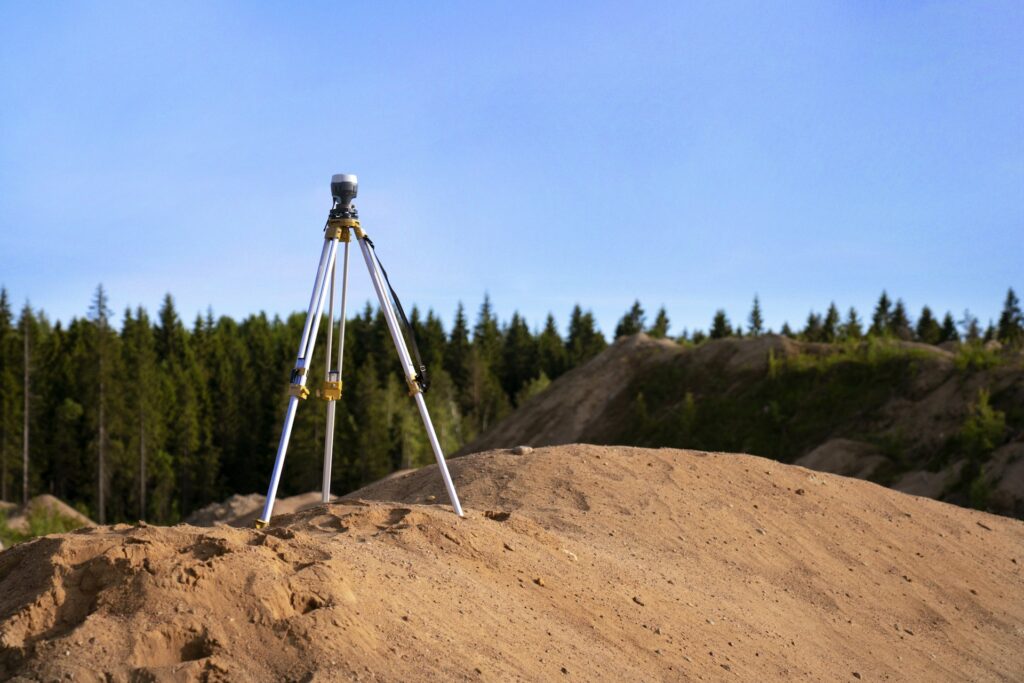
If you’re buying a home, building a fence, or settling a property dispute in Southwest Florida, understanding boundary survey cost in Florida is one of the first steps. Survey pricing varies based on several factors, but knowing what to expect helps you budget properly and avoid surprises. Here’s a complete breakdown of what boundary surveys cost in Florida and what affects the final price.

Typical Boundary Survey Cost in Florida

Detailed land survey map with boundary markings

Most residential boundary surveys in Florida range from $300 to $800 or more, depending on the complexity of the job. A standard quarter-acre lot in a platted subdivision like those found throughout Cape Coral or Fort Myers typically falls on the lower end. Larger, irregular, or rural parcels in areas like Lehigh Acres or eastern Collier County can push costs above $1,000.

Here’s a general pricing range for SW Florida:

Property Type Estimated Cost
Standard residential lot (under 0.5 acres) $300 – $500
Larger residential lot (0.5 – 2 acres) $500 – $800
Rural or unplatted acreage (2+ acres) $800 – $1,500+
Commercial property $1,000 – $3,000+

These figures are estimates. The only way to get an accurate quote is to contact a licensed surveyor who can evaluate your specific property.

Factors That Affect Boundary Survey Pricing

Lot Size and Shape

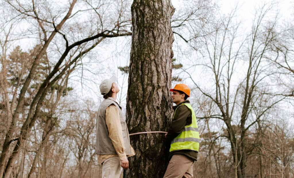
Larger lots take more time to traverse and measure. Irregularly shaped parcels with many corners require additional setup points and calculations, which adds to the cost. A simple rectangular lot in a Cape Coral subdivision is straightforward compared to a waterfront parcel with curved seawalls and irregular boundaries.

Terrain and Vegetation

Dense vegetation, wetlands, and overgrown lots are common in parts of Lee and Collier counties. Surveyors may need to cut sight lines through brush or work around standing water, which increases field time. Properties with heavy tree cover or mangrove areas near the coast require more effort to access boundary corners.

Access and Location

Remote properties without clear road access take longer to reach and set up on. If the surveyor needs special equipment or additional crew members to access the site, expect higher costs. Properties in gated communities may also require coordination for access.

Age of the Subdivision

Newer subdivisions in Florida typically have well-documented plats and easily located survey monuments. Older neighborhoods, especially those platted before the 1970s, may have missing or deteriorated markers. The surveyor then needs to perform additional research and fieldwork to re-establish corners, adding time and cost.

Existing Survey Records

If a recent survey exists for your property, the new surveyor can reference it, which may reduce research time. If no prior survey is on file, the surveyor must start from the original plat and deed records, which takes longer.

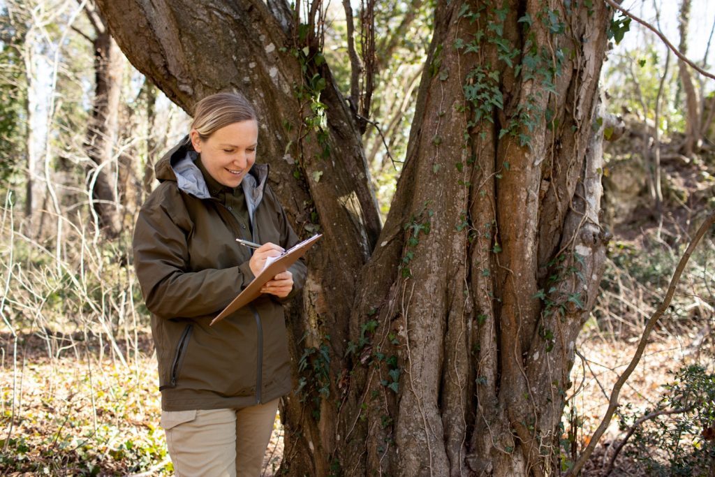
What’s Included in a Boundary Survey

ALTA surveys

A standard residential boundary survey in Florida typically includes:

  • Research of public records, deeds, and plat maps
  • Fieldwork to locate or re-establish property corners
  • Measurement of all boundary lines
  • Setting of new iron rods or pins at corners (if needed)
  • A signed and sealed survey drawing showing boundary dimensions, setback lines, and any visible encroachments

The final deliverable is a legal document prepared by a Florida-licensed Professional Surveyor and Mapper (PSM) that can be used for permits, title work, and dispute resolution.

Boundary Survey vs. ALTA Survey: Cost Comparison

An ALTA survey is a more comprehensive survey type governed by national standards set by the National Society of Professional Surveyors (NSPS) and the American Land Title Association. ALTA surveys are typically required for commercial real estate transactions and include additional items like easements, utilities, zoning information, and flood zone classification.

Survey Type Typical Cost (Florida) Common Use
Boundary Survey $300 – $800 Residential purchases, fences, disputes
ALTA/NSPS Survey $1,500 – $4,000+ Commercial transactions, lender requirements

If you’re purchasing residential property, a boundary survey usually meets your needs. For commercial deals, your lender or title company will likely require the more detailed ALTA survey.

The ROI of Investing in a Boundary Survey

A boundary survey might seem like an added expense, but it protects you from far costlier problems. Consider these scenarios:

  • Fence disputes: Removing and relocating a fence built on a neighbor’s property can cost thousands of dollars. A $400 survey prevents that mistake.
  • Building permit issues: Lee County requires setback compliance for all structures. Building without a survey risks permit denial or forced demolition.
  • Title problems at closing: Unresolved boundary questions can delay or kill a real estate deal. A current survey keeps your closing on track.
  • Encroachment claims: Discovering that your driveway, shed, or landscaping crosses onto a neighbor’s lot after the fact is far more expensive than preventing it with a survey upfront.

Understanding boundary survey cost florida helps Florida property owners make informed decisions about their land and investments. Contact Will’s Service Group for professional guidance tailored to your specific needs.

Frequently Asked Questions

How long does a boundary survey take in Florida?

Most residential boundary surveys in SW Florida take 1 to 2 weeks from scheduling to delivery of the final survey drawing. Fieldwork itself usually takes a few hours to a full day, depending on the property. Research, drafting, and quality review account for the remaining time.

Does a boundary survey show easements?

A standard boundary survey shows visible evidence of easements (like utility lines or drainage ditches) and recorded easements found during title research. If you need a comprehensive easement analysis, an ALTA survey provides a more thorough review of all recorded encumbrances.

Can I use my neighbor’s survey for my property?

No. A survey is prepared for a specific property and client. While a neighbor’s survey may show the shared boundary, it does not constitute a legal survey of your property. You need your own survey signed and sealed by a licensed PSM to use for permits, disputes, or title work.

Do I need a survey to build a fence in Cape Coral?

Cape Coral requires a fence permit, and the city may require a survey to verify setback compliance. Even when not strictly required by the city, getting a boundary survey before building a fence is strongly recommended to avoid placing it on your neighbor’s property.

Get a Boundary Survey Quote for Your Florida Property

Every property is different, and the best way to know your exact boundary survey cost in Florida is to request a quote from a licensed local surveyor. Will’s Service Group LLC provides accurate, competitively priced boundary surveys throughout Cape Coral, Fort Myers, Lehigh Acres, Naples, and Port Charlotte. Call (239) 478-4242 or place your order online for a fast, free estimate.

Do You Need a Survey Before Buying Commercial Property in Florida?

tree survey

Before you sign on a commercial property in Florida, one of the most important steps is getting a professional survey. A survey before buying commercial property reveals boundary issues, easements, zoning conflicts, and encroachments that can derail your investment or limit how you use the land. In most cases, the answer is yes — you need one, and here is why it matters.

Unlike residential home purchases where a simple boundary survey might suffice, commercial real estate transactions in Florida often involve larger parcels, more complex title histories, and stricter regulatory requirements. At Will’s Service Group, we provide commercial surveys and ALTA surveys for property buyers, investors, and developers across Cape Coral, Fort Myers, Naples, and Port Charlotte. This guide explains when a survey is required, what types of surveys apply, and what they typically uncover.

When Florida Law Requires a Survey for Commercial Property: Before Buying

Commercial property lot survey in progress in Southwest Florida

Florida does not legally require a survey for every commercial property purchase, but several practical factors make it essential:

  • Lender requirements: Most commercial lenders require an ALTA survey before approving financing. The survey confirms that the property matches the legal description in the title commitment and identifies risks that could affect the lender’s collateral.
  • Title insurance: Title companies use surveys to identify exceptions to coverage. Without a current survey, the title policy may exclude coverage for boundary disputes, encroachments, and easement conflicts, leaving you exposed.
  • Zoning and permitting: If you plan to modify, expand, or change the use of the property, your local Florida building department will require a survey to verify compliance with setback, height, and lot coverage requirements.
  • Environmental and flood zone concerns: Properties in or near flood zones need elevation data that only a survey can provide. This affects insurance costs and development potential.

Even when a survey is not strictly required, buying commercial property without one is risky. The cost of a survey is a fraction of the property price, and it can prevent problems that cost far more to resolve after closing.

Types of Surveys Used in Commercial Property Purchases

Not all surveys are the same. The type you need depends on the transaction, lender requirements, and how you plan to use the property. Here are the surveys most commonly used for commercial purchases in Florida:

  • ALTA/NSPS Land Title Survey: This is the standard for commercial transactions. It meets the requirements of the American Land Title Association and includes boundary lines, improvements, easements, rights of way, and optional Table A items. Most lenders require this survey type.
  • Boundary survey: A more basic survey that establishes property lines and corners. Suitable for vacant land purchases where a full ALTA is not required, but insufficient for most improved commercial properties.
  • Topographic survey: Maps the elevation contours, drainage patterns, and natural features of the site. Required when you plan to develop, grade, or construct on the property.
  • Environmental or wetland survey: Identifies wetland boundaries, protected areas, and environmental constraints. Critical for properties near waterways, conservation areas, or in Lee County’s environmentally sensitive zones.

For most commercial property purchases with financing, the ALTA survey is the recommended choice. It provides the most comprehensive protection for buyers, lenders, and title companies.

What a Survey Uncovers Before You Buy

Surveyor reviewing property boundaries before commercial real estate purchase in Naples FL

A professional survey before buying commercial property can reveal issues that are invisible from a simple property visit. Here are the most common problems surveys uncover in Florida commercial transactions:

  • Boundary discrepancies: The actual property lines may differ from what the seller described or what the fencing suggests. This can mean you are getting less land than you thought, or that existing improvements cross onto adjacent parcels.
  • Encroachments: Neighboring structures, signs, fences, or landscaping may extend onto the subject property, or the property’s improvements may encroach on neighbors. Both create legal and practical problems.
  • Easement conflicts: Recorded easements for utilities, drainage, or access may restrict where you can build or expand. A survey plots these easements so you can evaluate their impact on your plans.
  • Setback violations: Existing buildings may not comply with current setback requirements. This matters if you plan to expand, renovate, or change the property’s use.
  • Access issues: Some commercial properties rely on easements or shared driveways for access. A survey confirms that legal access exists and documents any shared-use agreements.
  • Flood zone placement: The survey determines whether any portion of the property falls within a FEMA flood zone, which affects insurance requirements and development restrictions. Learn more about elevation certificates and flood zone surveys.

How Much Does a Commercial Property Survey Cost

Survey costs for commercial property in Florida depend on the property size, survey type, and complexity. Here are typical ranges for Southwest Florida:

Survey TypeTypical CostWhen Needed
Boundary survey$800 – $2,000Vacant land, simple transactions
ALTA/NSPS survey$2,000 – $6,000+Financed purchases, title insurance
Topographic survey$1,500 – $4,000Development, grading, construction
Combined ALTA + topo$3,000 – $7,000Development with financing

These costs are modest compared to the value of the property and the risks they mitigate. A $3,000 survey on a $500,000 commercial property is less than 1% of the purchase price but can identify issues worth tens of thousands of dollars.

Understanding survey before buying commercial property helps Florida property owners make informed decisions about their land and investments. Contact Will’s Service Group for professional guidance tailored to your specific needs.

Frequently Asked Questions

Land survey equipment on commercial development site in Lee County Florida

Can the seller provide the survey instead of the buyer ordering one?

Sellers sometimes have a prior survey on file, but lenders and title companies usually require a survey dated within 6 to 12 months of closing. An older survey can sometimes be updated and recertified by the original surveyor, which saves time and money compared to ordering a new one.

How far in advance should I order the survey?

Order your survey as soon as you have a signed contract or letter of intent. ALTA surveys typically take 2 to 4 weeks to complete, and delays can push back your closing date. Starting early gives the surveyor time to obtain title commitment documents and schedule fieldwork.

What happens if the survey finds problems?

If the survey reveals encroachments, boundary disputes, or easement conflicts, you have several options. You can negotiate with the seller to resolve the issue before closing, request a price reduction, require the seller to cure the defect, or walk away from the deal if the contract allows it. The survey gives you leverage and information to make an informed decision.

Do I need a survey for a commercial lease?

Surveys are less common for commercial leases but may be needed for ground leases, build-to-suit agreements, or leases where the tenant is responsible for property improvements. If you are investing significant capital in tenant improvements, a survey confirms the boundaries and restrictions of the leased space.

Get a Commercial Property Survey in Southwest Florida

Will’s Service Group provides commercial property surveys throughout Lee County, Collier County, and Charlotte County. Whether you need an ALTA survey for a financed acquisition, a boundary survey for vacant land, or a topographic survey for site development, our licensed surveyors deliver accurate, timely results. Call (239) 478-4242 or contact our Naples office to discuss your commercial property survey needs.

How Much Does an ALTA Survey Cost in Florida?

tree survey

If you are planning a commercial real estate deal in Florida, one of the first questions you will ask is how much an ALTA survey costs. An ALTA survey cost in Florida typically ranges from $2,000 to $6,000 or more, depending on the size, complexity, and location of the property. Understanding what drives the price helps you budget accurately and avoid surprises at closing.

ALTA surveys are the gold standard for commercial property transactions. They follow the requirements set by the American Land Title Association and the National Society of Professional Surveyors, which means buyers, lenders, and title companies can rely on the results. At Will’s Service Group, we perform ALTA surveys throughout Southwest Florida, including Cape Coral, Fort Myers, Naples, and Lehigh Acres. Here is what you need to know about ALTA survey pricing in 2026.

What Affects ALTA Survey Cost in Florida

ALTA survey plat document for commercial property in Cape Coral Florida

Several factors determine the final ALTA survey cost for a Florida property. The biggest variables are property size, terrain, and the number of optional Table A items your lender or title company requires. Here is a breakdown of what affects your quote:

  • Property size and acreage: A 1-acre commercial lot costs less to survey than a 20-acre industrial site. Larger parcels require more fieldwork time and additional measurements.
  • Table A optional items: The 2021 ALTA/NSPS standards include 19 optional Table A items. Common requests include flood zone classification (Item 8), zoning information (Items 6a-6b), and underground utility location (Item 11). Each adds to the total cost.
  • Property complexity: Sites with multiple structures, easements, rights of way, encroachments, or irregular boundaries take more time to survey accurately.
  • Existing survey records: If a prior survey exists, the surveyor can often verify and update rather than starting from scratch, which may reduce cost.
  • Location within Florida: ALTA survey pricing varies by county. Properties in Lee County, Collier County, and Charlotte County may differ in cost due to local filing requirements and access conditions.

Typical ALTA Survey Pricing in Southwest Florida

Based on current rates for commercial properties in the Cape Coral and Fort Myers area, here is what property buyers and developers can expect to pay:

Property TypeApproximate SizeEstimated Cost Range
Small commercial lotUnder 1 acre$2,000 – $3,000
Mid-size commercial1 – 5 acres$3,000 – $4,500
Large commercial or industrial5 – 20 acres$4,500 – $6,000+
Multi-structure campusVaries$5,000 – $8,000+

These ranges cover the base ALTA survey. Adding multiple Table A items can increase the total by $500 to $2,000 or more, depending on the scope. Always request an itemized quote so you understand exactly what is included.

Who Pays for the ALTA Survey

Licensed surveyor performing land survey measurements in Southwest Florida

In most Florida commercial transactions, the buyer pays for the ALTA survey. However, this is negotiable. Some purchase agreements split survey costs between buyer and seller, and lenders may require specific Table A items that add to the expense. The key is to discuss survey requirements early in the transaction so both parties understand the cost before closing.

Regardless of who pays, the ALTA survey protects the buyer and lender by confirming exact boundaries, identifying any encroachments, and documenting easements or restrictions that could affect future use of the property. Skipping this step to save money often leads to far more expensive problems after closing. Learn more about how ALTA surveys protect your investment.

Why ALTA Surveys Cost More Than Standard Boundary Surveys

A standard boundary survey in Florida might cost $400 to $800 for a residential lot. An ALTA survey costs significantly more because it goes beyond just marking property corners. Here is what makes ALTA surveys more comprehensive and more expensive:

  • National standards compliance: ALTA surveys must meet strict 2021 ALTA/NSPS Minimum Standard Detail Requirements. Every measurement, notation, and deliverable must follow this standard.
  • Improvements and structures: Every building, fence, wall, driveway, sign, and visible improvement must be located and documented on the survey plat.
  • Easement and restriction research: The surveyor must review the title commitment and plot all recorded easements, rights of way, and restrictions on the survey.
  • Certification language: ALTA surveys include specific certification language required by the title company and lender, which adds a layer of legal accountability.
  • Professional liability: The licensed surveyor certifies the accuracy of the plat, which carries professional liability. This certification is what makes the ALTA survey trustworthy for title insurance purposes.

If you are purchasing commercial property in Florida, the additional cost of an ALTA survey over a basic boundary survey is a worthwhile investment. It provides the level of detail that lenders and title companies require for commercial real estate transactions.

How to Save on ALTA Survey Costs

Commercial property boundary markers after ALTA survey in Fort Myers FL

While ALTA surveys are a significant expense, there are practical ways to manage costs without sacrificing quality:

  • Request only the Table A items your lender actually requires. Some buyers request all 19 items out of caution, but your lender and title company will specify exactly which items they need.
  • Provide existing survey records. If the seller has a prior survey on file, share it with your surveyor. Updating an existing survey is faster and less expensive than starting fresh.
  • Bundle with other survey services. If you also need an elevation certificate or environmental assessment, some survey firms offer bundled pricing.
  • Get multiple quotes. Pricing varies between survey companies. Compare quotes from at least two licensed firms, but prioritize experience with ALTA surveys over the lowest price.

Understanding alta survey cost florida helps Florida property owners make informed decisions about their land and investments. Contact Will’s Service Group for professional guidance tailored to your specific needs.

Frequently Asked Questions

How long does an ALTA survey take in Florida?

Most ALTA surveys in Florida take 2 to 4 weeks from the date the surveyor receives the title commitment. Complex properties or those requiring extensive Table A items may take longer. Rush services are sometimes available for an additional fee.

Is an ALTA survey required for commercial property purchases?

Most commercial lenders require an ALTA survey before issuing a loan. Even if your lender does not require one, title insurance companies use ALTA surveys to identify risks. The survey protects your investment by documenting exactly what you are buying.

Can I use an old ALTA survey instead of ordering a new one?

Lenders and title companies typically require surveys completed within the last 6 to 12 months. An older ALTA survey can sometimes be updated and recertified rather than redone entirely, which reduces cost. Ask your surveyor whether an update is possible for your situation.

What is the difference between ALTA survey cost per acre?

ALTA survey cost per acre generally decreases as acreage increases. A small half-acre commercial lot might cost $3,000 to $4,000 per acre, while a 10-acre site might average $400 to $600 per acre. The fixed costs of title research and certification are spread across more acreage on larger properties.

Get an ALTA Survey Quote in Southwest Florida

At Will’s Service Group, we provide ALTA surveys for commercial property buyers, developers, and lenders throughout Lee County, Collier County, and Charlotte County. Our team understands the specific requirements for Florida real estate transactions and delivers certified ALTA survey plats that meet the 2021 ALTA/NSPS standards. Contact us at (239) 478-4242 or visit our Cape Coral office to request your ALTA survey quote today.

How to Find Your Property Lines Without a Survey in Florida

Wondering how to find property lines without a survey in Florida? Whether you just bought a home in Cape Coral or you’re planning a fence project in Southwest Florida, knowing where your property boundaries fall is essential. While a professional land survey is the most accurate method, there are several ways to get a general idea of your property lines on your own before deciding if you need one.

Why Property Lines Matter in Florida

Survey markers placed along a property boundary line

Property line disputes are surprisingly common in Florida, especially in fast-growing areas like Lee County and Collier County. Building a fence, adding a pool, or even planting a tree too close to your neighbor’s land can lead to costly legal battles. Understanding your boundaries helps you avoid encroachment issues and protects your investment.

6 Ways to Find Your Property Lines Without a Survey

1. Check the Lee County Property Appraiser Website

The Lee County Property Appraiser website offers free access to parcel maps, legal descriptions, and aerial imagery for every property in the county. Search by address or parcel ID to pull up a map showing your lot dimensions. Collier County, Charlotte County, and other SW Florida counties have similar tools. Keep in mind these maps are approximate and not legally binding.

2. Review Your Property Deed

Your property deed contains a legal description that defines your boundaries using metes and bounds, lot and block numbers, or section-township-range references. You can find your deed at the Lee County Clerk of Court’s office or through their online records search. The language can be technical, but it gives you the official description of what you own.

3. Use GIS Mapping Tools

Geographic Information System (GIS) tools are available through most Florida county websites. These interactive maps overlay property boundaries on satellite imagery. While helpful for getting a visual sense of your lot, GIS maps carry disclaimers that they are not survey-grade and should not be used for construction or legal purposes.

4. Look for Iron Rods or Survey Pins

Previous surveys often leave physical markers at property corners. These are typically iron rods or pipes driven into the ground, sometimes topped with a plastic cap stamped with the surveyor’s license number. Grab a metal detector and walk the approximate corners of your lot. In many Cape Coral subdivisions, you can find these markers just below the surface. However, pins can shift over time due to erosion, construction, or landscaping.

5. Check for Survey Stakes or Monuments

Some properties, especially newer developments in Lehigh Acres and Fort Myers, have concrete monuments or wooden stakes placed during the original subdivision platting. Look near sidewalks, curbs, or the edges of your lot. These markers are part of the original plat survey recorded with the county.

6. Talk to Your Neighbors

Sometimes a simple conversation with your neighbor can clarify shared boundary assumptions. They may have a copy of a previous survey or know where markers were placed. While verbal agreements are not legally binding, open communication prevents misunderstandings before they escalate.

When You Still Need a Professional Land Survey

Completed boundary survey markers on a property

DIY methods give you a rough idea, but there are situations where only a licensed residential survey will do. You need a professional survey when:

  • Building a fence, pool, or structure — Lee County and most SW Florida municipalities require a survey before issuing building permits.
  • Resolving a boundary dispute — Only a survey performed by a licensed Professional Surveyor and Mapper (PSM) holds up in Florida courts.
  • Buying or selling property — Title companies and lenders often require a current survey to close.
  • Subdividing land — Florida law requires a recorded plat prepared by a licensed surveyor.
  • Applying for flood insurance — An elevation certificate requires precise survey measurements.

The reality is that online tools and old markers can point you in the right direction, but they cannot replace the legal accuracy of a boundary survey performed by a licensed Florida surveyor.

Understanding find property lines without survey helps Florida property owners make informed decisions about their land and investments. Contact Will’s Service Group for professional guidance tailored to your specific needs.

Frequently Asked Questions

Can I use Google Maps to find my property lines?

Google Maps and Google Earth show aerial imagery but do not display legal property boundaries. County GIS tools overlay approximate parcel lines on aerial photos, which is more useful. However, neither source is survey-grade accurate, and neither should be relied on for construction or legal decisions.

Are property line apps accurate in Florida?

Apps like LandGlide and Regrid pull data from county assessor records and can show approximate boundaries. They are convenient for quick reference but carry the same accuracy limitations as county GIS maps. For anything involving construction, permits, or disputes, you need a licensed surveyor.

How do I find old survey records for my property?

Check with the Lee County Clerk of Court, your title company, or the Florida Board of Professional Surveyors and Mappers. Previous surveys are often recorded with the county or kept on file by the surveying firm that performed them. Your Cape Coral land surveyor can also help locate historical survey data for your parcel.

What happens if my neighbor’s fence is on my property?

If you suspect encroachment, start by getting a professional boundary survey. Florida law allows property owners to seek removal of encroaching structures, but the process typically begins with a certified survey that proves the encroachment. From there, you can negotiate with your neighbor or pursue legal remedies if necessary.

Get Accurate Property Lines from a Licensed Florida Surveyor

While these DIY methods can help you get a general sense of your boundaries, nothing replaces the precision of a professional land survey. Will’s Service Group LLC provides accurate, affordable residential surveys throughout Cape Coral, Fort Myers, Naples, and all of Southwest Florida. Call us today at (239) 478-4242 or visit our order page to get started.

How ALTA Surveys in Florida Can Prevent Title Surprises

ALTA surveys

Alta surveys prevent title surprises plays a critical role in property management and development in Florida. Buying property in Florida comes with its share of questions, especially when it’s time to check if the land is clear of surprises. ALTA surveys in Florida are one way we help buyers, lenders, and developers understand exactly what they’re working with. These surveys give a detailed look at the land, boundary lines, access rights, easements, and more. They show things other reports might miss.

As spring gets closer, the real estate market usually starts to pick up. It’s a busy time for property deals. That makes it even more important to avoid anything that could slow things down, like title issues or misfiled documents. Having a full, accurate look at the land before closing gives everyone more confidence to move forward.

What an ALTA Survey Includes: Surveys Prevent Title Surprises

Construction stakeout survey for a new building

ALTA stands for American Land Title Association. The survey that follows ALTA standards is a full view of the property tied to the title. It’s not just lines on a map. It shows real features that matter when land is bought, sold, or built on.

For more information, see the American Land Title Association.

During a survey, we gather:

  • Exact property boundaries
  • Locations of buildings, fences, driveways, or other improvements
  • Easements that let others use part of the land (like utility companies or shared access points)
  • Rights-of-way and access routes

We walk the property with equipment that tracks lines, corners, and elevation. We check for encroachments, things built over the line, and make sure what’s on the ground matches legal records. Once everything is measured and confirmed, we put it all into a report with detailed drawings and legal descriptions.

Compared to a basic boundary survey, an ALTA version includes more research and reporting. That’s why banks and title companies usually ask for it when ownership or money is involved. It protects everyone from unknowns.

On the Will’s Service Group service page, our ALTA surveys include flood zone mapping and detailed utility location, fulfilling title requirements for Florida lending and insurance.

Why Title Surprises Happen Without a Good Survey

Property surprises aren’t always easy to spot. Sometimes a driveway crosses into a neighbor’s yard. Other times a drainpipe or fence sits outside the lot line. It may not seem like a big deal at first, but it can turn into a real roadblock when it’s time to sell, build, or get funding.

There are a few common title problems we help uncover:

  • Utility lines or poles that were never documented
  • Easements for access that aren’t clearly recorded
  • Shared driveways or walls that cross property lines
  • Encroachments from nearby lots that weren’t caught before

Without checking these things early, deals can hit delays. Permits might get held back. Titles can be flagged. Buyers may end up responsible for fixing problems that weren’t theirs to begin with. ALTA surveys in Florida help bring these red flags to the surface before money changes hands. That’s the kind of clarity people expect when big decisions are on the table.

Why ALTA Surveys Are Especially Important in Spring Purchases

Land surveying team at a commercial property

In Florida, warmer weather comes early, and spring often kicks off a wave of listings and closings. After the quiet months of winter, buyers start walking lots, reviewing properties, and planning construction. But what may have looked fine last fall could now be affected by nearby changes.

New construction, zoning shifts, or updates to drainage systems can all move fast. One month your land drains fine. By the next, a neighbor’s new patio changes everything. That’s why we recommend updated surveys as part of any spring sale or purchase. It gives everyone a clean starting point.

We’ve noticed that this time of year often brings:

  • New permit applications for fences, buildings, or driveways
  • Fresh landscaping or grading work that doesn’t match old records
  • Seasonal drainage patterns that aren’t clear from photos or fall visits

Getting an updated survey now avoids surprises later. It keeps the process moving at a time when timing often matters most.

Who Needs an ALTA Survey and When to Get One

Most people ordering an ALTA survey are involved in buying, financing, or developing property. That includes business owners, commercial buyers, and lenders. But residential buyers, especially when purchasing land or older homes, benefit too.

We recommend getting your ALTA survey done early in the purchasing process. Waiting too long can cause delays. It’s not something to squeeze in after other steps. Survey results can help shape decisions around insurance, financing, access, and construction. Catching a setback early on is much easier than fixing it under a deadline.

Here’s when it’s smart to order a survey:

  • Before closing on a property, especially if title insurance is part of the deal
  • When applying for a permit that requires land layout or flood info
  • If you’re planning to develop the property in any major way
  • When a disagreement or question comes up over boundaries

Getting the survey done before paperwork gets too far offers a better chance to address problems without creating bigger ones. It’s not just about future risks, but current clarity.

We use GPS, robotics, and modern mapping tools for ALTA surveys, and our reports are accepted by Florida title companies and lenders.

Know Your Property Before You Sign

Property issues often stay hidden until someone takes the time to look. That’s what an ALTA survey does, it shows what lines, rights, and uses look like on paper and in real life. We believe every buyer deserves to know that before signing anything official.

In Florida, spring is a time when real estate activity picks up speed. Starting the process with current, grounded information helps avoid misunderstandings and keeps everything moving. If your property plans include purchase, development, or title review this season, don’t wait to learn what your survey might reveal. It makes a difference when you understand your land before you make it yours.

Getting ready to buy or develop land in Florida is an exciting step, and understanding the property thoroughly can help you avoid costly surprises and delays, especially during the busy spring sales season. An updated report suited to current site conditions will answer questions and provide peace of mind well before closing day. When you’re prepared to order ALTA surveys in Florida, our team at Will’s Service Group is here to make sure you have everything you need for a smooth experience, reach out today to get started.

How to Read a Florida Survey Plat Like a Pro

residential surveys

Taking the time to read your Florida survey plat carefully can save you from costly boundary mistakes and help you make informed decisions about your property.

How to Read a Florida Survey Plat

Learning how to read a Florida survey plat is one of the most practical skills a property owner can develop. A Florida survey plat is one of the most important documents tied to your property, yet most people only glance at it during closing and never look again. That single sheet of paper, covered in lines, symbols, and numbers, is the professional map of what you actually own and what sits on it. It affects your ability to build, remodel, get permits, secure financing, and even get the right insurance coverage.

In Florida, survey plats are typically required for real estate transactions, remodels, and new construction. Lenders want to confirm boundaries and improvements, building departments want to confirm setbacks and easements, and you should want to avoid surprises like a shed built over the property line. At Will’s Service Group, we provide residential surveys in Florida, along with commercial, ALTA, construction stakeout, topographical, tree, as-built surveys, and elevation certificates. In this guide, we will walk through how to read a survey plat so you can approach your next project or transaction with confidence.

Learn more about our land surveying services in Cape Coral.

The Anatomy of a Florida Survey Plat

land survey

A typical residential survey plat looks technical, but once you know what each part does, it becomes much easier to read. Start with the title block, usually found in a corner of the sheet. It identifies the property owner, property address, surveyor, company, date of survey, and often the type of survey. This is where you confirm you are holding the correct survey for the correct property.

Next, look for the legend. The legend explains the symbols and line styles used on the plat, such as what marks a property corner, a fence, a utility line, or an easement. The north arrow shows which direction is north, so you can understand how your house sits relative to the street, neighbors, or water. The scale tells you how the drawing relates to real-world distances, for example, one inch on paper equals a certain number of feet on the ground.

One of the most important sections is the legal description. For residential surveys in Florida, this should match the legal description in your deed or purchase contract. It may describe the lot and block within a recorded subdivision, or it may be a metes and bounds description using distances and bearings. If the legal description on the survey does not match your deed or contract, that is a reason to ask questions before closing or starting any work.

You will also see a certification statement, signed and sealed by the surveyor, along with survey notes. These notes explain what standards were followed, what records were reviewed, and any special conditions. On the same plat, you might see different survey types referenced or combined, such as:

  • Boundary survey for property lines and corners  
  • Topographical survey for ground elevations and contours  
  • Tree survey showing significant trees and their locations  
  • As-built survey showing existing structures and improvements  
  • Elevation information that supports an elevation certificate

Each type is usually labeled in the title or notes, so you know what the survey was prepared to show.

Symbols, Lines, and Shading You Should Recognize

At first glance, a survey can look like a foreign language of symbols. Once you recognize the common ones, the plat becomes much easier to interpret. Property corners are often shown with small symbols noting the type of monument set or found, such as an iron rod or concrete monument. Fences, walls, and hedges are drawn with different line styles or patterns, and utility features like poles, meters, and manholes have their own symbols explained in the legend.

You will also see trees indicated, especially when a tree survey is part of the work. Trees may be labeled with size or species if required. Easements, which give others certain rights to use part of your land, are usually shaded or dashed, and labeled with their type, like drainage, utility, or access easement. Benchmark points, which are used for elevation control, are often marked and labeled with an elevation.

Line styles tell a big part of the story. Solid bold lines often represent property boundaries, while lighter or dashed lines may show setback lines or easement limits. Building footprints are drawn to show the outline of your house, garage, pool, or other structures. Encroachments, such as a fence or driveway that crosses a line, are usually noted clearly.

You will also see bearings and distances along property lines. Bearings describe direction, such as north or south and degrees east or west. Distances are usually in feet and hundredths of a foot. Curved lines are common on corner lots or cul-de-sacs and will show radius, arc length, and central angle. For residential surveys in Florida, these measurements are your key to understanding the actual size, shape, and orientation of your lot.

Reading Survey Notes, Easements, and Legal Disclaimers

Land Survey

The survey notes section is where a lot of important information lives. You may see notes about the sources of data used, such as recorded plats, deeds, and public records. There are usually fieldwork dates, which tell you when the surveyor was on site. Vertical and horizontal datum references show what elevation system and coordinate basis the survey is tied to. For flood-related information, notes may reference flood zones or map panels used.

Easements deserve special attention. Common types include:

  • Utility easements for power, water, sewer, or communications  
  • Drainage easements for stormwater flow or retention areas  
  • Access easements that let others legally cross part of your land  
  • Conservation easements that limit clearing or building  

On the plat, these are usually labeled and often shaded or hatched. By matching the labels in the notes with the graphics on the map, you can see exactly where you are limited in where you can build or plant.

Certification language and disclaimers explain what is and is not covered by the survey. For example, a survey may note that underground utilities were not located, or that only visible improvements were shown. For lenders and insurers, this language helps define the scope of what the surveyor is taking responsibility for. Reading these sections carefully helps you understand the limits of the survey, instead of assuming it covers every possible issue.

Red Flags to Watch for on a Florida Survey Plat

When reviewing your plat, you are looking not just for what is there, but for what might cause trouble. Common boundary and improvement issues include fences that are not on the property line, driveways that cross into a neighbor’s land, or sheds and patios that extend into setbacks or easements. These can lead to disputes, permit denials, or required removals.

Florida has some special concerns that often appear on survey plats and elevation certificates. Flood zones are a big one. If your property lies in a higher-risk zone, that can affect building requirements and insurance. Elevation data, tied to flood maps, is key for understanding your risk and what your building department or insurer may require. In coastal areas, coastal construction limits or lines may appear, indicating regulated zones where work is more restricted.

Title-related red flags include unrecorded or conflicting easements, missing right-of-way information for roads, or discrepancies between the recorded plat and the deed. If you see conflicting dimensions, unclear easements, or notes that reference unknown documents, that is a signal to bring your surveyor or a real estate attorney into the conversation before you proceed.

Putting Your Survey to Work for Your Property Decisions

survey

A survey plat is not just for closing day; it is a planning tool for everything you do with your property in the future. If you are thinking about an addition, a pool, a new fence, or major landscaping, your plat helps you stay inside setback lines and outside restricted easements. That can save you from redesign costs, permit rejections, and costly tear-outs after the fact.

Many people are surprised by how many parties rely on current residential surveys in Florida. Lenders use them to confirm that improvements sit within the property boundaries and to understand any encroachments or easements. Insurers look at surveys and elevation certificates to evaluate risk and coverage options. Building departments review them as part of permit applications, checking zoning compliance and access for utilities and drainage.

If you already have a survey, take it out and spend a few minutes finding the title block, legend, legal description, and notes. Match the legal description to your deed or contract, confirm the type of survey performed, and look for any easements or encroachments that affect your plans. If anything on the plat is unclear, professional guidance can help you interpret what you are seeing so you can move forward with your Florida property decisions with far more confidence.

Get Started With Your Project Today

If you are planning a new build, addition, or property purchase, our team can provide accurate residential surveys in Florida to help you move forward confidently. At Will’s Service Group, we take the time to understand your property goals and deliver detailed survey data you can rely on. Ready to schedule or have questions about your next step? Simply contact us and we will walk you through the process.

You can access official property records and plat maps through the Lee County Property Appraiser.

For more on survey standards in Florida, visit the Florida Board of Professional Surveyors and Mappers.

Frequently Asked Questions

How much does a residential survey cost in Florida?

Residential surveys in Southwest Florida typically cost between $300 and $700, depending on the lot size, terrain, vegetation, and the age of the subdivision. Properties with unclear boundaries or missing monuments may require additional research and fieldwork.

Do I need a survey before building a fence in Cape Coral?

Yes. Cape Coral requires a fence permit, and knowing your exact property boundaries is essential to avoid building on your neighbor’s land. A boundary survey identifies your property corners and ensures your fence stays within your legal limits.

How long does a residential property survey take?

Most residential surveys in Cape Coral and Southwest Florida are completed within 1 to 2 weeks. Rush services may be available for an additional fee if you have a closing deadline or urgent construction timeline.

Schedule Your Survey Today

Will’s Service Group provides accurate, licensed land surveying services throughout Cape Coral, Fort Myers, Lehigh Acres, Naples, and Port Charlotte. Whether you need a Residential Survey or any other survey type, our experienced team delivers reliable results on time. Call us today at (239) 478-4242 or place an order online to get started.

How Topographical Surveys Help Florida Homeowners Plan for Drainage

Topographical Surveys

A topographical survey for drainage planning gives Florida homeowners the detailed elevation data needed to manage water flow and prevent flooding. Drainage isn’t usually top of mind for most homeowners until water starts pooling around the house or sinking into low spots in the yard. That’s when things begin to feel more urgent. In Florida, where the ground stays relatively flat and heavy rains are common, runoff without a path can quickly become a problem. A topographical survey takes the guesswork out of figuring out where water is going and why it’s collecting where it shouldn’t. It maps elevation changes, even the ones that are hard to see, so you can make better decisions before spring rains arrive. Late winter is the ideal time to start making these plans, while the weather is cooler and before stormy conditions start showing up.

Investing in a topographical survey for drainage planning before breaking ground is one of the smartest decisions a Florida homeowner can make.

How a Topographical Survey Supports Drainage Planning

Topographical Surveys

For many homeowners in Florida, drainage problems seem to pop up overnight. But they often build gradually, especially during months of heavy rainfall or after a dry spell followed by a deluge. Since the terrain here is so level, water doesn’t always move efficiently without help.

Learn more about our land surveying services in Port Charlotte.

These are a few early warning signs to keep an eye on:

  • Standing water that lingers in your yard or driveway, especially along sidewalks or near the foundation
  • Soil erosion around the base of your home or between lawn sections
  • Cracks in slab foundations or crawl space walls linked to shifting soil
  • Damp patches next to your home that never dry fully after a storm

Ignoring them too long could lead to structural damage, soggy landscaping, and even mold growth near exterior walls. Fixing drainage now, before the spring rains hit, helps avoid larger repair jobs later on.

What a Topographical Survey Shows About Your Property

When we run a topographical survey, we document the shape of the land, not just its borders but the ups, downs, and everything in between. That includes physical features like driveways, tree lines, elevation drops, and spots where water naturally collects.

Here’s what this kind of survey typically includes:

  • A map showing elevation contours and slope direction across your property
  • Identified high and low points that influence water flow
  • Key site features such as buildings, fences, paved areas, and drainage lines

On our service page, Will’s Service Group explains that our topographical surveys use laser and GPS equipment to measure elevation and feature location, ensuring details are accurate for both large properties and small residential lots.

By looking at this data, we can figure out how water moves through the yard during a storm and where it may get stuck. What may look flat to the eye can actually have meaningful dips that affect water direction. This helps Florida homeowners get ahead of problems that may not be visible during dry spells.

Using Survey Data to Design Better Drainage

erosion concerns

Once we’ve collected the topographical data, we can use it to make practical drainage plans. Even small corrections in grading make a noticeable improvement in how fast and far water travels away from a structure.

Here’s how we typically use the information:

  • Design swales or shallow ditches that guide rainwater away from buildings
  • Adjust slope grades to stop pooling next to driveways, patios, or walls
  • Plan where to place drains or dry wells that catch runoff from hard surfaces
  • Suggest landscape changes, like mulched berms, that manage overflow naturally

Every fix we suggest is based on what the land is already showing us. That way, we avoid creating new trouble spots while solving the old ones. Relying on the real site shape, not guesses, keeps us from installing a drain in a useless spot or creating a puddle where there used to be none.

Why Late Winter is the Right Time to Start Planning

topographical surveys

The time between late February and early March is one of the best windows for checking in on your drainage setup. Cooler days make outdoor planning easier, and the spring rains haven’t come in full yet. Drainage issues that built up during the fall and early winter often start to show more clearly now.

Walking around your property during or right after a light rain can be very revealing. Sagging soil, damp patches around the steps, or runoff crossing your sidewalk all tell part of the story. If you’ve seen any of these signs indoors, like watermarks on garage walls or drywall near the baseboards staying damp, those are worth paying attention to too.

Starting with a survey now means you have time to fix things before bigger problems appear. Contractors schedule up quickly once the spring season starts. Waiting until signs become worse usually means longer delays and more complicated fixes.

Florida’s relatively mild winters give us a head start, so using February to get ahead of the rain is worth the effort.

Better Drainage Planning Leads to Fewer Headaches Later

Small drainage problems can turn into expensive ones if they’re ignored for too long. Water almost always finds a way into places it shouldn’t be. When it does, it can cause damage that’s difficult and costly to make right.

Assessing your property with a topographical survey gives you a clean view of what’s happening below your feet. Instead of reacting to soggy spots or guessing why the garden floods, you’ll know exactly what the land is doing. From there, you can make changes that suit your home and the way water already moves across it.

Will’s Service Group also notes that our survey drawings can be used by engineers or landscape designers for grading and construction planning.

Getting a head start in late winter gives you time to design plans that actually work. It keeps small problems from growing and sets your yard and your home on firmer ground for the months ahead.

Soggy spots and uneven drainage around your yard are often signs that your property’s contours may be causing water to flow where it shouldn’t. We use a topographical survey to identify subtle slopes and low points that impact rainwater direction, allowing us to create solutions that help protect your foundation and outdoor living areas. At Will’s Service Group, we believe in preventing issues before they start, so contact us to schedule an assessment before spring storms hit.

The Florida Department of Environmental Protection provides additional guidance on stormwater management and drainage requirements.

Property owners can view elevation and drainage data through the Lee County GIS mapping portal.

Understanding topographical survey drainage planning helps Florida property owners make informed decisions about their land and investments. Contact Will’s Service Group for professional guidance tailored to your specific needs.

Frequently Asked Questions

What does a topographical survey show?

A topographical survey maps the natural and man-made features of a property, including elevation changes, drainage patterns, trees, buildings, utilities, and contour lines. Engineers and architects use this data to plan grading, drainage, and construction.

How much does a topographical survey cost in Cape Coral?

Topographical survey costs in Cape Coral and Southwest Florida typically range from $400 to $1,200, depending on the lot size, vegetation density, and level of detail required. Larger parcels and heavily wooded lots cost more.

When do you need a topographical survey in Florida?

You need a topographical survey before any new construction, major landscaping project, drainage improvement, or site development in Florida. Lee County and the City of Cape Coral often require topo surveys as part of the permitting process.

Schedule Your Survey Today

Will’s Service Group provides accurate, licensed land surveying services throughout Cape Coral, Fort Myers, Lehigh Acres, Naples, and Port Charlotte. Whether you need a Topographical Survey or any other survey type, our experienced team delivers reliable results on time. Call us today at (239) 478-4242 or place an order online to get started.

Land Survey Services That Catch Boundary Line Mistakes Early

Land Survey

Boundary line mistakes happen more often than most Florida property owners realize, and a professional land survey is the only reliable way to catch them early. Property lines might sound simple, but in real life, they can be surprisingly hard to pin down. A fence might look like the edge, but that doesn’t always mean it’s in the right spot. Tree lines, old markings, or even local stories can give people the wrong idea. That confusion can turn into a big problem during a home sale, a remodel, or when building something new.

That’s where land survey services come in. When used early, they help spot boundary issues before they grow into delays or disputes. In Florida, where homeowners are already thinking ahead to spring projects, now is the right time to talk about how early surveys protect your land and peace of mind.

Learn more about our land surveying services in Naples.

A professional land survey is your best defense against boundary line mistakes that could lead to disputes, fines, or costly construction errors.

Common Boundary Line Mistakes a Land Survey Catches

land surveys

A lot can go wrong when it comes to figuring out where a property begins or ends. Some of the records go way back. We’ve seen paperwork drawn by hand, missing key details, or just plain hard to read. Over time, pins and property markers can move or get lost. New fences, hedges, or additions go up without checking where the real line is. Then decades pass, and people just start assuming that what’s visible is what’s legal.

• Old drawings may not match what’s there today

• Natural features like trees and slopes blur where the property stops

• People build without a survey and end up overlapping someone else’s space

When people guess instead of confirming, surprises are almost guaranteed. And when two neighbors think they each own the same strip of land, it usually doesn’t stay quiet for long.

How Early Surveys Can Prevent Costly Problems

Timing makes a difference. Catching an issue before you pour concrete or sign a sales agreement is way better than finding out after. When we’re called in before a big change, like adding a driveway or moving a fence, we can double-check that everything fits inside the true property lines.

• Surveys before building help prevent encroachments or zoning violations

• We can flag issues before a sale is final, so no one inherits a problem

• Knowing the line ahead of time helps avoid neighbor arguments or stop-work orders

On our site, Will’s Service Group also shares that we use GPS and total station equipment to check and mark boundaries accurately. For residential customers, our boundary surveys make it easier to obtain permits, resolve neighbor concerns, and comply with city or county requirements before projects start.

Waiting too long can mean redoing work, adjusting when construction is already halfway done, or dealing with lawyers. On the flip side, early surveys give homeowners a better chance to fix things without anyone getting upset. That early check is often the difference between a smooth project and one that drags out far longer than expected.

What to Expect During a Boundary Survey

Land Surveyor

When we do a survey, it’s more than checking a map. We start in the field, walking the property and looking for clues, metal pins, old marker stakes, or signs of previous work. We bring in records, too. Public drawings, plats, and past surveys all help paint the bigger picture.

• Field tools help us find or replace missing markers

• We compare actual land features with recorded parcel lines

• Survey drawings give a clear report that homeowners can share if needed

Once finished, there’s a real visual of what belongs to you and what doesn’t. This is helpful for building permits, fence planning, or any discussion with neighbors. It takes the guesswork out and replaces it with something solid everyone can agree on. Occasionally, we encounter areas where past records conflict with what we see in the field, so comparing both sources becomes important to form a complete understanding. In some places, trees or historic landscaping cross into the boundary area, reminding us how Florida yards can change over decades.

Why Timing Matters More Than People Think

land survey

In Florida, February is the calm before the rush. By early spring, permits start stacking up and construction schedules fill fast. Waiting too long means running into delays, especially once the rain and heat arrive.

Getting a survey in late winter has advantages. The weather’s dry and cooler, making it easier to walk the property without overgrown brush or puddles. With fewer homeowners breaking ground right now, survey schedules are often more open.

• Spring projects like patio work or home additions need clear boundaries

• Fence planning is easier when we survey before vegetation regrows

• Getting ahead now helps avoid conflicts when construction starts in warmer months

Most people wait until they’re ready to build. But those who plan early often make smoother progress and have fewer hold-ups later on. Timing connects to more than just the weather. Once authorities start issuing more permits in March and April, review times slow down, and one loose end can suddenly hold up your whole project. A completed survey before the spring rush can help you move your plans along right when it matters.

Clarity Now Means Fewer Surprises Later

No one enjoys last-minute problems. Discovering a fence is on someone else’s land or a pool is a foot past the setback can stall work and increase costs fast. Getting a survey done early clears up those questions before they become roadblocks.

Land survey services give property owners the clear answers they need. With a confirmed boundary, moving ahead on a project or sale just feels more certain. And when everyone’s working from the same map, there’s a better chance everything falls into place without disagreement.

We’ve seen firsthand how a little planning now can save a lot of time later. Whether you’re thinking big or small, boundary lines are behind it all. Better to get them right from the beginning.

Knowing exactly where your property lines are makes all the difference when you’re adding a patio, updating a fence, or preparing to close on a home in Florida. We’ve seen firsthand how early evaluations prevent headaches and delays once projects pick up in spring. That’s why we recommend getting reliable land survey services before starting any plans. At Will’s Service Group, we believe proactive action protects your investments from unexpected issues. Reach out to us today and let’s make sure your next move goes smoothly.

Official boundary and parcel data can be verified through the Lee County Property Appraiser.

The National Society of Professional Surveyors sets the professional standards that licensed surveyors follow when establishing boundary lines.

Understanding boundary line mistakes land survey helps Florida property owners make informed decisions about their land and investments. Contact Will’s Service Group for professional guidance tailored to your specific needs.

Frequently Asked Questions

How much does a residential survey cost in Florida?

Residential surveys in Southwest Florida typically cost between $300 and $700, depending on the lot size, terrain, vegetation, and the age of the subdivision. Properties with unclear boundaries or missing monuments may require additional research and fieldwork.

Do I need a survey before building a fence in Cape Coral?

Yes. Cape Coral requires a fence permit, and knowing your exact property boundaries is essential to avoid building on your neighbor’s land. A boundary survey identifies your property corners and ensures your fence stays within your legal limits.

How long does a residential property survey take?

Most residential surveys in Cape Coral and Southwest Florida are completed within 1 to 2 weeks. Rush services may be available for an additional fee if you have a closing deadline or urgent construction timeline.

Schedule Your Survey Today

Will’s Service Group provides accurate, licensed land surveying services throughout Cape Coral, Fort Myers, Lehigh Acres, Naples, and Port Charlotte. Whether you need a Residential Survey or any other survey type, our experienced team delivers reliable results on time. Call us today at (239) 478-4242 or place an order online to get started.

When Do You Need a Commercial Survey for Parking Lot Changes

Parking Lot

Making changes to a parking lot may seem straightforward, but it can stir up problems if the right steps aren’t taken early. Shifting even a few parking spots or adding a new entrance can affect how traffic moves, create drainage issues, or mess with local zoning rules. Commercial surveys give us a clear view of what already exists, helping us plan improvements without stepping into trouble.

We have seen commercial property owners, store managers, and developers run into avoidable setbacks just because a small project like resurfacing or re-striping wasn’t fully thought through. Good planning isn’t just about the design on paper. It’s about confirming what’s under the pavement, what might sit just outside your property line, and how each piece connects on a larger scale. When it comes to parking lot updates, timing and preparation make all the difference.

Learn more about our land surveying services in Lehigh Acres.

Before making any parking lot changes, getting a commercial survey ensures your project complies with local codes and avoids costly setback violations.

When a Commercial Survey Is Needed for Parking Lot Changes

Updating how cars move through a lot might sound simple, but it comes with big questions. Are you shifting entrances or exits? Adding angled parking? Moving where the drive aisles start and stop? These things can create flow problems if they cut into setback lines or cross over buried utilities.

Every inch matters when you start moving parking lanes, especially near property edges. Without a recent survey, it’s easy to assume you have more space than you do. If that updated spot lines up too close to a public sidewalk or across an old easement, complications can follow.

A survey helps map out where your legal boundaries really are and shows features like curbs, sidewalk edges, driveway cuts, and nearby signage. This information lets you look at the big picture before anyone starts tearing up asphalt. It also helps prevent you from running into local review boards that may want revisions to new lot plans.

Will’s Service Group’s commercial survey options include ALTA/NSPS land title surveys and boundary surveys, which give property owners precise layout benchmarks for any planned changes or updates.

Adding or Replacing Surfaces

Parking Lot

Getting ready to tear up an old lot or pour new pavement? That opens up bigger challenges. As we head into late winter in Florida, many projects are getting prepped for spring. While temperatures allow for year-round work here, early planning helps avoid rainy-season delays. If you’re resurfacing, adding concrete islands, or changing slopes, a survey plays a key role.

We check the current grade of the land, how water flows across it, and whether changes will trap water near buildings or send it toward neighbors. Paving over low spots or flattening a slope might seem harmless, but it can change the way water drains throughout the site.

Using commercial surveys gives us a real-world snapshot. This helps engineers and designers adjust for proper drainage, avoid pooling, and check for any conflicts with nearby utility lines or swales. A surface might look level to the eye, but a few inches off can cause bigger drainage problems that reveal themselves too late.

Our team at Will’s Service Group is equipped to provide topographic information and utility mapping as a part of commercial survey services.

Planning for Accessibility and Code Updates

Making a lot easier to navigate doesn’t just help your customers or staff. In many cases, updates to a site trigger full-site reviews, and that includes accessibility. Older parking lots may not meet current rules for how large accessible spaces need to be, how van parking is handled, or where ramps and walkways connect to building entrances.

If you’re repainting stripes or adding new curb ramps, it may trigger requirements to adjust slope grades or widen certain pathways. These updates aren’t just optional upgrades. They often become part of the approval process once physical work begins.

Commercial surveys are used to verify that any changes still meet local code, including spacing, slope, access routes, and clearances. Before adding a ramp or adjusting entry angles near sidewalks, we use measured details to confirm your layout matches what’s allowed in your area. That way, nothing needs to be reworked after it’s already built.

Expanding or Merging With Adjacent Lots

Commercial Survey

When a project calls for growing a parking area or using land next door, things can get complicated fast. You might be dealing with neighboring parcels that share driveways or operate under mixed-use zoning. Connecting two parking areas or extending into newly purchased land will involve checking property lines, setbacks, and any current rights of way.

It’s easy to assume neighboring lots are aligned without checking the records. But site lines, fencing, and even existing paving can be deceiving. What you think of as extra space may actually be outside your boundary or sit on a utility easement.

We use commercial surveys to mark legal lot lines and verify whether any expansion will cause zoning conflicts or require formal lot combination filings. They give engineers, architects, and planners reliable info to work from, so nothing will have to be removed or redone once the project moves ahead.

Working With Drainage, Landscaping, or Lighting

Parking lot updates aren’t just paint and pavement. Many changes involve adding small items like light poles, retention areas, planting strips, or signage that seem minor at first but can interfere with easement areas, setbacks, or buried infrastructure.

For example, planting trees near sidewalks may risk hitting underground pipes or wires. Adding new poles for lighting might require certified spacing that can’t interfere with pedestrian routes or parking stalls.

We use surveys to help plan where utilities run, how runoff is handled, and where plantings or lighting structures will be safe to install. Florida’s flat topography already makes drainage planning tricky, especially as we move closer to early spring rains. Knowing the elevation of your site helps make sure new features won’t create blockage or flow issues during storms.

Smarter Planning Means Fewer Surprises

commercial surveys

Parking lot changes can affect more than just your surface layout. From property lines to access points and drainage, every part of your lot works together with the land around it. Starting with current data lets you stay ahead of slowdowns, redesigns, or code issues that set schedules back.

By using commercial surveys to lay the groundwork, we help provide clearer, more accurate planning. Whether it’s fixing slopes, confirming access, or adjusting layout lines, handling those details upfront saves headaches and helps each update move faster once crews are on site.

Planning updates to your lot in Florida goes smoothly when you have all the accurate details you need from the start. Reviewing underground utilities, property lines, and slope conditions early on helps avoid setbacks and costly fixes. Before paving, re-striping, or adding to your space, get a clear foundation from a current set of commercial surveys. At Will’s Service Group, we use trusted measurements to help you plan efficiently and build with confidence. Give us a call when you’re ready to get started.

Before making parking lot changes, check local permit requirements with the Cape Coral Building Division.

The American Society of Civil Engineers publishes standards for site grading and drainage that apply to commercial parking facilities.

Frequently Asked Questions

What is included in a commercial property survey?

A commercial property survey typically includes boundary lines, building locations, parking areas, easements, rights-of-way, utility locations, flood zone determination, and setback measurements. The scope depends on the survey type ordered.

How long does a commercial survey take?

Commercial surveys in Southwest Florida generally take 1 to 3 weeks, depending on the property size and complexity. Large parcels with multiple structures, extensive utilities, or complicated legal descriptions may take longer.

Do I need a survey before buying commercial property in Florida?

While not legally required, a survey is strongly recommended before any commercial property purchase in Florida. It reveals boundary issues, encroachments, easement conflicts, and zoning setback violations that could affect your investment.

Schedule Your Survey Today

Will’s Service Group provides accurate, licensed land surveying services throughout Cape Coral, Fort Myers, Lehigh Acres, Naples, and Port Charlotte. Whether you need a Commercial Survey or any other survey type, our experienced team delivers reliable results on time. Call us today at (239) 478-4242 or place an order online to get started.

Reasons to Order a Tree Survey Before Winter Ends in Florida

tree survey

Florida doesn’t get much of a winter, but the short break in growth makes it a good time to start planning for spring. When it comes to trees on your property, waiting too long can lead to issues once things start to grow again. Ordering a tree survey in Florida before the end of winter gives you a clearer picture of what you’re working with and helps avoid costly mistakes later.

A tree survey might seem like a small step, but it plays a big role in keeping your property safe and ready for changes. It gives you the information needed to move forward with confidence, especially if you’re thinking about adding a pool, changing your yard, or prepping for new construction. By acting before spring gets into full swing, you avoid a time crunch and get ahead of the crowd.

Learn more about our land surveying services in Cape Coral.

Scheduling a tree survey before winter in Florida gives you time to address hazards, plan removals, and protect your property from storm damage during the cooler months.

Why You Should Schedule a Tree Survey Before Winter in Florida

Before any yard work or building starts, it helps to know exactly what kind of trees are on your land. A tree survey shows details about each one, and that information makes it easier to make smart decisions.

• The survey records tree names, sizes, heights, and where they sit on the property

• It notes whether the trees are healthy, damaged, overcrowded, or showing signs of disease

• The report can also flag trees protected by local codes. These may not be removed or trimmed without permission

With that level of detail, you’re not guessing. Property owners can plan around trees rather than run into problems after digging has already started. This is especially helpful in Florida, where tree rules often change depending on city or county guidelines. A tree that looks fine from the street might need a plan before it comes down, and having the right info early makes that step easier to manage.

Will’s Service Group provides tree survey reports that include digital maps of tree locations and key features, making it easy to share accurate info with contractors or officials. On our site, property owners can see that we prepare surveys for both residential and commercial lots throughout Florida.

Planning for Spring Construction or Landscaping

tree survey

If you’re thinking about breaking ground on something new this spring, timing matters. Once the busy season begins, especially across Florida, it can get harder to line things up. Having a tree survey ahead of time sets you up to move forward without delays.

• You’ll know where you can build without hitting roots or risking tree removal halfway through

• It’s easier to design around existing trees when their exact placement and size have already been logged

• Crews can avoid off-limits zones, like roots near septic tanks or trunks that sit too close to new structures

Late winter is a smart time to take care of this step. It’s easier to walk the property, trees aren’t as thick with leaves, and you get time to adjust plans before contractors get booked solid. Waiting until March or April could mean pushing your whole project back by weeks, especially if tree permits are involved.

Preventing Property Damage and Safety Hazards

Old trees don’t always show their problems right away. Weak limbs, hidden decay, or root damage can go unnoticed until a strong wind or heavy rain makes things worse. A survey gives you a chance to deal with those risks while the weather is still mild.

• It flags trees that lean, crack at the base, or have soft spots showing inside the bark

• Root systems that lift sidewalks, crowd plumbing lines, or press into foundations can be identified early

• Some trees grow too close together, increasing the chance of breakage once the rainy season hits

Getting ahead of these problems before spring storms hit gives you more control. It’s easier to schedule trimming, removal, or protective steps when you’re not working around weather or emergency damage.

Meeting Local Rules and Permits

tree inspection

Tree rules aren’t always easy to read, but they’re a big deal in Florida. Whether you’re in a smaller town or a larger city, bylaws often limit which trees you can remove, how many you can take out, and whether replacements are required.

• Tree surveys make it easier to apply for permits with the exact info needed

• Marked maps from the survey help local officials see what’s being removed and why

• Getting this done before spring helps you avoid long waits when everyone else is filing paperwork too

By starting now, you’re less likely to run into hang-ups. You’ll also reduce the risk of doing unauthorized work or removing a tree that turns out to be protected. The margins in property planning are tight, so it’s better to stay on the safe side.

How Tree Surveys Help Avoid Costly Mistakes

Skipping a tree survey might seem like a time-saver, but it usually leads to larger problems. Putting up a fence or patio, installing a new driveway, or expanding a home gets harder when unexpected roots or canopies show up mid-project.

• Features may need to be moved last-minute, which can throw off timelines and budgets

• Failing to spot protected trees could result in fines or project shutdowns

• Repairing damage from missed trees can cost more than the survey itself

We’ve seen how one overlooked root can delay concrete work, or how a neighbor’s tree causes issues that weren’t flagged ahead of time. Planning with a survey helps avoid these common missteps.

Start the Season with a Clearer Plan

tree survey

Every winter in Florida comes with a short window to get ahead, and this one is no different. A quick, thoughtful tree survey gives you the information you need to step into the spring season with less stress on your plate.

When you know exactly where your trees are, how healthy they are, and which ones could cause trouble, you’re not reacting under pressure. You’re ready. Planning early is what often separates a drawn-out project from a smooth one, and there’s still time left to do it right.

At Will’s Service Group, we understand how quickly spring projects can go off track when tree details are missed. Having a clear map of the trees on your Florida property keeps everything moving smoothly, from building plans to permit approvals. Planning ahead during this ideal time of year means you can schedule a tree survey in Florida and take advantage of the best conditions for early inspections. Let’s get your property ready for what’s next, reach out to us to start your project.

The Florida Department of Environmental Protection provides resources on tree preservation and environmental regulations in the state.

Understanding tree survey before winter florida helps Florida property owners make informed decisions about their land and investments. Contact Will’s Service Group for professional guidance tailored to your specific needs.

Frequently Asked Questions

When do you need a tree survey in Florida?

Florida municipalities often require tree surveys before any land clearing, new construction, or major landscaping project. Cape Coral and Fort Myers have tree protection ordinances that require surveys to identify protected species before development.

What does a tree survey include?

A tree survey identifies every tree on a property by species, size (trunk diameter), health condition, and exact location. The survey map shows protected trees, specimen trees, and any trees that may need to be removed or relocated during development.

How much does a tree survey cost in Southwest Florida?

Tree survey costs in Southwest Florida range from $300 to $1,000, depending on the property size and the number of trees. Heavily wooded lots with dozens of trees require more fieldwork and cost more than cleared or lightly landscaped parcels.

Schedule Your Survey Today

Will’s Service Group provides accurate, licensed land surveying services throughout Cape Coral, Fort Myers, Lehigh Acres, Naples, and Port Charlotte. Whether you need a Tree Survey or any other survey type, our experienced team delivers reliable results on time. Call us today at (239) 478-4242 or place an order online to get started.