Topographical surveys play a vital role in our understanding of the land’s layout, especially in regions as unique as Florida. These surveys offer a detailed picture of a property’s terrain, making them indispensable for identifying potential drainage issues. By mapping out the hills, valleys, and natural pathways water might take, a topographical survey provides insight into how water flows across a property. As we all know, water can be both life-giving and destructive, so understanding its path is crucial for maintaining stable properties.
In Florida, a state prone to heavy rains and occasional hurricanes, drainage issues can quickly escalate into major problems. Poor drainage not only affects the structural integrity of buildings but also leads to soil erosion, damaging landscapes and potentially reducing property values. With the help of a topographical survey, property owners can make informed decisions on how to best manage water on their land, ultimately safeguarding their assets and the environment around them.
Identifying Common Drainage Problems Through Topographical Surveys
Topographical surveys are exceptionally useful for pinpointing where water troubles might arise. Here are a few common drainage problems often identified through these surveys:
– Poor Runoff Management: This occurs when water fails to properly drain away, often pooling in areas where it shouldn’t, which can lead to flooding.
– Blocked Channels: Natural or manmade channels meant to guide water can become obstructed by debris or overgrowth, causing water to back up.
– Erosion: Over time, water flowing over land can wear away soil, leading to loss of soil stability and potential landslides.
In Florida, where these problems are prevalent due to the state’s low elevation and frequent rainfall, addressing them early is key to preventing expensive damage. For example, blocked drainage channels might flood nearby land, damaging both landscaping and property foundations. Such overflow has the potential to create a domino effect, leading to further issues down the line.
Engaging in regular topographical surveys can help property owners stay ahead of the game. Knowing where these problems might occur allows for proactive solutions, such as installing additional drainage systems or reinforcing existing ones. This foresight is especially important in planning new developments, where proper water management needs integration from the get-go to mitigate long-term risks. Through these surveys, property owners gain valuable insights into not just the current state of their land, but also plans for its future, ensuring it remains resilient against the challenges posed by Florida’s climate.
The Role of Topographical Surveys in Preventing Drainage Issues
Topographical surveys are more than just a map of a property’s ups and downs. They are a practical tool in preventing drainage issues before they turn into costly problems. These surveys offer valuable insights to help guide land planning and development. By understanding the lay of the land, developers can position buildings, roads, and drainage systems in a way that minimizes water accumulation and maximizes efficient water flow.
For example, a topographical survey might reveal that a particular area is prone to water pooling. Armed with this information, developers can install strategic drainage systems or slightly adjust the land’s contour to direct water away from vulnerable spots. Proactive measures such as these prevent complications like flooding and erosion, ensuring that new developments stand on solid ground.
Investing in topographical surveys as part of standard planning procedures means fewer headaches and surprises down the road. By making these surveys a priority, property owners can avoid unexpected water issues and make the best use of every inch of their land.
Benefits of Addressing Drainage Problems Early
Taking charge of drainage problems early on provides a multitude of benefits for property owners. Here are some advantages:
– Cost Savings: By planning and addressing potential problems before they occur, property owners avoid expensive repairs and damages that can arise from unmanaged water flow.
– Property Value and Safety: Properties with well-managed drainage are more appealing and often enjoy higher market values. Additionally, they pose less risk to infrastructure, ensuring the safety of residents and structures.
– Environmental Impact and Compliance: By preventing water-related issues, property owners contribute positively toward environmental sustainability. Well-planned drainage systems help manage rainwater runoff and reduce pollution and erosion, ensuring compliance with local water management regulations.
Owning property can be a rewarding investment, but it’s crucial to ensure that it stays protected from all potential hazards. Addressing drainage issues before they escalate is a key part of safeguarding that investment.
The Process of Conducting a Topographical Survey in Florida
Understanding what to expect from a topographical survey can make the process smoother for everyone involved. Here’s how it typically unfolds in Florida:
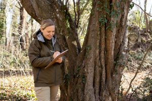
1. Initial Consultation: Meet with land surveyors to discuss your property’s needs and identify specific concerns, such as potential drainage issues.
2. On-Site Surveying: Surveyors visit your property, using specialized equipment to measure land features like elevations and depressions.
3. Data Analysis: Surveyors analyze the collected data to produce a detailed topographical map of your property.
4. Report and Recommendations: You receive a comprehensive report including maps and suggestions on how to tackle identified drainage problems.
Property owners can expect clear visuals illustrating water paths and potential problem areas. With this understanding, adjustments and improvements can be made to fortify against drainage issues. By keeping informed and proactive, property owners in Florida can maintain their land effectively, preparing for anything Mother Nature throws their way.
Ensuring Your Property’s Drainage with Accurate Surveys
Topographical surveys, when executed by professionals, offer an indispensable layer of security against potential drainage problems. Property owners who engage with these surveys set themselves up for success, ensuring their land and investments remain secure and productive. Staying informed and proactive equips owners with the knowledge to make wise decisions, keeping their properties in prime condition, regardless of the elements.
To ensure your property in Florida remains well-protected against drainage issues, consider conducting a thorough topographical survey. At Will’s Service Group, we offer expert guidance to help manage water flow effectively and enhance your land’s value and sustainability. Take proactive steps now to maintain your property’s integrity and secure its future.