Erosion is an ever-present concern for property owners, especially in areas like Florida where the climate and landscape make it a common issue. It silently reshapes land, potentially causing significant damage to structures over time. Property owners must remain vigilant and informed to protect their investments. Understanding how erosion works and how it impacts land can make a big difference in managing these risks.
Topographical surveys play a crucial role in identifying erosion early. They provide a clear picture of the land’s surface, revealing changes or threats that aren’t immediately visible. This knowledge is essential not just for preserving property value but also for planning future developments or landscaping. In Florida, where the dynamic environment can lead to unpredictable land shifts, these surveys are invaluable.
Understanding Erosion And Its Effects
Erosion is a natural process where soil, rock, and other surface material are worn away, primarily due to wind or water. This process can dramatically change the landscape over time, impacting both the appearance and the usability of the land. While erosion is a natural occurrence, human activities can accelerate it, leading to more severe impacts.
There are several types of erosion to be aware of:
- Water Erosion: Caused by rain, rivers, and waves, leading to soil being washed away.
- Wind Erosion: Occurs in dry, bare areas where soil particles are carried away by strong winds.
- Gravity Erosion: Involves materials moving downward, such as in landslides or rockfalls.
- Glacial Erosion: Though less common in Florida, glaciers can significantly impact landscapes as they move.
These forms of erosion can result in a variety of issues, such as soil degradation, reduced agricultural productivity, and structural damage to buildings and roads. In severe cases, erosion can even lead to landslides or the collapse of structures built on compromised land. For property owners, staying aware of these potential impacts is crucial to managing and mitigating risks.
Erosion shapes the world around us, but when left unchecked, it can wear away parts of our environment that we rely on. Understanding what causes erosion and the forms it can take is the first step in effectively managing it, ensuring your land remains healthy and safe.
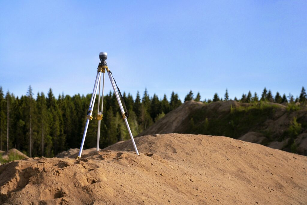
The Role Of Topographical Surveys In Identifying Erosion
Topographical surveys are a detailed way to map out the features of a piece of land. They work by making precise measurements that show variations in terrain, elevations, and existing structures. Using tools like GPS units and specialized software, land surveyors gather data that creates an accurate depiction of the site.
These surveys can catch early signs of erosion by identifying changes in the landscape that may not be visible to the naked eye. For instance, a survey might reveal slight shifts in land that could indicate future erosion issues. By regularly monitoring these changes, property owners can address potential problems before they cause significant damage.
Some of the specific tools and techniques involved in topographical surveys include:
- GPS Equipment: Used for precise location tracking and elevation measurements.
- Levels and Theodolites: Instruments that measure slopes and angles.
- Drone Technology: Helps capture aerial views of large areas, providing a comprehensive overview.
- Mapping Software: Translates raw data into understandable maps and models.
These tools not only highlight erosion risks but can also aid in planning for construction and development, ensuring that projects are built on solid ground.
Common Erosion Concerns In Florida
Florida’s unique environment presents particular challenges regarding erosion. The state’s sandy soils, coupled with seasonal rains and occasional hurricanes, make it especially prone to erosion issues. Coastal and inland areas face different forms of erosion, each with its own challenges.
Coastal regions often deal with erosion from storms and sea-level rise, which can lead to beach erosion and threaten buildings near the shore. Inland areas might experience erosion from heavy rainfalls that wash away soil, especially in places with less vegetation to hold the soil in place.
Some common erosion issues faced by Florida property owners include:
- Beach Erosion: Occurs due to waves and storms, gradually wearing away sandy shorelines.
- Soil Erosion from Rainwater: Heavy rains can wash away unprotected soil on properties.
- Sinkholes: These sometimes form when underground water erodes limestone, causing the ground to collapse.
Awareness of these local factors can help property owners better prepare and respond to erosion-related challenges.
Managing Erosion With Surveys
Taking proactive steps based on survey results can make all the difference in maintaining property stability. Regular topographical surveys provide ongoing insights that help catch changes early. By staying updated, property owners can apply effective measures to manage erosion.
Here are some practical suggestions for managing erosion:
- Plant Vegetation: Add plants with strong root systems to help hold soil in place.
- Install Retaining Walls: Use these in sloped areas to keep land from shifting.
- Improve Drainage: Ensure that water flows away from vulnerable areas to prevent pooling and soil erosion.
Ultimately, ongoing monitoring through surveys ensures the stability and safety of property over time. Addressing issues before they escalate can save significant resources and prevent potential hazards.
A Path To Long-Term Stability
In the end, understanding and managing erosion is all about preserving the space you call home. With detailed insights from topographical surveys, landowners can confidently navigate the specific challenges of Florida’s environment. Through thoughtful planning and regular checks, the landscape remains an asset rather than a liability.
Protecting land might seem daunting, but with the right approach and expert advice, it becomes manageable and even straightforward. A little investment in foresight pays off in maintaining a property that stands the test of time.
To keep erosion under control and maintain the integrity of your property, regular assessments are key. A detailed topographical survey can uncover early signs of landscape changes that might lead to erosion issues. At Will’s Service Group, we offer the expertise needed to manage these challenges effectively, helping you safeguard your investment against Florida’s unique environmental factors.