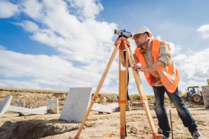
Natural disasters can strike without warning, leaving communities to face their devastating impacts. Planning ahead is the best way to reduce the damage caused by these events. One tool that plays a crucial role in disaster preparedness is the topographical survey. This type of survey provides a detailed map of the land, showing its features, elevations, and contours.
Topographical surveys are essential for assessing the risk of natural events like floods, landslides, and earthquakes. They give planners and emergency responders valuable information to guide their actions. By understanding the shape and features of the land, officials can design better flood control systems, plan evacuation routes, and build more resilient infrastructure.
Whether you’re a community leader or a concerned citizen, learning about topographical surveys can help you understand the steps needed to protect your area. These surveys are vital tools in preparing for and responding effectively to natural disasters. By reducing uncertainty, they help communities stand strong in the face of nature’s challenges.
Understanding Topographical Surveys and Their Importance in Disaster Preparedness
Topographical surveys provide a detailed view of the land’s surface, capturing the natural and manmade features. These surveys are crucial in disaster preparedness, offering insights that help communities anticipate and mitigate the effects of natural disasters like floods, landslides, and earthquakes.
By gathering data on the land’s elevation and shape, topographical surveys allow for a clearer understanding of how water, soil, and debris might move during a disaster. These surveys are conducted using various tools such as GPS, drones, and total stations to ensure accurate data collection.
Understanding these details is essential for city planners and emergency managers. The information guides decisions on infrastructure development, ensuring that buildings and roads are positioned to withstand potential threats. Additionally, topographical surveys are used to create detailed maps that highlight areas at greater risk of natural disasters, helping prioritize where resources and protective measures are needed most.
Communities that employ topographical surveys as part of their disaster preparedness strategy can respond more effectively to threats. By identifying vulnerabilities and planning accordingly, they protect lives and property, minimizing the potential impact of natural disasters.
Key Features Measured in Topographical Surveys for Risk Assessment
Topographical surveys measure a variety of features that are crucial for assessing disaster risk. These features help create an accurate picture of the land’s traits, allowing for better preparation and risk management. Here are key features commonly measured:
- Elevation and Contours: Understanding the elevation of different land areas helps identify flood-prone zones and plan for water drainage patterns.
- Slopes and Gradients: Steep slopes can be prone to landslides, especially after heavy rainfalls. Knowing the gradients aids in assessing these risks and planning preventive measures.
- Water Bodies and Drainage Patterns: Surfaces of rivers, lakes, and streams are mapped to evaluate flood risks and plan for effective water management systems.
- Vegetation and Land Use: Documenting existing vegetation and land usage helps assess the risk of forest fires and understand how land might absorb or repel water during heavy rain.
- Manmade Structures: Identifying buildings, roads, and utilities analyzes how these structures might impact or be impacted by natural events.
By measuring these features, a topographical survey provides a comprehensive understanding of the land’s potential vulnerabilities. This information is integral for developing detailed risk assessments, optimizing emergency response, and making informed decisions to safeguard communities from future natural disasters.
How Topographical Surveys Inform Emergency Planning and Response
Topographical surveys are vital in shaping effective emergency planning and response strategies. They provide a clear picture of how land lies, enabling planners to anticipate areas at risk during a natural disaster. With accurate data, emergency responders can create more effective strategies for evacuation, resource allocation, and infrastructure protection.
The survey data helps identify potential evacuation routes by mapping the safest and most accessible paths. This information is essential for ensuring the safety of residents during an emergency. By knowing where slopes are steep or areas are prone to flooding, planners can devise routes that avoid these hazards.
Furthermore, understanding the topography aids in the strategic placement of emergency resources. It allows responders to determine the best locations for shelters, supply depots, and command centers—areas least likely to be affected by natural disasters.
Topographical surveys also inform the development of systems like levees and flood barriers to protect vulnerable areas. The knowledge gained from these surveys ensures that protective measures are tailored to the unique landscape, providing maximum protection to communities.
Steps to Conduct a Topographical Survey for Disaster Mitigation
Conducting a topographical survey effectively requires careful planning and execution. Here are the basic steps involved in performing a survey aimed at disaster mitigation:
- Define the Objectives: Determine what specific data is needed and how it will be used in disaster planning and response. Clear goals guide the survey process.
- Pre-Survey Planning: Study existing data and maps of the area to understand what has already been documented. Prepare the necessary equipment and personnel required for the survey.
- Field Data Collection: Utilize tools like GPS, drones, and total stations to gather accurate data on land elevation, slopes, and surface features. Make sure that all key areas and features are thoroughly examined.
- Data Analysis and Mapping: Process the collected data to create detailed maps showing the topography of the area. Highlight potential risk zones and important features.
- Integration with Disaster Plans: Use the survey data to inform and update emergency planning and risk assessment strategies. Make improvements to existing plans based on new insights.
- Regular Updates: Conduct periodic surveys to keep data current and account for any changes in the landscape. Continuous updates ensure that disaster plans remain relevant and effective.
Conclusion:
Topographical surveys play an essential role in preparing for natural disasters. They provide critical data that helps shape the safety plans communities rely on during crises. By accurately mapping out the terrain, these surveys enable better resource distribution, safer evacuation routes, and more reliable disaster mitigation strategies. With thorough survey practices, cities and towns can significantly enhance their resilience to natural threats, protecting both lives and property.
As the impacts of natural disasters become more unpredictable, having detailed topographical information becomes even more crucial. This detailed data empowers communities to anticipate challenges and respond accordingly, minimizing damage and ensuring quicker recovery.
Don’t wait for disaster to strike before you prepare. Trust our team at Will’s Service Group to provide precise and thorough topographical surveys tailored to your needs. Our expertise ensures that you have the information needed to protect your community and stay a step ahead of potential threats. Contact us today to learn how we can assist in safeguarding your future.


