5 Tree Problems That Professional Tree Surveys Can Identify

tree survey

Tree problems identified by survey plays a critical role in property management and development in Florida. Trees play a crucial role in creating a harmonious environment, enhancing aesthetics, and supporting the ecosystem around us. Whether we find them nestled in residential gardens or lining the streets of commercial areas, maintaining their health and safety is key. A healthy tree not only offers shade and beauty but also contributes to cleaner air and provides habitats for various forms of wildlife. However, like any living organism, trees face challenges that can affect their longevity and structure.

A tree survey can help identify and address these challenges. This process involves a thorough examination of trees to evaluate their condition and determine any possible issues. In a place like Florida, with its rich biodiversity and unique climate, certain tree species might face specific problems that require attention. By understanding the common issues trees encounter and how a tree survey can help, property owners can take proactive steps to ensure their trees thrive.

Common Tree Diseases: Problems Identified Survey

tree survey

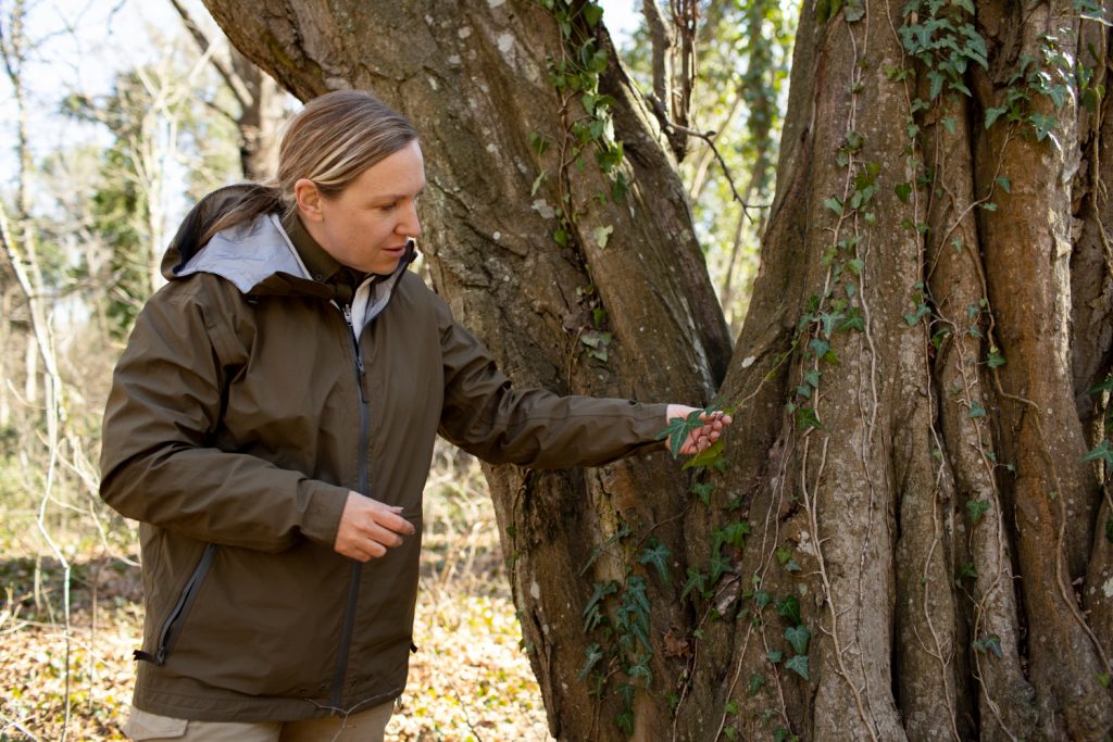
Florida’s climate provides an ideal environment for trees to flourish, but it also creates conditions where diseases can thrive. Understanding these diseases helps in taking early action to prevent significant damage. Here’s a look at some common tree diseases that professional surveys can identify:

– Powdery Mildew: This easily recognizable disease appears as a white or grayish powder on leaves. It thrives in warm, dry conditions. A survey can catch this early, allowing for timely intervention.

– Root Rot: Often caused by excess moisture, root rot weakens the foundation of the tree. Professional surveys check for signs of decay or mushroom growth around the base.

– Anthracnose: Affects leaves, causing them to develop dark spots and curl. This can hinder the tree’s ability to photosynthesize effectively. Early detection by survey specialists can prevent its spread.

Identifying and understanding these diseases is the first step toward treatment and prevention. Left unchecked, these issues may spread, affecting not only a single tree but potentially an entire area of greenery. Early intervention through tree surveys can prevent this scenario, maintaining the health and safety of both trees and the property they enhance.

Structural Issues in Trees

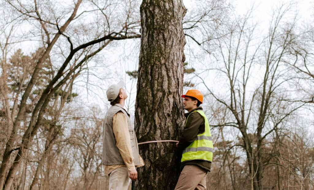
Even the sturdiest of trees might have hidden structural issues. From weak branches that might break during a storm to hollow trunks that compromise stability, these hidden problems pose risks not just to the tree, but also to nearby people and structures.

Tree surveys provide an in-depth look at the structural integrity of trees. Professionals use specific tools and techniques to identify weak points that might not be visible to the untrained eye. They can detect signs like unusual leaning, cavities, or cracks. Once identified, these issues can be addressed promptly, whether through pruning to remove weak branches or providing support with cables and braces.

Early detection of structural issues is essential for preventing damage and maintaining safety in both residential and commercial properties. Taking preventative measures ensures not only the tree’s health but also the protection of the surrounding environment and property.

Pests and Infestations

tree survey

In Florida’s warm climate, certain unwanted visitors can make their homes in trees, causing significant problems. Among the usual suspects are beetles and caterpillars, which can be hard to spot before they’ve already done damage. Beetles, for instance, often bore into wood and lay their eggs, leading to infestation and weakening the structure. Caterpillars munch through leaves at a surprising rate, potentially stripping a tree and affecting its ability to photosynthesize.

A tree survey can be a lifesaver when it comes to these sneaky invaders. Surveyors can detect the subtle signs of pest activity that might be easy to miss, like small holes in the bark or unusual leaf damage. Once discovered, they can suggest effective treatments or preventative measures to protect your trees. Quick action can mean the difference between a tree that heals and one that continues to decline.

Impact of Environmental Stress

Trees live and breathe with help from the environment, and when that environment is less than ideal, it can stress them out. Events like drought or storms can put trees through the wringer, making them more susceptible to disease and pests. Poor soil conditions, whether too sandy or too dry, also play a part in making trees struggle.

Tree surveys come in handy by evaluating these stress factors. During a survey, experts assess the soil quality, water availability, and any recent weather events that might impact the trees. They’ll provide feedback about what’s hurting the trees and practical ideas for helping them cope. Whether it’s ensuring sufficient water or improving soil conditions, these measures ensure trees aren’t just surviving but thriving.

Root Health and Soil Conditions

Roots are like the foundation of a building; they’re essential for keeping the tree upright and nourished. Problems underground can go unnoticed until it’s too late, leading to serious instability or even toppling. Tree surveys dig deep, sometimes literally, to check how healthy the roots are. They look for signs like exposed roots, poor growth, or foul smells that might indicate issues.

Surveys also examine soil conditions, assessing whether the nutrients and moisture levels are suitable for healthy tree growth. By pinpointing what’s missing or abundant, these evaluations provide the information needed to amend the soil and tackle root health proactively. Healthier roots mean healthier trees, contributing to a strong and stable landscape.

Maintaining Healthy Trees

Caring for trees requires ongoing attention and expertise, especially in an area like Florida, where environmental factors can change quickly. Professional tree surveys offer a comprehensive way to stay ahead of potential issues, from pest infestations and diseases to structural and environmental threats. Regular surveys aren’t just about preventing problems; they’re about stewarding the natural beauty and ecological benefits that trees provide.

Trees are more than just a backdrop; they are crucial to the ecosystem and to our enjoyment of outdoor spaces. Keeping them in top shape isn’t just a task—it’s part of maintaining a healthy environment for everyone who shares it. By taking advantage of professional expertise, property owners can ensure that their trees not only survive but truly flourish.

To keep your trees in optimal health and enhance their safety, consider scheduling a tree survey with Will’s Service Group. By identifying potential issues early on, you can take the necessary steps to protect your greenery and sustain your environment beautifully and sustainably.

Florida’s tree protection regulations and environmental policies are managed by the Florida Department of Environmental Protection.

Topographical Surveys: What They Reveal About Your Land

topographical survey

Topographical survey land reveal plays a critical role in property management and development in Florida. Understanding your land is crucial, especially if you’re planning to build or develop in Florida. One of the best tools for getting to grips with the lay of your property is a topographical survey. These surveys map out the land’s features, giving you a clear picture of what’s really going on beneath your feet. They show you various elements like elevations and contours, helping to paint a detailed picture of your land.

Imagine a topographical survey as your land’s blueprint. It tells you all the details about what’s there, from the height of hills to the depth of valleys. This information can be incredibly useful if you’re thinking about starting a new project. Whether you’re putting up a new building or simply landscaping your garden, knowing the features of your land can prevent headaches down the line.

Why Topographical Surveys Matter: Survey Land Reveal

Aerial view of residential property for boundary survey

A topographical survey helps in pinpointing the layout of the land. It identifies natural features such as hills, ditches, and flat areas. This is crucial for many reasons:

– Planning and Development: If you’re considering a construction project, understanding the natural features of your land can save time and money. For example, knowing how water flows across your property can help you avoid costly drainage problems.

– Environmental Considerations: Recognizing natural watercourses and slopes helps plan eco-friendly designs. It helps in placing buildings in a way that works best with nature.

– Safety and Compliance: Topographical surveys ensure buildings conform to local regulations. In areas prone to flooding, these surveys can highlight risk zones, enabling safer building practices.

For homeowners and developers in Florida, where the terrain can be as varied as the weather, topographical surveys are a smart way to ensure your land is used effectively. By having a clear understanding of the natural landscape, you can make informed decisions, streamline projects, and avoid potential pitfalls.

In today’s world, getting a topographical survey is like fitting your land with a GPS—it keeps you on the right track and reduces surprises once development begins. Investing in one before you start your project can ease the process and set your plans for smooth sailing.

What Topographical Surveys Reveal

When you conduct a topographical survey, you’re essentially mapping out every nook and cranny of your land. These surveys highlight key features such as:

– Elevations and Contours: These show the height differences and slopes across your property, which can be crucial for construction projects.

– Natural Features: Identifying existing natural structures like trees, streams, and rocks helps determine what’s possible during development.

– Man-Made Features: Things like pathways, fences, and utility lines need to be mapped to understand their impact on the land.

Understanding these details is like having a toolkit for your land. Knowing where water naturally wants to go can protect your future home from flooding. Being aware of underground utility lines can prevent accidents. And having a clear sense of elevations ensures your project remains structurally sound and meets regulations.

Benefits for Property Owners in Florida

Legal documents review for commercial property survey transaction

For those living in Florida, topographical surveys offer a treasure trove of benefits. Given Florida’s unique landscapes, from its wetlands to sandy soils, these surveys are particularly helpful.

– Protection Against Flooding: Florida’s weather can be unpredictable. By knowing the elevations, you can position buildings away from low-lying areas that may flood.

– Enhanced Property Value: By understanding the land’s intricacies, you make better decisions. This understanding helps in making improvements that can boost property value.

– Safety and Regulation Adherence: Building on solid ground and respecting natural features ensures safety. This also means your property is more likely to meet local building codes, which can save you from future hassles.

How To Get a Topographical Survey for Your Property

If you’re thinking about getting a topographical survey in Florida, here’s a simple guide to help you move forward:

1. Find a Qualified Surveyor: Look for certified professionals who specialize in your area. They’ll have the local expertise to address specific challenges.

2. Understand the Process: The survey begins with measurements using specialized tools. Then, these measurements are turned into detailed maps.

3. Prepare for Costs and Timing: Costs may vary based on the size and complexity of your land. Likewise, the timeline can stretch over days, especially for larger properties.

Explore the Insights of Your Land

Getting a topographical survey is like opening a window to understand your land’s true potential. Whether you’re a new property owner or considering developing your land, it’s worth investing in this valuable tool. By exploring the features of your property, you pave the way for smarter decisions and ultimately a more rewarding ownership experience.

Discover what your land has to offer beyond the surface. With a detailed understanding, every decision becomes informed, ensuring your property serves your needs now and in the future. Step forward with the confidence that your land holds no surprises, just opportunities waiting to be harnessed.

Feeling ready to explore your land’s full potential? Get started with a topographical survey to uncover all aspects of your property. Will’s Service Group offers the expertise you need to map out the details effectively. Learn more about how a topographical survey can make a difference in your plans today.

Topographical surveys reference elevation benchmarks maintained by the NOAA National Geodetic Survey.

Land use and environmental considerations for development are regulated by the Florida Department of Environmental Protection.

Understanding Land Surveys: Types and Their Uses

land survey

Land survey types and uses plays a critical role in property management and development in Florida. Land surveys might not be something we think about every day, but they play a big role in property ownership and development. Imagine you’re buying a house or planning to build. You’d want to know exactly where your property lines are, right? That’s where land surveys come into the picture. They are precise measurements that tell you about the boundaries, features, and even the elevation of your land. They help determine the legal boundaries of a property, ensuring you know what you own and can avoid any disputes with neighbors.

In Florida, land surveys are especially important due to the state’s unique landscape. Whether you’re a homeowner, developer, or real estate agent, understanding the types of surveys and their purposes can help you make informed decisions. From identifying your property’s exact boundaries to knowing how it slopes and drains, different types of land surveys provide crucial insights. We’ll dive into the main types of land surveys and explore their uses, so you can see how they fit into your property needs.

Types of Land Surveys: Survey Uses

drone view of a land property with trees

Boundary Surveys

Boundary surveys focus on establishing the exact borders of a property. Think of them as the instructions to a complex puzzle that shows which pieces go where. They define where your property begins and ends, providing clarity and avoiding disputes with neighbors. This type of survey is essential when you’re purchasing land or settling boundary disagreements. For instance, if you’re planning to build a fence, a boundary survey ensures you’re placing it on your property, not accidentally on someone else’s.

Here’s what a boundary survey typically entails:

– Marking property corners with stakes or flags.

– Identifying and recording details about the property like the length of each border.

– Checking records from previous surveys to verify accuracy.

Topographical Surveys

Survey blog featured image of survey crew at property

Topographical surveys give you the lay of the land. They map out the elevation and natural features of your property, like hills, valleys, trees, and water bodies. This information is vital, especially in development and construction. Contractors and builders often rely on topographical surveys to design structures that fit the landscape naturally and efficiently.

Here’s how topographical surveys can be useful:

– Offering detailed contour lines that show height changes.

– Helping architects design buildings that work with the land.

– Assisting in drainage planning to prevent future water issues.

Topographical surveys are the key to understanding the natural shape of land, ensuring structures are built to last, and keeping environmental concerns in check. They’re an essential tool when planning any physical changes to the land in Florida, given the diverse terrain and weather challenges.

Types of Land Surveys (Continued)

ALTA/NSPS Surveys

ALTA/NSPS surveys, or American Land Title Association/National Society of Professional Surveyors surveys, are comprehensive surveys tailored for commercial property transactions. They help ensure all parties have a clear understanding of the property boundaries and features, which is vital in complex real estate deals. These surveys cover everything from boundary lines to the location of buildings and any easements or rights of way affecting the property. They play a key role in real estate transactions by confirming that everything aligns with current title records, thus preventing future disputes or financial losses.

For example, if you’re about to invest in a commercial property, an ALTA/NSPS survey gives you peace of mind. It confirms that all structures are correctly documented and that there are no unforeseen issues such as unrecorded easements that might impede your plans. This level of detail is necessary for transactions that involve large sums and complex properties, ensuring that buyers, lenders, and insurers have the complete picture.

As-Built Surveys

An as-built survey provides an accurate map of the property’s current condition, showing exactly what exists on the ground. These surveys become particularly useful after construction projects are completed. They document what was built, allowing property owners and developers to ensure everything complies with the original design plans and local regulations. This survey type is essential for those planning future renovations or expansions, as it gives an up-to-date reference of the site’s layout and utilities.

As-built surveys are a valuable tool when you want to verify that construction was completed according to the plans. They help avoid any compliance issues with government regulations by showing that all structures meet zoning and building code requirements. They also serve as a vital resource for future alterations, allowing you to work from accurate data rather than outdated blueprints.

How to Choose the Right Survey

Factors to Consider

Choosing the right kind of survey depends on several factors. Here are a few things to keep in mind:

– Property Type: Residential, commercial, or undeveloped land might require different survey types.

– Intended Use: The purpose of the survey, whether it’s for a sale, construction, or resolving a boundary dispute, will dictate the type of survey.

– Budget: Survey complexity can vary widely, impacting cost. Plan according to what’s necessary for your needs.

Consulting with a qualified professional can help you decide which survey suits your specific situation. They can offer insight into local requirements and ensure you’re meeting all legal standards.

Making Informed Decisions with Land Survey Services

Navigating property ownership and development can be smoother when you have the right information. By understanding different kinds of land surveys, you significantly decrease the likelihood of unwelcome surprises down the road. Opting for professional services ensures you’re getting precise and comprehensive data, which helps you make informed decisions about your property.

Land surveys are like a roadmap to your property, showing you the way forward in complex real estate landscapes. Whether you’re buying your first home, developing commercial space, or simply wanting to demystify your property lines, knowing which survey to choose is a step towards smart property management.

As you consider your property needs in Florida, it’s important to choose the right survey to ensure accurate results and peace of mind. To gain a better understanding of how professional services can assist you, explore your options with Will’s Service Group. Learn more about our comprehensive land survey services and how they can benefit your property management or development needs.

The National Society of Professional Surveyors provides comprehensive information on different survey types and their applications.

In Florida, all survey types must be performed by professionals licensed through the Florida Board of Professional Surveyors and Mappers.

How Commercial Surveys Help Prevent Construction Delays

commercial surveys

Commercial survey prevent delays plays a critical role in property management and development in Florida. Construction delays can be incredibly frustrating, often leading to increased costs, longer completion times, and stressful situations for everyone involved. Especially in a state like Florida where weather and regulatory considerations can complicate matters, keeping a project on schedule is a top priority. That’s where commercial surveys come into play. Having a clear picture of the construction site, as well as anticipating potential issues, can make all the difference in keeping a project on track.

So, what exactly does a commercial survey offer? At its core, it’s a detailed assessment of all the elements of a construction site. This assessment paints a clear picture of the land, identifying any obstacles that could cause setbacks. By addressing these roadblocks before they arise, a commercial survey helps ensure your construction project flows as smoothly as possible.

Identifying Potential Site Issues Early: Commercial Survey Prevent Delays

Legal documents review for commercial property survey transaction

A commercial survey is like having a roadmap before you set out on a trip. It guides you to identify possible roadblocks ahead of time, such as underground utility lines or uneven ground. Without this insight, construction teams might encounter unexpected surprises that stall progress or even pose safety hazards. Let’s break down some areas where commercial surveys can be invaluable:

– Underground Utilities: Knowing the location of pipes, cables, and other utilities beneath the surface is crucial. Hitting these during construction not only causes delays but can also mean hefty repair costs.

– Soil Conditions: Different areas have varying soil stability, which affects foundation support. Surveying the site ensures the ground can support planned structures, preventing future settling or cracking.

– Environmental Considerations: Florida’s unique ecosystems mean projects often need to consider wetlands or protected areas. Identifying these beforehand can prevent legal and environmental issues.

With a solid commercial survey, you tackle these concerns early, saving time and avoiding costly interruptions. Remember, the goal here is to prepare for the unexpected, ensuring that your construction project can proceed without a hitch.

Ensuring Accurate Project Planning

One essential step to keep your construction project from hitting a snag is precise project planning. Commercial surveys play a huge role in this process, providing detailed and accurate data about the construction site. This information is the cornerstone of good project management. When you have reliable data about property boundaries and other site specifics, it’s easier to plan effectively.

Precise measurements help avoid misunderstandings on the job site. They ensure that structures fit perfectly on the land, reducing the likelihood of costly adjustments down the line. Think of it like putting together a puzzle. When all the pieces fit as expected, the picture comes together smoothly. The same goes for construction—accurate data ensures everything aligns as planned. Accurate project planning ultimately results in smoother construction progress, saving time and resources.

Compliance with Local Regulations

commercial land surveying

It’s crucial to comply with local building codes and regulations, especially in a diverse environment like Florida’s. These rules exist to ensure safe and responsible building practices. Commercial surveys offer detailed insights into compliance requirements, preventing potential legal headaches.

For example, understanding setbacks, heights, and zoning laws keeps your project from encountering regulatory hurdles. These surveys act as a guiding light, helping you navigate the often complex web of rules and standards. Having a comprehensive understanding of these regulations isn’t just about following the law. It’s about ensuring the integrity of your construction project and its longevity.

Facilitating Clear Communication with Contractors

Communication stands as one of the most critical aspects of a successful construction project. Clear, concise information sharing helps all parties involved to understand their roles and responsibilities. Commercial surveys empower this communication, offering a clear blueprint that contractors and stakeholders can trust.

When every team member has access to the same accurate site data, coordination improves. Miscommunications become less frequent, and everyone can focus on their tasks without worrying about unexpected issues. Projects progress more smoothly because everyone shares an understanding of the project’s scope and limitations.

Smooth Project Execution and Timely Completion

Having accurate survey data forms the backbone of smooth project execution. It streamlines the workflow, allowing teams to progress according to schedule without major disruptions. This means that contractors can focus on what they do best: building.

Accurate data also means fewer surprises. When teams know exactly what to expect, they can prepare adequately and maintain efficiency. This organization translates to fewer delays and a project that finishes on time. When everything runs like a well-oiled machine, from the planning stages to the final touches, the benefits to timeline and budget are clear.

Keeping Your Construction Project on Track

Commercial surveys play a significant role in ensuring that construction projects run smoothly and efficiently. They provide the crucial data needed for accurate planning and compliance with regulations, supporting clear communication and teamwork on site. By being proactive with potential site issues, projects avoid unnecessary delays and stay on schedule.

Remembering the value of professional survey services can be your best ally in navigating the complexities of construction. Investing in this step can mean the difference between a project that runs seamlessly and one that hits snags and setbacks. It’s all about paving the path to success with informed decisions and careful planning.

For a successful construction project that avoids delays and runs smoothly from start to finish, consider the advantages of using commercial surveys. Will’s Service Group is here to help you unlock the full potential of your building plans. Learn more about comprehensive commercial surveys that fit your needs and ensure seamless execution.

The American Society of Civil Engineers publishes project management and construction standards that help minimize delays on commercial projects.

The Importance of Tree Surveys in Urban Development Projects

Tree Surveys

Florida’s urban landscape is growing fast, with cities expanding and new developments popping up all over the place. This bustling growth brings a lot of opportunities but also some big challenges. One major hurdle is ensuring that urban development respects the environment. That’s where tree surveys come in. They play a key role in balancing development needs with the preservation of natural spaces.

A tree survey is a detailed report that helps developers understand the trees on a site before construction begins. It identifies tree species, health, and location, providing vital information to guide planning decisions. Understanding the role and process of tree surveys can be incredibly beneficial for anyone involved in urban development. By preserving trees, developers not only enhance the beauty of an area but also contribute to environmental health, creating sustainable cities for future generations.

Understanding Tree Surveys

tree survey

Tree surveys are essential tools for developers and city planners because they offer a snapshot of the green areas within a proposed construction site. But what exactly does a tree survey entail? At its core, a tree survey involves cataloging all the trees in a specific area before any development starts. This catalog typically includes the types of trees present, their condition, and where they are located.

Let’s break down the process:

– Species Identification: Surveyors identify each tree species on the land. This helps developers make informed decisions about which trees are valuable for conservation.

– Tree Health Assessment: The health of each tree is carefully assessed. Trees that are diseased or in poor condition might be removed, while healthy ones can be preserved and protected.

– Mapping and Measurements: Surveyors create detailed maps showing the precise locations and sizes of trees. This helps determine how the development can best fit around these natural elements.

Compared to other surveys, like topographical or boundary surveys, tree surveys focus specifically on the living components of the landscape. This makes them unique and highly valuable, especially in environmentally conscious areas like Florida. By utilizing tree surveys, developers can achieve a harmony between new infrastructure and the existing green spaces.

Benefits of Tree Surveys in Urban Development

Tree surveys play a big role in urban projects, ensuring that green spaces are preserved while development takes place. Let’s explore some benefits that make these surveys so important.

– Preserving Trees and Green Spaces: By identifying trees that are vital to local ecosystems, surveys provide a way to protect these natural beauties from unnecessary removal. Preserved trees enhance the visual appeal of new developments while maintaining wildlife habitats.

– Compliance with Local Laws: Many areas have rules that protect certain tree species or limit the removal of trees larger than a specified diameter. A tree survey ensures that development complies with these regulations, avoiding fines and ensuring a smooth planning process.

– Preventing Legal Issues: By knowing the boundaries and locations of significant trees, developers can avoid legal disputes related to tree removal. Early identification of tree preservation areas reduces potential conflicts with local communities or environmental groups.

Tree Surveys and Urban Planning

tree surveys

Incorporating tree surveys into urban planning can lead to more thoughtful and efficient developments. When planners use survey data, it informs decisions on layout, building placement, and other crucial aspects of development.

Successful urban projects often include detailed plans emphasizing tree conservation. For example, in a recent Florida development, planners used survey results to redesign road layouts, ultimately helping preserve a substantial number of mature shade trees. The project not only respected the local environment but also enhanced the community’s living spaces.

Tree surveys can also be cost-effective in the long run. By knowing the important trees that need conservation, developers can avoid costly relocations or redesigns later in the process. Identifying potential conflicts early means fewer surprises down the line and more efficient use of resources.

Choosing the Right Surveyor

When it comes to conducting tree surveys, hiring a qualified professional is incredibly important. A skilled surveyor will provide accurate data and make informed recommendations to balance development needs with environmental preservation.

When selecting a surveyor, consider the following:

– Experience and Expertise: Look for someone with significant experience in handling tree surveys in urban settings, particularly in Florida.

– Attention to Detail: The best surveyors pay close attention to every aspect of the survey, ensuring nothing is overlooked.

– Strong Communication Skills: Good surveyors clearly explain their findings and help guide developers through the decision-making process.

Choosing the right professional ensures that the tree survey is comprehensive and reliable, providing a solid foundation for successful and sustainable urban development.

Paving the Way for Green Urban Development

Tree surveys hold tremendous potential in shaping the future of urban areas. By integrating these insights into planning and development efforts, communities can enjoy vibrant, green spaces alongside modern infrastructure. This careful balance contributes to a higher quality of life and a stronger connection with nature.

Looking ahead, more cities and developers will likely embrace tree surveys as a standard part of their planning processes. As they do, the landscapes of urban areas will transform, becoming greener and more sustainable. This represents an exciting opportunity for urban regions to grow while staying committed to environmental values.

For urban projects in Florida that aim to integrate development with environmental mindfulness, a comprehensive tree survey is indispensable. Will’s Service Group is dedicated to providing thorough surveys that help create sustainable urban environments. By understanding the unique natural elements of your site, you can preserve valuable green spaces while advancing your projects seamlessly. Explore how tree surveys can contribute to your development goals and ensure compliance with local guidelines, all while enhancing the beauty and ecological balance of your community.

Urban development projects must comply with environmental standards set by the Florida Department of Environmental Protection.

Common Issues Uncovered by As-Built Surveys

As-Built Surveys

As-built survey common issues plays a critical role in property management and development in Florida. As-built surveys play a crucial role in construction projects, offering significant insights long after the building stage is complete. These surveys capture the actual dimensions and layouts of completed structures, compared to the original construction plans. By doing this, they reveal any changes or variations that occurred during construction. This helps ensure that everything is as it should be, and addresses any unexpected hiccups.

Discovering potential issues early with as-built surveys can save property owners from future headaches. By identifying discrepancies and structural concerns right off the bat, owners can address and resolve these issues before they escalate. For example, if an as-built survey reveals that a wall was constructed out of alignment, this knowledge allows for corrective measures that prevent further complications. Understanding these potential pitfalls early means avoiding costly and time-consuming fixes down the road.

As-built Survey Common Issues

as-built survey

One common outcome of an as-built survey is the identification of discrepancies. These happen when there’s a mismatch between the initial blueprints and the finished structure. While minor variations might seem trivial, they can significantly impact the building’s function and longevity. Some typical discrepancies that crop up include:

– Mismatched wall placements

– Variations in floor levels

– Differences in window or door locations

For property owners, these differences might lead to unexpected surprises. For instance, if a window is slightly off from its planned location, it might affect the room’s lighting or ventilation. Discovering these issues early means owners can plan for adjustments in their upcoming renovations or even assist in negotiating repairs or changes with contractors.

Overall, though discrepancies aren’t always a disaster, being aware of them empowers owners to make informed decisions about their properties. It’s like having a roadmap to navigate any potential bumps in the road, ensuring smoother interactions with contractors and maintenance teams.

Unearthing Hidden Structural Issues

As-built surveys often reveal structural issues that weren’t immediately obvious during construction. These could be problems related to the building’s integrity that develop when minor faults are overlooked. Over time, these can lead to more severe troubles if not addressed promptly. An example might be the gradual settling of foundations, which, if left unchecked, can cause significant cracks in walls.

Ignoring such issues can lead to safety hazards and expensive repairs. A small crack may not seem like a big deal, but it could signal a much larger problem beneath the surface. Catching these early with an as-built survey allows homeowners to tackle them before they escalate into something unmanageable.

Detecting Non-Compliance with Building Codes

As-built survey blog post image

Another critical aspect uncovered by as-built surveys is building code compliance. Construction projects must adhere to strict regulations to ensure safety and legal conformity. These codes cover everything from fire safety measures to electrical systems.

– Identifying non-compliance: As-built surveys highlight any areas where the building deviates from these requirements. This might include improper installation of systems or inadequate safety features.

– Addressing non-compliance: Once identified, necessary modifications can be made. This might involve installation of extra supports or correcting electrical mistakes to meet code.

By resolving these issues swiftly, property owners avoid potential penalties and safeguard the well-being of the building’s occupants.

Legal and Financial Implications

There are notable legal and financial consequences for ignoring the discoveries from as-built surveys. Legal issues may arise if a property violates building codes, leading to fines or mandates to correct violations. From a financial standpoint, unaddressed construction issues can decrease property value, making it harder to sell or refinance.

Investing in corrections early, as identified by as-built surveys, can prevent these problems and preserve the property’s market value. In essence, tackling these issues upfront can save significant amounts of money and legal trouble in the long run.

Summing Up the Importance of As-Built Surveys

Having an as-built survey is like having a thorough check-up for your property. It ensures everything’s in line with original plans and current standards. These surveys not only pinpoint discrepancies and structural concerns but also highlight compliance with regulations. This kind of inspection assures peace of mind, letting property owners sleep easy knowing their investment is sound.

Relying on professional surveyors to conduct as-built surveys can guarantee thorough and accurate assessments. With their help, property owners can confidently address any building concerns, keeping everything safe and compliant. This knowledge empowers property owners to manage their assets wisely and keep any unexpected costs at bay.

For property owners aiming to maintain the value and structure of their buildings, understanding the role of an as-built survey is essential. It helps catch discrepancies, structural issues, and compliance concerns. To ensure your property is thoroughly assessed and in line with standards, consider an as-built survey from Will’s Service Group. Our expertise can help identify potential problems early, keeping your property in prime condition.

As-built survey findings that reveal code violations should be reported to the Cape Coral Building Division for resolution guidance.

Ensure your as-built survey is performed by a licensed professional registered with the Florida Board of Professional Surveyors and Mappers.

How to Plan Your Build with a Construction Stakeout Survey

Construction Stakeout Survey

Plan build stakeout survey plays a critical role in property management and development in Florida. Starting a construction project is an exciting yet challenging endeavor. It’s all about transforming ideas into reality, deciding where each structure will go, and making sure everything fits right. This is where construction stakeout surveys come into play, acting like a blueprint on the ground for builders to follow.

A construction stakeout survey involves marking out where various elements of a project will be built. Imagine the survey as a roadmap that guides builders, ensuring everything is placed exactly where it should be. This precision is crucial because even the smallest misplacement can lead to significant problems down the line.

Construction stakeout surveys not only help avoid these costly mistakes, but they also keep the building process smooth and efficient. By accurately defining key points such as boundaries, foundation locations, and utility lines, these surveys provide a clear path forward. Understanding how to integrate construction stakeout surveys into your project planning can make all the difference between a seamless build and one full of unexpected hurdles.

Understanding Construction Stakeout Surveys: Plan Build Survey

Construction stakeout survey for a new building

A construction stakeout survey is a critical component of laying the groundwork for any building project. It involves marking the exact locations of structures and utilities on a site before construction begins. This survey acts as the bridge between architectural plans and the physical land where the project will take form. By doing this, builders and contractors have a tangible guide that makes sure everything fits as intended.

Accuracy in these surveys is crucial. Precise marking of boundaries and structures prevents overlaps and misplacements that can lead to costly delays and even legal disputes. For example, if a building’s foundation is incorrectly marked, it might encroach on a neighbor’s property or violate setback requirements. This kind of miscalculation can trigger significant financial losses and project downtime.

Construction stakeout surveys are essential in avoiding such expensive mishaps. By clearly defining all critical points, they help ensure that construction follows the planned design. This process reduces the chance of needing to redo work, keeping the project on schedule and within budget. Understanding the importance and function of stakeout surveys empowers anyone involved in building a home or commercial property to proceed with confidence.

Key Elements of a Construction Stakeout Survey

Various components are marked during a construction stakeout survey, each playing a vital role in ensuring a successful build. Here are some key elements:

– Foundation Layout: This sets precise locations for the building’s base, ensuring the structure’s stability and alignment.

– Utility Placements: Locations for water, electricity, and sewage are marked to prevent interference with the building’s functions.

– Grading: This involves shaping the land to manage water drainage, reducing the risk of flooding or erosion.

Each of these elements ensures the construction aligns perfectly with the approved design plan. If foundation marks drift away from the specified spots, for instance, the building’s integrity could be compromised, leading to uneven floors or walls. Similarly, poor utility placement might result in expensive and complicated modifications later on.

Errors in any of these components can spell trouble. Misplaced utilities can lead to service outages or hazards, and improper grading may worsen water management issues. Such mistakes not only increase the project’s cost but also prolong the timeline. A well-executed stakeout survey mitigates these risks, setting a firm groundwork for a successful construction endeavor.

Benefits of Using a Construction Stakeout Survey

Construction Stakeout Survey

Construction stakeout surveys provide numerous advantages that make them indispensable in the building process. One of the key benefits is their contribution to efficient project timelines. By precisely marking where each part of the project should be, these surveys minimize delays caused by misalignments or missing elements. Contractors can follow a clear roadmap, ensuring that each phase of construction progresses smoothly.

Managing budgets is another significant benefit. With accurate stakeout surveys, builders can avoid rework due to misplacements, which often result in unexpected expenses. By preventing these costly mistakes, stakeout surveys help keep projects within financial plans. It’s easier to stay on budget when builders are not constantly correcting errors or dealing with unforeseen development issues.

Constructing without a proper stakeout survey can result in several common problems like misplaced utility lines or incorrect elevations. By identifying potential issues early, these surveys save time and money. For example, inaccurately placed foundation markings can lead to structural problems down the line, which are often expensive to rectify. With a thorough survey, such issues are avoided, keeping the focus on moving forward instead of backtracking.

Steps to Implement a Construction Stakeout Survey in Your Build

Successfully incorporating a construction stakeout survey into your project involves several key steps. First, it’s essential to coordinate with a qualified surveyor before construction begins. Engaging the surveyor early ensures that they understand the project scope and can prepare accordingly. Scheduling this ahead of time also allows for any necessary adjustments before the onset of construction activities.

Ensure the surveyor has accurate and complete building plans. This means double-checking all dimensions, layouts, and specific instructions. Providing clear and detailed designs will help the surveyor mark accurate points on your site. This communication is vital to translating paper plans into on-site reality.

Finally, verifying survey results with design teams is crucial. After the surveyor has completed their work, walk through the site with your design team to confirm everything matches up with the original plans. This step acts as a final assurance that no details were overlooked or misinterpreted. Having a second set of eyes ensures that all elements align perfectly, minimizing the risk of errors before groundbreaking begins.

Conclusion

Incorporating a construction stakeout survey into your building plans can significantly impact the success of your project. These surveys provide the accuracy and foresight needed to seamlessly transition from blueprints to reality. By paying attention to every detail before construction starts, you set up the entire project for success. Think of it as laying a solid foundation for the rest of your work—getting it right means everything else falls into place.

Ensuring your build aligns perfectly with its design plan is imperative. A construction stakeout survey is your assurance against costly setbacks and errors. This proactive approach creates a smoother and more predictable construction timeline, fostering both efficiency and peace of mind. It ensures your visions are correctly implemented and that the project can proceed without unnecessary interruptions.

To make your project a success, it’s crucial to rely on skilled professionals who understand the complexities involved. Consider reaching out to Wills Service Group for expert guidance in planning and executing your construction stakeout needs. Our team of experienced land surveyors is ready to help you bring your building project to life, ensuring every detail is precisely in place as you envisioned. Contact us today for a construction stakeout survey.

Before breaking ground, verify your building permit status and setback requirements with the Cape Coral Building Division.

Construction stakeout practices align with standards published by the American Society of Civil Engineers.

ALTA Surveys: What Buyers and Sellers Need to Know

ALTA surveys

Buying or selling a property can be a complex journey with many details to manage. One crucial aspect of any real estate transaction is understanding the exact boundaries and conditions of the property. This is where ALTA surveys come into play. An ALTA survey offers critical information that helps both buyers and sellers confidently engage in property transactions.

Conducted to strict standards, ALTA surveys reveal important details like boundary lines and easements. They also help identify any encroachments, providing a clearer picture of what you are buying or selling. These insights are essential for making informed decisions and avoiding potential legal troubles. Understanding the role and components of an ALTA survey can make a significant difference in ensuring a smooth and successful real estate process.

Understanding ALTA Surveys

ALTA surveys

An ALTA survey, which stands for American Land Title Association survey, is a detailed map of a property that helps both buyers and sellers during real estate transactions. It’s important because it provides a precise overview of the land and any improvements, ensuring clarity and accuracy about what the buyer is purchasing. This survey is crucial for establishing property boundaries and helping to avoid disputes with neighbors or other parties.

The American Land Title Association set specific standards for these surveys to ensure consistency and reliability. These standards require surveyors to check several aspects of a property, making sure the survey is thorough. 

This process ensures that all parties involved have a clear understanding of the property limits and any potential issues, such as easements or encroachments, which are areas where someone might have legal access to your land or where other structures might intrude on your property boundaries.

By identifying these factors, ALTA surveys help prevent real estate headaches. For example, discovering an unexpected easement during a purchase can lead to renegotiations or affect how a buyer plans to use the land. Thus, understanding and relying on ALTA surveys is a smart step for anyone involved in real estate transactions.

Key Components of an ALTA Survey

An ALTA survey covers several key components, offering a detailed snapshot of a property’s conditions. These features are essential for understanding what you are buying or selling:

– Property Boundaries: It clearly marks where a property begins and ends, which is crucial for avoiding border disputes.

– Improvements: The survey records any existing structures like buildings or fences, providing insight into what is already present on the land.

– Utility Locations: Critical for developers, the survey shows where utilities like water and sewer lines are located.

Having these insights helps buyers and sellers by providing a comprehensive view of the property. For buyers, it ensures they are getting exactly what they expect, and for sellers, it helps in presenting the property accurately.

The significance of these detailed insights cannot be overstated during negotiations. For instance, knowing the exact location of utility lines can influence the property’s value or impact development plans. Similarly, understanding all the improvements on a property might affect the sale price.

In negotiations, both buyers and sellers have compelling data to back their claims or counteroffers. This level of transparency and detail fosters trust and helps streamline the transaction process, ensuring a smoother journey to closing the deal.

Benefits of ALTA Surveys for Buyers and Sellers

ALTA Survey

ALTA surveys provide considerable advantages to both buyers and sellers involved in real estate transactions. For buyers, these surveys reveal potential issues that might not be apparent at first glance. By identifying boundary problems, encroachments, and easements early, a buyer can assess the true value of a property. This information helps buyers decide whether to negotiate for better terms or reconsider the purchase if the issues seem insurmountable.

Sellers also gain significant benefits from ALTA surveys. They provide an honest picture of what is being sold, including any improvements or limitations on the use of the property. This transparency reduces the risk of future disputes, as buyers have access to all the information before completing a transaction. Sellers can leverage these surveys to demonstrate clear titles and robust property descriptions, potentially enhancing buyer confidence and expediting the sale process.

ALTA surveys contribute to smoother transactions by eliminating surprises. When both parties fully understand property details, negotiations can proceed with confidence and clarity. Disputes become less common, and transactions close more swiftly. Other examples of how ALTA surveys support a smoother transaction include clarifying legal access routes, providing evidence for zoning compliance, or confirming that improvements are within property limits.

How to Obtain a Reliable ALTA Survey

Getting a reliable ALTA survey involves a straightforward process, beginning with hiring a qualified professional surveyor. To ensure accuracy, select a surveyor familiar with ALTA standards and experienced in similar property types. Verifying their credentials and checking reviews can be beneficial in choosing the right expert for the job.

Once you’ve contracted a surveyor, they will conduct a thorough examination of the property, including measuring boundaries and identifying features like utility lines, easements, and existing structures. Upon completion, they will provide a detailed report, which requires careful review. Take time to understand each part of the survey, checking for accuracy and ensuring all property aspects are covered.

It’s wise to discuss the survey report with a legal expert to interpret complex aspects if needed. Including the survey findings in transaction documents are crucial, as this adds a layer of legal protection. This integration not only safeguards against future disputes but also clarifies responsibilities and rights tied to the property.

Conclusion

ALTA surveys play an essential role in real estate transactions, offering detailed insights and contributing to smoother negotiations. They provide clarity and security to both buyers and sellers, ensuring all parties understand the true nature of a property. By addressing potential issues upfront, ALTA surveys prevent complications during and after the transaction process. They facilitate honest, clear communication, leading to successful real estate endeavors.

Real estate transactions can be daunting, but ALTA surveys ease the process significantly. By investing in a comprehensive survey, you take a proactive approach that minimizes risks and maximizes the potential for a smooth transaction. Having all the relevant information from the beginning allows you to make informed decisions and advocate for the best outcomes, leading to successful and satisfying property acquisitions or sales.
Ensure your next real estate deal is backed by the quality and precision of ALTA surveys from Will’s Service Group. We provide the reliable insights you need to make confident decisions, smoothly navigating the complexities of property transactions. Let us help you gain peace of mind with our trusted surveying services. Contact us today.

ALTA surveys must comply with the ALTA/NSPS Minimum Standard Detail Requirements, which establish the scope of work for land title surveys used in property transactions.

The National Society of Professional Surveyors jointly administers these standards with the American Land Title Association.

Avoiding Legal Issues with a Commercial Survey Before Purchase

Commercial Survey

When purchasing a commercial property, there’s more to consider than just the price and location. Understanding the exact details and legal status of the property is crucial. This is where a commercial survey becomes invaluable. It offers an in-depth look at the property, ensuring buyers are aware of any possible legal issues such as boundary disputes or encroachments.

Commercial surveys highlight critical information that might not be obvious at first glance. They reveal the true boundaries and existing easements, giving buyers a clear picture of what they’re committing to. This knowledge empowers buyers to make informed decisions, anticipate possible costs, and adjust their plans accordingly.

By conducting a thorough commercial survey, buyers safeguard themselves from unexpected legal challenges down the line. It’s like having a map that shows every detail of the land, eliminating surprises and ensuring peace of mind as you finalize the purchase. Ultimately, a commercial survey serves as a vital tool in achieving a successful and legally sound transaction.

For more information, see the Florida Bar commercial property resources.

Understanding the Importance of Commercial Surveys: Survey Legal Issues

commercial surveys

Before buying commercial property, it’s essential to conduct a commercial survey. A commercial survey provides detailed insights into the property and helps protect potential buyers from unexpected legal issues. Essentially, it maps out the property’s boundaries and any legal constraints it might face.

These surveys help identify potential legal problems such as boundary disputes or easements. Easements are rights that others might have over the property, while boundary disputes arise when property lines are unclear. Knowing these issues upfront can save buyers from future headaches.

In addition, commercial surveys play a crucial role in safeguarding buyers from legal challenges that could arise after the purchase. By understanding exactly what they are buying, including any restrictions, buyers can make informed decisions. This transparency reduces the risk of contentious legal battles or fines due to non-compliance with local regulations. Conducting a comprehensive survey is a proactive step in ensuring a smooth property transaction.

Key Elements Analyzed in a Commercial Survey

Commercial surveys examine a variety of essential features that help buyers understand exactly what they’re getting. Here are some key elements assessed in these surveys:

1. Property Boundaries: Establishing clear property lines prevents disputes with neighbors. This clarity ensures you know the exact dimensions and limits of the property.

2. Utility Lines: Surveys identify the location of water, gas, electricity, and sewer lines. Knowing the placement of these utilities is crucial for future construction or maintenance.

3. Zoning Classifications: Understanding zoning laws helps determine allowable property use. This knowledge prevents legal trouble related to unauthorized activities.

Commercial surveys also have the ability to identify encroachments or violations. Encroachments occur when parts of a neighboring property cross the boundary lines, which can lead to conflicts if not addressed. Surveys expose such issues early, so they can be remedied before closing a deal.

Moreover, properly done surveys highlight any discrepancies between existing structures and municipal records. This verification ensures that the buildings on the property comply with local regulations, protecting the buyer from future problems. By uncovering these issues, commercial surveys provide buyers with a clear picture of what they are purchasing, safeguarding their investment and peace of mind.

Key Elements Analyzed in a Commercial Survey

commercial surveys

Conducting a commercial survey is essential when you are considering buying property. It thoroughly assesses key elements that could affect the value and use of the property. Here’s what a commercial survey typically looks at:

1. Property Boundaries: Surveys determine the exact limits of the land. This helps avoid future disputes over where one property ends and another begins.

2. Utility Lines and Zoning Classifications: These include water, electricity, and sewer lines, as well as the zoning category of the property, which affects what can be built there.

3. Encroachments: Surveys identify any structures that extend beyond their boundaries. Spotting these early can prevent legal battles down the road.

4. Violation Checks: They check for building code violations and ensure that all parts of the property comply with local regulations.

5. Existing Structures: Comparing structures with municipal records ensures they match and are within legal perimeters.

These surveys can uncover potential issues that a buyer might not notice until it’s too late. Having all this information at hand means you know precisely what you’re getting into, preventing surprises that could complicate ownership or development plans.

Benefits of Conducting a Commercial Survey Before Purchase

Doing a commercial survey before purchasing property has several key benefits that protect your investment:

– Legal Risk Awareness: Knowing about any potential legal issues beforehand allows you to address them proactively, protecting you from unexpected disputes or fines.

– Smart Financial Planning: A clear picture of the property’s condition helps anticipate any additional expenses, such as repairs or modifications, which aids in budgeting accurately.

– Peace of Mind: With a commercial survey, you understand everything about the property, from its boundaries to its legal standing. This knowledge provides confidence and security when making a big investment.

Getting a commercial survey can save you from headaches and unplanned costs in the long run, ensuring your purchase supports your goals without hidden challenges.

Steps for Obtaining an Accurate Commercial Survey

Getting an accurate commercial survey is a straightforward process if you follow these steps:

1. Hire a Qualified Surveyor: Choose a certified professional with experience in commercial property to ensure quality and reliability.

2. Understand the Survey Report: Once the survey is complete, take the time to understand the findings thoroughly. Don’t hesitate to ask questions to clarify any uncertainties.

3. Interpret Results and Seek Legal Advice: Consult with a lawyer to interpret complex findings, especially if legal or zoning issues arise.

4. Include Survey Conditions in the Purchase Agreement: Protect yourself by incorporating survey results into the purchase contract. This stipulation can be crucial if any issues are discovered after the purchase.

By carefully following these steps, you ensure that the commercial survey provides valuable insights, enabling smart decision-making and secure transactions. Making this survey part of your buying process is a wise step towards a successful investment.

Conclusion

Commercial surveys are an invaluable asset when purchasing property. They offer detailed insights into the piece of land and any existing structures, helping prospective buyers avoid legal troubles and additional expenses. These surveys provide an opportunity to uncover potential problems and offer guidance on resolving them which is essential for informed decision-making. By knowing the ins and outs of property through surveys, you set the path for safe and profitable real estate ventures.

Incorporating commercial surveys into the buying process reflects a proactive approach that anticipates challenges rather than reacting to them. They lay the groundwork for planning future developments securely and sustainably. As real estate continues to thrive, having trustworthy data about potential investments becomes indispensable. Ensure your next property acquisition is a complete success by prioritizing a comprehensive survey.

Secure your peace of mind and protect your investment with a detailed commercial survey from Wills Service Group. Our experienced team provides reliable, thorough surveys that uncover every detail about your prospective property, ensuring you make informed decisions confidently. Don’t let uncertainty cloud your next real estate transaction; partner with us to get the clarity you need.

Topographical Surveys: Preparing for Natural Disasters

topographical surveys

Natural disasters can strike without warning, leaving communities to face their devastating impacts. Planning ahead is the best way to reduce the damage caused by these events. One tool that plays a crucial role in disaster preparedness is the topographical survey. This type of survey provides a detailed map of the land, showing its features, elevations, and contours.

Topographical surveys are essential for assessing the risk of natural events like floods, landslides, and earthquakes. They give planners and emergency responders valuable information to guide their actions. By understanding the shape and features of the land, officials can design better flood control systems, plan evacuation routes, and build more resilient infrastructure.

Whether you’re a community leader or a concerned citizen, learning about topographical surveys can help you understand the steps needed to protect your area. These surveys are vital tools in preparing for and responding effectively to natural disasters. By reducing uncertainty, they help communities stand strong in the face of nature’s challenges.

For more information, see the NOAA National Geodetic Survey.

Topographical Survey Natural Disaster Prep

Survey data collection at a Southwest Florida property

Topographical surveys provide a detailed view of the land’s surface, capturing the natural and manmade features. These surveys are crucial in disaster preparedness, offering insights that help communities anticipate and mitigate the effects of natural disasters like floods, landslides, and earthquakes.

By gathering data on the land’s elevation and shape, topographical surveys allow for a clearer understanding of how water, soil, and debris might move during a disaster. These surveys are conducted using various tools such as GPS, drones, and total stations to ensure accurate data collection.

Understanding these details is essential for city planners and emergency managers. The information guides decisions on infrastructure development, ensuring that buildings and roads are positioned to withstand potential threats. Additionally, topographical surveys are used to create detailed maps that highlight areas at greater risk of natural disasters, helping prioritize where resources and protective measures are needed most.

Communities that employ topographical surveys as part of their disaster preparedness strategy can respond more effectively to threats. By identifying vulnerabilities and planning accordingly, they protect lives and property, minimizing the potential impact of natural disasters.

Key Features Measured in Topographical Surveys for Risk Assessment

Topographical surveys measure a variety of features that are crucial for assessing disaster risk. These features help create an accurate picture of the land’s traits, allowing for better preparation and risk management. Here are key features commonly measured:

  • Elevation and Contours: Understanding the elevation of different land areas helps identify flood-prone zones and plan for water drainage patterns.
  • Slopes and Gradients: Steep slopes can be prone to landslides, especially after heavy rainfalls. Knowing the gradients aids in assessing these risks and planning preventive measures.
  • Water Bodies and Drainage Patterns: Surfaces of rivers, lakes, and streams are mapped to evaluate flood risks and plan for effective water management systems.
  • Vegetation and Land Use: Documenting existing vegetation and land usage helps assess the risk of forest fires and understand how land might absorb or repel water during heavy rain.
  • Manmade Structures: Identifying buildings, roads, and utilities analyzes how these structures might impact or be impacted by natural events.

By measuring these features, a topographical survey provides a comprehensive understanding of the land’s potential vulnerabilities. This information is integral for developing detailed risk assessments, optimizing emergency response, and making informed decisions to safeguard communities from future natural disasters.

How Topographical Surveys Inform Emergency Planning and Response

Residential property survey with total station setup

Topographical surveys are vital in shaping effective emergency planning and response strategies. They provide a clear picture of how land lies, enabling planners to anticipate areas at risk during a natural disaster. With accurate data, emergency responders can create more effective strategies for evacuation, resource allocation, and infrastructure protection.

The survey data helps identify potential evacuation routes by mapping the safest and most accessible paths. This information is essential for ensuring the safety of residents during an emergency. By knowing where slopes are steep or areas are prone to flooding, planners can devise routes that avoid these hazards.

Furthermore, understanding the topography aids in the strategic placement of emergency resources. It allows responders to determine the best locations for shelters, supply depots, and command centers—areas least likely to be affected by natural disasters.

Topographical surveys also inform the development of systems like levees and flood barriers to protect vulnerable areas. The knowledge gained from these surveys ensures that protective measures are tailored to the unique landscape, providing maximum protection to communities.

Steps to Conduct a Topographical Survey for Disaster Mitigation

Conducting a topographical survey effectively requires careful planning and execution. Here are the basic steps involved in performing a survey aimed at disaster mitigation:

  • Define the Objectives: Determine what specific data is needed and how it will be used in disaster planning and response. Clear goals guide the survey process.
  • Pre-Survey Planning: Study existing data and maps of the area to understand what has already been documented. Prepare the necessary equipment and personnel required for the survey.
  • Field Data Collection: Utilize tools like GPS, drones, and total stations to gather accurate data on land elevation, slopes, and surface features. Make sure that all key areas and features are thoroughly examined.
  • Data Analysis and Mapping: Process the collected data to create detailed maps showing the topography of the area. Highlight potential risk zones and important features.
  • Integration with Disaster Plans: Use the survey data to inform and update emergency planning and risk assessment strategies. Make improvements to existing plans based on new insights.
  • Regular Updates: Conduct periodic surveys to keep data current and account for any changes in the landscape. Continuous updates ensure that disaster plans remain relevant and effective.

Conclusion:

Topographical surveys play an essential role in preparing for natural disasters. They provide critical data that helps shape the safety plans communities rely on during crises. By accurately mapping out the terrain, these surveys enable better resource distribution, safer evacuation routes, and more reliable disaster mitigation strategies. With thorough survey practices, cities and towns can significantly enhance their resilience to natural threats, protecting both lives and property.

As the impacts of natural disasters become more unpredictable, having detailed topographical information becomes even more crucial. This detailed data empowers communities to anticipate challenges and respond accordingly, minimizing damage and ensuring quicker recovery.

Don’t wait for disaster to strike before you prepare. Trust our team at Will’s Service Group to provide precise and thorough topographical surveys tailored to your needs. Our expertise ensures that you have the information needed to protect your community and stay a step ahead of potential threats. Contact us today to learn how we can assist in safeguarding your future.

Frequently Asked Questions

How do topographical surveys help with natural disaster preparedness?

Topographical surveys provide the detailed elevation and terrain data that emergency planners, engineers, and local governments use to model flood paths, identify landslide-prone slopes, and design stormwater infrastructure that can handle extreme weather events. In Florida, this data is critical for determining which properties face the highest hurricane storm surge and flooding risks, allowing communities to plan evacuation routes, set building codes, and design resilient infrastructure.

Can a topographic survey help reduce flood damage to my property?

Yes, a topographic survey identifies the exact elevations and drainage patterns on your property, which allows engineers to design solutions that redirect floodwater away from structures. The survey data can reveal low spots where water pools, slopes that channel runoff toward your building, and areas where berms or swales could be added. In Florida, using topographic data to improve drainage and elevate critical structures has proven to significantly reduce flood damage and lower insurance costs.

Are topographic surveys used in Florida hurricane planning?

Topographic surveys are a foundational tool in Florida hurricane planning. Emergency management agencies use topographic data to create storm surge inundation models that predict which areas will flood during hurricanes of various categories. This data directly informs evacuation zone designations, building elevation requirements, and the design of seawalls and drainage systems. After a hurricane, post-storm topographic surveys document terrain changes to update flood maps and guide rebuilding decisions.