5 Useful Tips to Help You Prepare for a Land Survey

Land Survey

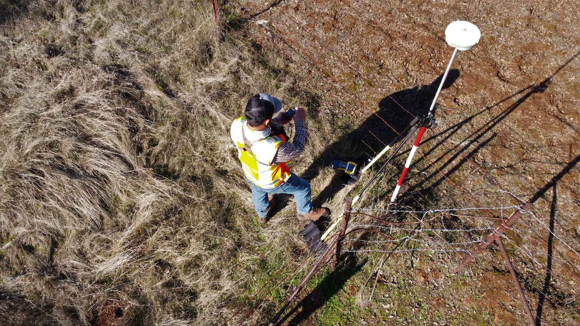
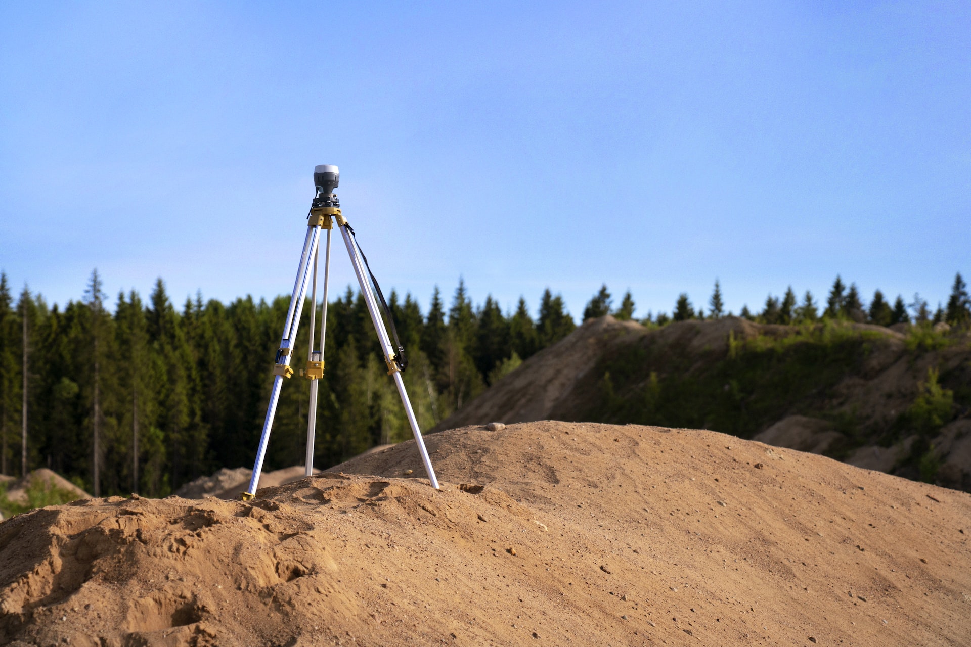
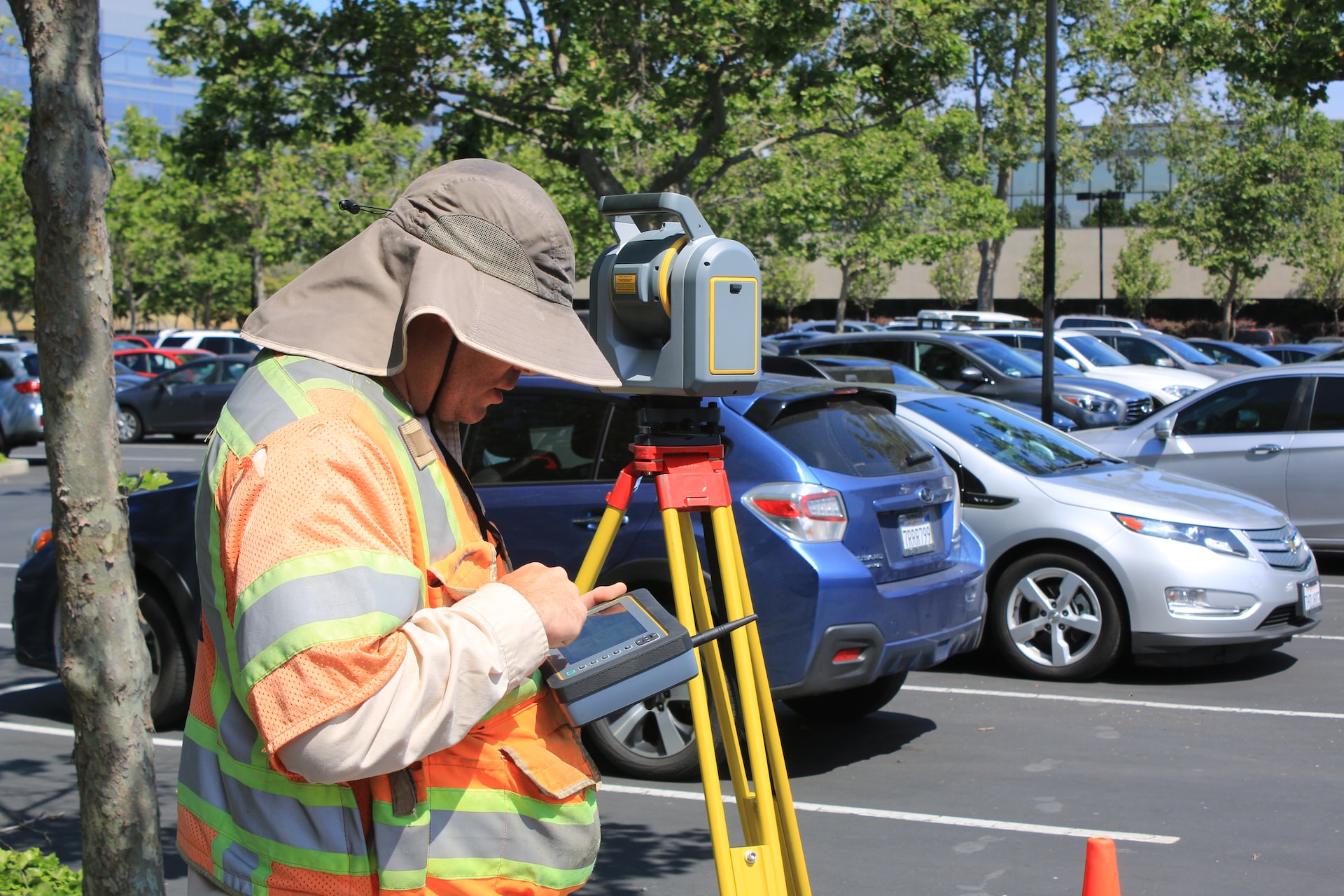
If you’re planning on having a land survey done, it’s important to be prepared. A land survey is a detailed and accurate mapping of a specific piece of land, and it can be used for a variety of purposes, such as determining property boundaries, establishing easements, and more. To ensure the best possible results, here are five useful tips to help you prepare for a land survey.

1. Gather Your Documents

When it comes to having a land survey conducted, it’s important to have all of the necessary documents on hand. This includes deeds, title documents, and any other relevant paperwork. Having these documents readily available can help the surveyor quickly and accurately assess the situation.

One of the first things the surveyor will do is review the title documents. This will help them determine the property boundaries and any easements or right-of-ways that may be in place. They will also take a look at the deed to see if there are any special instructions or restrictions that need to be taken into account.

2. Know Your Property Lines

It’s also important to have a good understanding of your property lines. Knowing where your property begins and ends can help the surveyor assess the situation and provide an accurate map. If you’re unsure of these boundaries, contact your local government or a lawyer to help you out. 

3. Mark Your Property Lines

Marking your property lines is an easy way to help the surveyor assess the situation quickly. There are a few different ways that you can mark your property lines. One option is to use stakes or flags. This is a simple way to create a visual representation of the boundaries. Another option is to use paint. This can be more permanent than using stakes or flags, but it can also be more difficult to remove if you need to make changes later on.

Whatever method you choose, it’s important to be as accurate as possible. This will help to ensure that there are no problems down the road. If you’re not sure where your property lines are located, you can always hire a surveyor to help you out.

4. Inform Neighbors

When it comes to surveying your property, it’s important to be as thorough as possible. This means not only surveying the property itself, but also any adjacent properties. This is especially important if your property shares a boundary with your neighbors.

Informing your neighbors of the survey can help avoid potential disputes and ensure a smooth process. It’s also a good idea to have a copy of the survey on hand, in case any questions or issues arise. With a little planning and preparation, surveying your property can be a hassle-free experience.

5. Hire a Professional

It’s important to hire a professional surveyor who is experienced and knowledgeable in the field. They will have the necessary equipment and expertise to provide accurate and reliable results. 

Conclusion

We hope this article helps you prepare for your land survey. Following these tips can help ensure a successful land survey. With the right preparation, you can ensure that the process goes as smoothly as possible.

Are you looking for professional surveying services? Will’s Service Group is the answer! We use the latest technology and equipment to ensure that all of our projects are completed efficiently and accurately. Get in touch with us today, and let us show you why we are the best in the business!

Tree Survey 101: When Do You Need It?

Tree Survey

Regarding construction projects, it is essential to know what trees are present and their condition. This is important for several reasons. After all, it helps to ensure that any potential hazards the trees may cause are identified and addressed. For example, a large, dead tree may harm nearby buildings or people. 

Tree surveys are an important part of any construction project, as they determine the health and stability of any trees on the property. That’s why it’s important to understand when, why, and how to conduct a tree survey. 

What Is a Tree Survey?

A tree survey is a type of environmental assessment that evaluates the health and condition of trees on a property. This assessment is conducted by a team of certified arborists and tree care professionals who inspect the trees for signs of disease, damage, and other potential hazards. The survey results identify any actions that need to be taken to ensure the trees’ safety and the surrounding environment. 

Why Conduct a Tree Survey?

Tree surveys are important for several reasons. First, they can help identify any potential hazards posed by trees before any work begins. For example, a dead tree may risk nearby buildings or people.

In addition, these surveys can help identify any maintenance that needs to be done. For example, they can determine if a tree needs to be pruned or treated for the disease. This can help ensure the trees remain healthy and stable for many years.

When to Conduct a Tree Survey

You should conduct tree surveys before construction begins and include a detailed assessment of the size, health, and condition of existing trees. This includes assessing the species of the trees, their age, and the amount of damage or decay in the trunk, branches, and roots.

The survey should also include a review of the area’s surrounding trees and vegetation. This will help identify potential hazards, such as roots that may interfere with construction or trees that need to be removed or relocated. Additionally, the survey should assess the project’s potential impact on the local wildlife, including the potential for animal displacement and the potential effects on nearby habitats.

How to Conduct a Tree Survey

The first step in a tree survey is to identify the trees in the area. This is usually done by looking for specific characteristics, such as leaf shape, bark patterns, and overall size. 

Once the trees have been identified, the surveyor can then inspect them for any signs of damage or disease. This can include looking for signs of rot, missing branches, or discolored leaves. They should document any identified issues to track any changes.

Finally, the surveyor should also document any other observations that may be relevant. This can include wildlife, plants, or other environmental factors affecting the trees’ health. By thoroughly documenting all findings, the surveyor can provide a comprehensive estimate of the health of the trees in the area.

Final Thoughts

It is important for homeowners, businesses, and municipalities to understand the significance of tree surveys and how they can be best implemented. This process can also help identify potential hazards that the tree may pose and help protect people and property. Aside from that, it is an invaluable tool for any tree owner and should be taken seriously to ensure that the tree remains healthy and safe.

Will’s Service Group conducts reliable and high-quality tree surveys in Florida to help maintain the health of trees and provide sound advice to our clients. We have a team of certified arborists and tree care professionals dedicated to providing the best service possible. Get in touch with us today for more information!

3 Significant Reasons to Use Land Surveying Services

Land Surveys

If you’re considering purchasing property, you may need to hire a land surveying company to help you determine the boundaries of the land. A land surveyor can also help you if you’re planning to build on the property.

If you didn’t know, a land surveyor is a professional who specializes in measuring and mapping land. They use various tools, including GPS and lasers, to take accurate measurements. Land surveying companies can help you determine the boundaries of your property, as well as any easements or rights of way that may be associated with it.

While there are plenty of scenarios where land surveying services are utilized, there are the main reasons to use land surveying services:

1) To Establish Structural Feasibility

If you’re considering a construction project, it’s important to have a clear understanding of the land you’ll be building on. That’s where land surveying services come in. A land surveyor can provide you with vital information about the feasibility of your project, including the lay of the land, the location of natural features, and any potential obstacles you might face.

This information is essential for making sure your construction project is structurally sound and will stay within your budget. With a land surveyor’s help, you can avoid any nasty surprises down the road and ensure that your project is a success.

2) To Determine the Precise Land Size

If you’re looking to purchase a piece of property, it’s important to know the exact size of the land you’re buying. To do so, utilize the services of a land surveying company. Have a land surveyor take into account factors such as the shape of the land, the contours of the terrain, and any existing structures on the property.

Once the survey is complete, you will be provided with a detailed report that includes the exact size of the land. This information will be invaluable when it comes to ensuring you’re getting what you’re paying for.

3) To Locate the Land Resources

Land surveying is the process of determining the precise three-dimensional position of points and the distances and angles between them. It is a critical part of mining, as it allows miners to locate the resources they are after precisely.

There are a few different ways that land surveying services can help you to find the resources you need. One way is by using GPS to pinpoint the exact location of the resources. This can be a very accurate way to find the resources, as GPS is very precise.

Another way that land surveying services can help you to find the resources you need is by using aerial photography. This can be a very useful tool, as it can help you to see the resources from a different perspective. This can be a helpful way to find the resources you need, as it can help you to avoid wasting time and money on resources that you will never be able to use.

Conclusion

Overall, land surveying is a valuable tool that’s utilized for a variety of purposes. If you have any questions about your property, consider contacting a land surveying company for more information.

Interested in getting residential surveys in Florida? Will’s Service Group has been in the business for over ten years as land surveyors with more than five years of experience in the USA. Get in touch with us today!

Understanding The As-Built Survey: What Is It For?

Survey

An as-built survey is a form of surveying that is used to measure and document the existing conditions of a site accurately. It is usually conducted after the completion of the construction or renovation of a building or other structure. These surveys are used for a variety of reasons, such as to document changes to a site, to measure the accuracy of a project, to assist in planning and design, and to provide an accurate record of the existing conditions of a site.

If you want to learn more about the as-built survey, keep reading our quick guide today.

What Is an As-Built Survey?

An as-built survey is a comprehensive survey of a property or structure that captures its current condition, including any changes that have occurred since the original construction. This type of survey is typically conducted after a property or structure has been built or renovated.

The purpose of an as-built survey is to document the exact measurements and locations of the property or structure so that any future projects or renovations can be accurately designed and built.

An as-built survey can include measurements of the property or structure, including its dimensions, floor plans, elevations, and any construction that has been added or removed. It also includes measurements of any existing infrastructure, such as pipes, wires, and ducts

An as-built survey may include photographs of the property or structure, as well as any additional information that may be necessary to document the current condition of the property or structure accurately.

As-built surveys are often used in construction projects to ensure that all changes are accurately documented and accounted for. This can prevent costly errors and delays in the construction process.

Additionally, as-built surveys can help ensure that a building or structure meets applicable building codes and regulations.

As-built surveys are also useful for real estate transactions, as they can provide an accurate record of a property or structure’s current condition. This helps ensure that any issues or changes that have occurred since the original construction are considered when calculating the property value or structure.

How Is an As-Built Survey Constructed?

The first step in constructing an as-built survey is to gather all the necessary information about the project. This includes the building plans, construction drawings, and any other relevant documents. This information should be reviewed so the surveyor can understand the project’s scope and design.

Once the surveyor has a good understanding of the project, they can begin to measure and document the physical features of the building or construction. This includes measuring the dimensions of walls, windows, doors, and other features. The surveyor will also document any changes made to the original design, such as additions or modifications.

The surveyor will then use this information to create an as-built plan. This plan will include all the measurements, changes, and other information gathered during the survey. The plan should be accurate and easy to read so that anyone who views it can easily understand what was measured and recorded.

Finally, the surveyor will review the as-built plan to make sure that it is accurate and complete. Once the surveyor is satisfied with the plan, it can be used to settle any disputes between contractors and owners. It can also be used to verify that a project was built as designed and to document any changes that may have been made during the construction process.

Final Thoughts

An as-built survey is an important part of the construction process. It helps to ensure that the final product meets the original survey’s requirements and complies with applicable regulations. By conducting an as-built survey, the surveyor can help to ensure that the project is completed to the highest standard and that any changes that have occurred are documented and accounted for.

Do you need an as-built survey in Florida? Let Will’s Service Group help you. We have been in business for over ten years and can help you with your surveying needs. Call us to place an order today! 

Why Does Your Business Need a Commercial Building Survey?

Commercial buildings

Having a commercial building surveyed is an important part of any business’s operations. A commercial building survey can provide valuable insights into the condition of the building, helping to ensure that the building is safe and efficient and that any necessary repairs or upgrades are identified and addressed. 

Continue reading to learn more about why your business needs a commercial building survey.

What is a Commercial Building Survey?

A commercial building survey provides an unbiased report of a property’s condition, enabling buyers, sellers, and lenders to make informed decisions about the property.

The purpose of a building survey is to help the buyer, seller, and lender identify potential risks or problems associated with the property. A qualified surveyor will inspect and evaluate the property’s structure, condition, and safety to provide a comprehensive report.

Depending on the type of survey, it will include photos, diagrams, detailed descriptions, and recommendations to mitigate risks and improve the building’s condition. 

What are the Types of Commercial Building Surveys?

1. Acquisition Survey

An Acquisition Survey is generally conducted when a buyer considers purchasing a property. The surveyor will assess the property, looking for any existing and potential problems that need to be addressed.

This survey will give the buyer a complete understanding of the property’s condition, helping them make an informed decision and negotiate the purchase price.

2. Condition Survey

A Condition Survey is conducted to assess the condition of a building and identify any issues or defects. This type of survey is usually conducted before embarking on a renovation or refurbishment project.

3. Disposal Survey

A Disposal Survey is conducted to determine a property’s condition and potential value before it is put on the market. This survey will identify any potential problems that could affect the sale of the property and can provide the seller with valuable information to help them price the property correctly.

4. Due Diligence Report

A Due Diligence Report is generally conducted when a property is being sold or transferred. The report will assess the property’s legal, structural, and environmental aspects and provide the buyer with a detailed report.

Why Does Your Business Need a Commercial Building Survey?

Having a commercial building survey done is beneficial for several reasons.

Firstly, it can help you identify potential problems before they become too costly. This can save you time and money in the long run, as you’ll be able to address any issues quickly and efficiently. In addition, a survey can provide valuable insights into the property’s condition, allowing you to make informed decisions about its use and upkeep.

A commercial building survey can also provide information about the building’s compliance with health and safety regulations. This is essential for any business, as it helps to ensure that you’re meeting all the requirements and that your employees are safe and healthy.

Finally, a commercial building survey can help you make the most of your property. By understanding its condition and potential risks, you can better decide how to use it, what improvements to make, and how to maximize its resources.

Final Thoughts

A commercial building survey is essential for any business. It can provide valuable insights into the condition of a property, help you identify potential risks, and ensure your business complies with health and safety regulations. Ultimately, it can help you make the most of your property and its resources.

If you need professional surveying services, Will’s Service Group is ready to help. We have ten years of land surveying experience, and you can expect the best from our team. Give us a call today for more information.

Why Land Surveys Are Needed and the Types There Are

land survey

If you’re planning to buy land or build a property, one of the first steps you’ll need to take is to schedule a land survey. A land survey is an important process that helps determine the boundaries of a property and is required for legal documentation. Of course, it does many things for you, but before you head out and schedule a survey, there are two things you will need to know before getting started: the reasons to get a land survey and the types of surveys that are commonly done.

Why Land Surveys Are Needed

One of the primary reasons a land survey is needed is to establish legal boundaries. A survey will accurately measure the land’s boundaries, including the property lines’ exact location. This is especially important when there are disputes over the exact boundaries of a property. A survey will help to resolve such disputes by providing an objective and accurate record of the property lines.

Another reason a land survey is needed is to identify any potential hazards or issues on the property. A surveyor will look for any potential risks, such as environmental hazards, wetlands, or other features that could impact the use of the land. This can help to ensure that any development plans comply with local regulations and laws.

A land survey can also be used to identify any potential restrictions or encroachments on the property. A surveyor can identify any potential encroachments from adjacent properties, rights-of-way, easements, or other restrictions that could limit the use of the land. This can help to ensure that a buyer or developer is aware of any potential issues that could impact their plans for the property.

Finally, a land survey can be used to help in the planning and development of a property. A survey will provide detailed information about the land, including its size, shape, elevation, and other features. This can help to inform any plans for development, ensuring that the land is used in the most effective way possible.

The Types of Land Surveys

There are many different types of land surveys available, each with its own specific purpose. Understanding the differences between them can help you choose the best survey for your project:

1. Boundary Surveys

A boundary survey is the most common type of survey conducted. It is used to determine the exact boundaries of a piece of property. The surveyor will use specialized instruments and measurements to map out the boundaries of the property. This type of survey is essential for any development project, as it provides an accurate understanding of the land’s boundaries before any work begins.

2. Topographic Surveys

Topographic surveys are used to measure the contours of the land. The surveyor will measure the elevation of the land, as well as the shape and slope of the land. This type of survey is often used in large-scale projects, such as construction sites or civil engineering projects.

3. Hydrographic Surveys

Hydrographic surveys are used to measure and map bodies of water. They measure the depth and shape of a body of water, as well as the water’s flow. This type of survey is commonly used for engineering projects that involve water, such as bridges or dams.

4. Aerial Surveys

Aerial surveys are conducted from an aircraft or helicopter. The surveyor will take aerial photographs of the land, which can then be used to create maps and other documents. This type of survey is often used for large-scale projects that require an overview of the land, such as a highway project.

5. GPS Surveys

GPS surveys are conducted using Global Positioning System (GPS) technology. The surveyor will use a GPS receiver to accurately measure the position of the land. This type of survey is often used to map remote areas, as it does not require any physical access to the land.

Conclusion

By knowing the reasons behind your need for a survey and the types of surveys there are, you stand a much better chance of picking the right land survey service to ensure you get the results you’re looking for. Having said that, always reach out to professional land surveyors to ensure the job is done thoroughly and properly, and be sure to compare quotes to ensure you get the right job for the right price!

Will’s Service Group helps individuals find the right survey they need at an affordable price. If you are looking for topographical survey help in Florida, reach out to us today.

Why a Land Survey Is Important for Construction Staking

Land survey

A land survey is an essential step in the construction process, and it plays a crucial role in construction staking.

What Is a Construction Staking

Construction staking is the process of taking measurements and marking the exact location of new structures, such as roads, buildings, and other improvements on a piece of land. It measures the boundaries of a piece of land, as well as its features, to determine its exact size, shape, and other parameters. This information is then used to mark the boundaries of the land, as well as to plan and build structures on it.

Land surveys are important for ensuring that all of these measurements are accurate and that the construction is done according to the plans.

Who Conducts the Land Survey

A land survey is conducted by a professional licensed surveyor and involves creating a detailed map of the area. The surveyor will use a variety of instruments, such as total stations, robotic total stations, and GPS receivers, to measure and plot the boundaries of the property. The surveyor will also take notes and photographs of the area to ensure accuracy, and then produce a detailed report, which will include all the measurements and locations of the boundaries.

Once a land survey is completed, and the boundaries of the property are established, construction staking can begin. This is done to ensure that the construction is facilitated according to the plans and specifications. The measurements taken by the surveyor will be used to determine the exact size and shape of the structure, as well as the location of the foundation and other essential elements.

What Are the Benefits of Land Survey in Construction Staking

The importance of a land survey for construction staking lies in its ability to accurately mark boundaries and plan construction projects. Without a land survey, construction projects can be hindered by inaccurate measurements, resulting in delays and costly mistakes. By having an accurate survey of the land conducted, construction projects can be planned and executed with confidence, saving time and money.

Here are some of the main benefits of land survey in construction staking:

Offers Accuracy in the Construction Staking Process

Land surveys provide the data necessary to ensure the accuracy of the construction staking process. Without a land survey, it would be impossible to accurately set out the project boundaries and establish the exact points where the construction will take place.

Identifies Potential Hazards

The data gathered during a land survey also helps to identify potential hazards on the construction site. By examining the land survey report, potential safety risks can be identified and avoided. This can help to reduce the risk of accidents and injuries during the construction process.

Helps Understand Legal Property Boundaries

A land survey is also important for understanding the legal boundaries of a property. For example, a land survey can reveal boundaries that may have been disputed in the past, preventing future conflicts that could lead to costly legal disputes. Having an up-to-date and accurate land survey can also provide peace of mind to landowners and developers, as it can ensure that construction projects are within the boundaries of their legal rights.

Provides Information about the Topography of the Site

A land survey can provide valuable information about the topography of the site. This data can be used to determine where the best places to build are, as well as help to identify any potential areas of concern that could affect the success of the construction project.

Protects the Environment

Finally, land surveys are also crucial for environmental considerations. By accurately mapping the land, it can help protect areas of environmental significance, allowing developers to plan their projects around these areas. In addition, land surveys can reveal potential hazards, such as floodplains, which can then be avoided in the construction process.

Conclusion

Overall, a land survey is an essential step in the construction process and is vital for ensuring that the structure is built according to the plans. By taking accurate measurements and providing detailed maps of the area, a land survey helps to ensure that the construction is done safely and correctly.

At Will’s Service Group, we offer comprehensive land survey services to ensure that your project is done safely and correctly. Our team of experienced professionals is equipped with the latest surveying technology and can provide detailed maps and accurate measurements for any project. Let us ensure that all projects are completed safely and correctly. Contact us today to get started!

Facts You Must Know about Surveying Before Engaging in One

Surveying

There are many reasons why land surveys are necessary. Surveys provide accurate, reliable information regarding property lines. This information is essential for a variety of reasons, including:

· Determining the size of a property

· Establishing property boundaries

· Resolving disputes

· Planning development projects

Accurate surveys are essential to make informed decisions about land use. With surveying services, it would be easier to determine where one property ends and another begins. It could lead to bitter disputes between neighbors.

In addition, surveys are necessary for planning development projects. When a development project is being designed, it is critical to know the exact size and boundaries of the area in which the project will be built. This information ensures the project can be completed within the desired timeframe and budget.

What Is a Land Survey?

Before you engage in surveying services, you must understand what it entails. It is the process of measuring and mapping the land surface. Surveys are used to determine the property’s boundaries, establish the locations of features on the land, and produce maps of the land.

The first step in a land survey is establishing the reference point, or starting point, from which all other measurements will be made. This reference point is usually a marker placed by a government agency or a previous surveyor. The marker is then used as a starting point to measure the property boundaries.

Next, the surveyor will use various tools to measure the property, including a tape measure, a level, and a transit. The surveyor will also measure the property’s features, such as buildings, trees, and bodies of water. These measurements will be used to produce a map of the property.

The surveyor will then prepare a survey report, including the property boundaries, the locations of features on the property, and the property dimensions. The information will also have a copy of the map of the property.

What Does It Include?

Consider hiring a surveying company to mark your property boundaries as a landowner. But what do surveying services include? Here is a rundown of what you can expect from professional surveying services.

First, a qualified surveyor will visit your property to collect data and take measurements. They will also take photos and notes to document the property’s condition. This information will be used to create a property survey report.

Next, the surveyor will analyze the data and create a boundary survey map. This map will show the property’s legal boundaries and any easements or rights-of-way that may be associated with the property.

Finally, the surveyor will provide you with a copy of the boundary survey map and report. This documentation can be used for various purposes, including property development, real estate transactions, and dispute resolution.

So, if you are considering hiring a surveying company, ask them about all the services they offer. And remember to ask for a copy of the boundary survey map and report once the job is complete!

Conclusion

Surveying services are essential in ensuring the accuracy of measurements and data collection for various purposes. They help ensure the safety of both people and property and can be used for multiple purposes, such as construction, land management, and environmental conservation.

If you are looking for surveying services in Florida, you do not have to look far because you can rely on Will’s Service Group. We have been in this industry for over a decade, which means that we have the experience and expertise to serve you efficiently. So, contact us now for more information!

Choosing a Land Surveying Company: 5 Qualities to Look For

land survey

A land surveying company is a company that provides land surveying services. Land surveying is the process of measuring and mapping land areas. It is used to determine property boundaries, topography, and other features of the land. 

If you need land surveying services, how do you choose a company to work with? Here are the best qualities to look for.

1. Excellent Reputation

It’s no secret that your choice of land surveying company can make or break your project. A bad surveyor can cause delays, cost overruns, and legal problems. That’s why choosing a company with an excellent reputation is important.

There are a few ways to research a company’s reputation.

One is to ask around simply. Talk to your friends, colleagues, and acquaintances who have used land surveying services. See if they have any recommendations.

Another way to research a company’s reputation is to read online reviews. Look for reviews on sites like Google, Yelp, and Angie’s List. See what people are saying about the company’s services.

Finally, you can contact the Better Business Bureau (BBB) to see if any complaints have been filed against the company. The BBB is an excellent resource for discovering a company’s reputation.

2. Cost

The price you pay for surveying services can vary greatly depending on your chosen company and the scope of work.

It’s important to get quotes from several companies before making a decision. Be sure to compare apples to apples, though. Some companies may give you a low quote but then try to upsell you on additional services. Others may give you a high quote but include everything in the price.

Once you’ve narrowed your choices, it’s essential to consider the cost of the services you need. If you only need a boundary survey, you may be able to get by with a less expensive company. But if you need a topographic survey or other specialized services, you’ll need to pay more.

3. Experience

When it comes to choosing a land surveying company, experience is important. You want to ensure that your chosen company has the experience and expertise to get the job done right.

So, make sure the company has been in business for a while. You want to choose a company with a track record of success. You should also see if the company is licensed and insured. This will protect you in case anything goes wrong.

4. Customer Service

Good customer service is essential in any business, but it’s especially important in land surveying. Make sure to choose a company that is responsive to your needs and has a good reputation for customer service.

5. Technological Sophistication

The technological sophistication of a land surveying company is important to consider when choosing a provider. This is because the technology used by the company will impact the accuracy and precision of the collected survey data.

Additionally, the company’s ability to use the latest technology will also impact the speed at which the surveys can be completed. The company should have a team of experienced surveyors who are familiar with using the latest technology. This experience will ensure that the collected survey data is of the highest quality.

Final Thoughts

A land surveying company can provide many services to landowners, including property boundary surveys, topographic surveys, and construction layout surveys. By working with a licensed land surveyor, landowners can ensure that their property is accurately surveyed and that potential problems are identified and resolved.

If you need professional surveying services, Will Service Group can help you. We have been in business for over ten years, and we make sure to provide great prices for excellent service. Give us a call or email to learn more.

The Significant Role of Conducting a Property Survey

Property Survey

Homebuyers often find themselves overwhelmed by the sheer number of services required for a real estate purchase. A title report, appraisal, home inspection, flood determination, credit report, tax determination, and survey are all necessary to help ensure that the property is marketable, insurable, and seen as a worthwhile investment by both the consumer and their lender.

The need for a survey can be challenging to understand, especially when looking at houses that have been standing for many years or when the local government has recently approved a new development. A survey can give the homebuyer and lender important information about the property. Read on to learn more.

Defining a Survey 

This is a document that shows the boundaries of a piece of land. It can use natural features like rivers or trees or man-made features like fences or buildings. It will also show the location of any structures on the land, like houses or sheds. A surveyor creates a survey by measuring the ground and recording what they find.

A lender often requires a survey when approving a mortgage for a prospective homebuyer to confirm that the property being purchased matches the legal description of the property. This is important to the lender if they need to foreclose on the mortgage, as the legal description is included in the public record filed in the recorder’s office for the property.

To protect its investment, the title company wants to make sure that there is title insurance coverage in place. Additionally, the company wants to confirm that there are no survey-related issues that could create problems with the marketability of the property in the future.

Is a Property Survey Important to a Buyer?

The homebuyer wants to be sure that the property lines are where they are supposed to be and that there are no encroachments from the neighbor’s property. To avoid any legal issues or problems with your neighbors, it is essential to know exactly where your property boundaries are. 

This is especially important if you plan to make any improvements to your property, such as building a fence or adding a swimming pool. Knowing your property boundaries will help you avoid any potential problems that could arise from infringing on your neighbor’s property or violating a zoning code.

Types of Property Surveys

Some survey types may limit the title insurance coverage your buyer receives after closing. It is important to understand the different survey products available and to help your buyers select the proper survey type for their particular situation. This will go a long way in building customer relationships that foster return and referral business.

1. Boundary Survey

A boundary survey is a process where a professional surveyor walks around the property in question, measuring the land and taking note of any features or changes. They will then review any available documents related to the property and draw an accurate representation of the property, including the location and size of boundaries, easements, structures, and any rights of access via public roads. Having a full boundary survey done can protect your interests in the event of a boundary dispute.

2. Land Title Survey

The American Land Title Association (ALTA) and the American Congress on Surveying and Mapping (ACSM) work together to create a standard for surveys of land parcels. This standard includes specifying the data that should be shown on the survey, such as boundary lines, locations of buildings and improvements, and easements. 

ALTA/ACSM surveys are complex, costly, and time-consuming to complete. For this reason, most ALTA/ACSM surveys are performed on commercial rather than residential properties.

3. Location Survey 

A location survey is a type of survey that provides the least amount of information but is also the least expensive. This survey type only certifies that the purchased structure is located within the outline of the parcel of land. It may also detail the position of buildings or other visible improvements on the land. 

A location drawing does not show where a property’s boundaries are. This is important for a buyer who plans to remodel because they need to know where they can and cannot build. 

There needs to be more than a location drawing to remove the survey exception from the owner’s title insurance policy. The purchaser may only be covered in buildings close to the property line.

Conclusion

A property survey is an essential tool that can be used to determine the boundaries of a piece of property. Property owners can avoid potential disputes with their neighbors by conducting a survey and ensuring their property is protected.

Do you need professional surveying services? Trust Will’s Service Group. We have been in the business for over ten years as land surveyors with more than five years of experience in the USA. Call today!