Knowing the Various Land Survey Symbols and Abbreviations

land survey

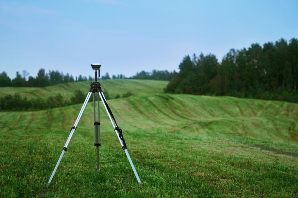
Having a land survey done is like having a precise map of your property. A surveyor will take measurements of the property’s size, shape, and boundaries, and record the area’s features and topography. A two-dimensional map is drawn up with all of this data. But before making this map, the surveyor would place stakes, flags, and steel rods all around the site for several reasons. A wide range of symbols and abbreviations will be used to label these items. That said, the language of the land surveyor is rife with symbols and jargon that this article will help you decipher.

For more information, see the National Society of Professional Surveyors.

The Typical Symbols Used by Surveyors: Land Survey Abbreviations

By necessity, a surveyor must make several physical markers on a site during the surveying process. Flags, tape, and stakes are all examples of such identifying markers; they may be color-coded or marked with acronyms. The Fractracker Alliance has compiled a short list of some of these identifiers.

The Flags and Tape for a Survey

land survey

Often called “streamers,” survey flags are taped to nearby trees, fences, or a stake driven into the ground. These flags and tape may also be marked with colors and symbols to further clarify the surveyor’s findings. Sometimes there is no obvious symbolism, suggesting that the markers are just part of a path or a planned construction area.

The Control Points

A control point is a site on the land where the surveyor does not want the work to be disrupted, much as the surveyor flags. Typically, pegs and tape are used to mark out a perimeter around the location. Metal tacks will be substituted for wooden stakes in some situations.

The Limit of Disturbance

survey

The surveyor will indicate the boundary of the disturbed area with special stakes and markers. This is either the boundary of the property or an uninterruptible area. A boundary survey monument or steel rod is typically used to indicate the edge of the property, especially the corners.

The Common Abbreviations

A surveyor’s job necessitates using abbreviations and acronyms, particularly when labeling maps, flags, and tags. Three letters or a short phrase can be used to represent a concept in these abbreviations.

  • BRL – Building Restriction Line
  • BS – Back Sight
  • BSL – Building Setback Line
  • CIP – Capped Iron Pin
  • CL – Center Line
  • Con Mon F – Concrete Monument Found
  • EBL – East Boundary Line or Eastbound Lane
  • EIP – Existing Iron Pipe
  • FD – Found
  • IPF – Iron Pipe/Pin found 
  • IPS – Iron Pipe/Pin Found
  • IRF – Iron Rod Found
  • IRS – Iron Rod Set
  • L.O.D. – Limit of Disturbance
  • LS – Licensed/Land Surveyor
  • MBS – Minimum Building Setback
  • N/F – Now or Formerly
  • NBL – North Boundary Line or Northbound Lane
  • NIP – New Iron Pin
  • NMS – No Monument Set
  • NPP – Nail in Power Pole
  • PI – Point of Intersection
  • PK Nail – A concrete nail stamped PK (Parker Kaelon)
  • PK – Point Known
  • POB – Point of Beginning
  • PRC – Point of Reserve Curve
  • PSDE – Private Storm Drain Easement 
  • PT – Point of Tangency
  • R/C – Rod and Cap or Rebar and Cap
  • SBL – South Boundary Line or Southbound Lane
  • SC – Standard Corner
  • SCM – Steel Rebar
  • SRS – Steel Rod Set
  • STE – Sight Triangle Easement 
  • UE – Utility Easement 
  • WBL – West Boundary Line or Westbound Lane
  • WC – Witness Corner

Conclusion

land survey

Overall, it is important to know the various land survey symbols and abbreviations in order to correctly interpret a map. The most common symbols and abbreviations used in surveying are listed above. However, there are many other less common symbols and abbreviations that may be used. Therefore, it is always best to consult a professional surveyor or mapmaker if you are unsure of their meanings.

If you are looking for a company that provides residential surveys in Florida, look no further than our expertise here at Will’s Service Group. We have been in the business for over ten years as land surveyors with more than five years of experience in the USA. Call us today and let us survey your property in no time!

Frequently Asked Questions

What do the symbols on a land survey mean?

Land survey symbols are standardized graphical marks that represent physical features, boundary markers, and legal reference points on a survey map. For example, a small circle typically marks a found monument, a triangle indicates a geodetic control point, dashed lines show easements, and solid lines with tick marks represent fences. Understanding these symbols helps property owners verify boundaries and identify features that affect their land use.

How do you read a property survey map?

To read a property survey map, start with the legend that defines all symbols and abbreviations used. Next, locate the north arrow for orientation and the scale bar for distance reference. Follow the boundary lines around your property, noting bearing angles and distances. Look for markers like iron pins, concrete monuments, and reference points that define corners. Pay attention to easements, setback lines, and utility corridors marked with dashed or dotted lines.

What does IPF mean on a land survey?

IPF stands for Iron Pipe Found, indicating that an existing iron pipe was located at that specific survey point during the fieldwork. Similar abbreviations include IRF (Iron Rod Found), IPS (Iron Pipe Set), and IRS (Iron Rod Set). The distinction between found and set markers tells you whether the surveyor discovered an existing monument or placed a new one during the survey.

What is the abbreviation for easement on a survey?

On a survey, easements are commonly abbreviated as ESMT or E. Specific types include UE for utility easement, DE for drainage easement, and AE for access easement. Easements appear as dashed lines with labels indicating their width and purpose. They represent legal rights granted to others to use a portion of your property for a specific purpose like utility access or drainage.

4 Sensible Legal Reasons for Commercial Property Surveys

survey

Buying a commercial property can be simple or complex, and there could be issues or no troubles at all. The land and structure should be inspected to determine these details.

Commercial real estate surveys evaluate the condition and value of a piece of commercial property. It is done by an independent third-party professional to ensure the results’ accuracy and provide an unbiased review. It involves looking at all aspects of the property, including the structure, condition, legalities, and potential issues. 

This helps the buyer or lessee determine if the property is a good investment and if the conditions and terms of the contract are suitable.

Some sensible legal reasons for this include the following:

Boundaries and Easements

Assessing will provide information about the exact location of roads, highways, alleys, and other streets in the area. It will also outline any easements that may be in place, such as allowing a neighbor access to the road through the parking lot or an adjoining company road. Creating boundaries is necessary to define the limits of the parking lot. This includes identifying where the lot ends and where the building begins and other considerations like the maximum area that can be occupied.

The process will indicate surface water bodies, such as rivers or lakes, but generally will not provide information on underground water sources or wetlands. If this information is needed, a professional inspector may need to be hired.

Deeds or Legal Updates

An assessment of the real estate is necessary to ensure that the property’s legal description and boundary lines are accurate. This can help identify issues with the title, legal description, easements, encroachments, and boundary lines. It also enables the resolution of any boundary disputes or conflicts that may be present. By doing this, the title and legal description can be updated, and the boundary lines can be insured. With surveys, this process may be possible.

Improvements and Violations

An assessor will examine a location in detail and document any laws, regulations, or restrictions that may be in place. This includes dimensions, parking areas, utilities, and any other features that may be present. In the end, they will provide a written report that outlines any violations of local or state laws, as well as any necessary modifications that must be made to comply with regulations.

The survey may include information about electric or gas power, telephone or telegraph lines, water drains, wires, and other lines.

Legal Articles

Property assessments can provide insight into potential issues, such as encumbrances, contamination, rights-of-way, flooding, seismic activity, and other potential risks. Furthermore, it can establish the exact boundaries of the property in question. This can become the basis of the estate, depending on the circumstances.

Legal Protection

Commercial property owners should invest in a lawyer to help them navigate the potential legal issues that may arise from the survey results. This could help avoid potentially expensive litigation resulting from any violations or boundaries in the survey.

In Closing

Assessing your acquired commercial property through a third-party group ensures your land follows legal compliance and protects you from hefty fines or other issues that may negatively impact development. Always have this done the moment the acquisition of a property pushes through.

Let Will Do It For You

For over ten years, Will’s Service Group has been a leader in land surveying in the USA. We’ve provided services to companies such as Target Surveying and Benchmark Land Services Inc. For Alta surveys, call today at (239) 478-4242!

The Types of Topographic Surveys Used by the Experts

Topographic Surveys

Types of topographic surveys for land development plays a critical role in property management and development in Florida. Understanding the different types of topographic survey methods is essential for engineers, architects, and land developers working in Florida. Each type of topographic survey provides an accurate representation of existing terrain, helping professionals determine the most efficient layout for a project. While these surveys may seem straightforward, their applications are far-reaching and critically important.

That said, did you know that there are many types of topographic surveys? That’s true! Let’s talk about that. But first, let’s discuss what a topographic survey is:

Topographic Surveys: Types Land Development

A topographic survey is a type of survey that is conducted to obtain information about the surface features of a particular area. It is used to create a detailed map of the land, which includes elevation, slope, contours, and natural and manmade features. Topographic surveys are used to create detailed maps for various purposes, such as engineering, construction, and land-use planning.

For more information, see the USGS topographic mapping resources.

Topographic surveys are conducted by taking precise measurements of the terrain and its features. These measurements are then used to create a map of the land, which typically includes elevation contours, slope measurements, and other features. The surveyor will also record any physical features, such as trees, buildings, roads, and rivers. The surveyor will use specialized equipment, such as a theodolite and a total station, to take the measurements.

The Types of Topographic Surveys

Topographical Surveys
topographical survey

The most common type of topographic survey is the contour line survey. This type of survey is used to measure the elevation of an area and create a contour map. Contour lines are created by connecting points of equal elevation and can be used to determine the terrain of the land. This type of survey is useful for construction projects, land development, and other activities that require an understanding of the land’s topography.

Another type of topographic survey is the spot height survey. This type of survey is used to measure the exact elevation of certain points on the land. Spot heights are used to pinpoint the location of high and low points and can be used to measure the elevation of a particular location. They are often used by engineers and surveyors to determine the best route for roads, waterways, and other infrastructure projects.

A third type of topographic survey is the triangulation survey. This type of survey is used to measure the distance between two points on the land. Triangulation surveys are used to create an accurate map of the land and to measure the elevation of certain points. This type of survey is useful for creating detailed maps of large areas, as well as for accurately measuring the location and elevation of certain points on the land.

Finally, a fourth type of topographic survey is the photogrammetric survey. This type of survey is used to measure the features of a land surface by taking aerial photographs. Photogrammetric surveys are used to create detailed maps and elevation models of a given area. This type of survey is often used for large-scale mapping projects, such as creating detailed maps of large cities or entire states.

Conclusion

Overall, topographic surveys are an essential tool for engineers, architects, and surveyors. They provide an accurate representation of existing terrain and can help to reduce costs associated with a project, as well as improve safety, identify natural resources, and so much more! And, with so many types of topographic surveys to be done, you can pick whichever one you need to fulfill your goals.

Will’s Service Group are expert land surveyors, offering the exact services clients need without any unnecessary costs. If you are looking for topographical surveys in Florida, contact us today!

Understanding types of topographic surveys for land development helps Florida property owners make informed decisions about their land and investments. Contact Will’s Service Group for professional guidance tailored to your specific needs.

Frequently Asked Questions

What are the main types of topographic surveys?

The main types of topographic surveys include planimetric surveys that map horizontal features like roads and buildings, hydrographic surveys that chart water depths and shorelines, geodetic surveys that account for the earth’s curvature over large areas, and ALTA/NSPS surveys that combine topographic data with boundary and title information for commercial real estate. Each type serves a different purpose depending on the project scope and requirements.

What is included in a topographic survey?

A topographic survey includes the measurement and mapping of natural and man-made features on a property. This covers elevation contours, trees, water features, existing structures, driveways, fences, utility poles, manholes, storm drains, slopes, and ground surface conditions. The deliverable is a detailed contour map with spot elevations that engineers and architects use for design and planning.

How is a topographic survey different from a boundary survey?

A boundary survey focuses exclusively on locating and marking property lines based on legal descriptions and recorded deeds, while a topographic survey maps the physical features and elevation changes across a property. A boundary survey answers where your property begins and ends. A topographic survey shows what the ground looks like within and around those boundaries, which is essential for grading, drainage, and construction design.

When do you need a topographic survey in Florida?

In Florida, you typically need a topographic survey before any new construction, major renovation, or site development project. Local building departments often require topographic data to evaluate drainage plans, flood zone compliance, and environmental impact. They are also essential before designing retaining walls, pools, septic systems, and landscape grading plans where accurate elevation data prevents costly drainage problems.

5 Useful Tips to Help You Prepare for a Land Survey

Land Survey

If you’re planning on having a land survey done, it’s important to be prepared. A land survey is a detailed and accurate mapping of a specific piece of land, and it can be used for a variety of purposes, such as determining property boundaries, establishing easements, and more. To ensure the best possible results, here are five useful tips to help you prepare for a land survey.

1. Gather Your Documents: Prepare Land Survey

Survey project gallery image of commercial property mapping

When it comes to having a land survey conducted, it’s important to have all of the necessary documents on hand. This includes deeds, title documents, and any other relevant paperwork. Having these documents readily available can help the surveyor quickly and accurately assess the situation.

One of the first things the surveyor will do is review the title documents. This will help them determine the property boundaries and any easements or right-of-ways that may be in place. They will also take a look at the deed to see if there are any special instructions or restrictions that need to be taken into account.

For more information, see the Florida Board of Professional Surveyors.

2. Know Your Property Lines

It’s also important to have a good understanding of your property lines. Knowing where your property begins and ends can help the surveyor assess the situation and provide an accurate map. If you’re unsure of these boundaries, contact your local government or a lawyer to help you out. 

3. Mark Your Property Lines

Commercial property boundary markers after survey completion

Marking your property lines is an easy way to help the surveyor assess the situation quickly. There are a few different ways that you can mark your property lines. One option is to use stakes or flags. This is a simple way to create a visual representation of the boundaries. Another option is to use paint. This can be more permanent than using stakes or flags, but it can also be more difficult to remove if you need to make changes later on.

Whatever method you choose, it’s important to be as accurate as possible. This will help to ensure that there are no problems down the road. If you’re not sure where your property lines are located, you can always hire a surveyor to help you out.

4. Inform Neighbors

When it comes to surveying your property, it’s important to be as thorough as possible. This means not only surveying the property itself, but also any adjacent properties. This is especially important if your property shares a boundary with your neighbors.

Informing your neighbors of the survey can help avoid potential disputes and ensure a smooth process. It’s also a good idea to have a copy of the survey on hand, in case any questions or issues arise. With a little planning and preparation, surveying your property can be a hassle-free experience.

5. Hire a Professional

It’s important to hire a professional surveyor who is experienced and knowledgeable in the field. They will have the necessary equipment and expertise to provide accurate and reliable results. 

Conclusion

We hope this article helps you prepare for your land survey. Following these tips can help ensure a successful land survey. With the right preparation, you can ensure that the process goes as smoothly as possible.

Are you looking for professional surveying services? Will’s Service Group is the answer! We use the latest technology and equipment to ensure that all of our projects are completed efficiently and accurately. Get in touch with us today, and let us show you why we are the best in the business!

Tree Survey 101: When Do You Need It?

Tree Survey

Regarding construction projects, it is essential to know what trees are present and their condition. This is important for several reasons. After all, it helps to ensure that any potential hazards the trees may cause are identified and addressed. For example, a large, dead tree may harm nearby buildings or people. 

Tree surveys are an important part of any construction project, as they determine the health and stability of any trees on the property. That’s why it’s important to understand when, why, and how to conduct a tree survey. 

What Is a Tree Survey?

A tree survey is a type of environmental assessment that evaluates the health and condition of trees on a property. This assessment is conducted by a team of certified arborists and tree care professionals who inspect the trees for signs of disease, damage, and other potential hazards. The survey results identify any actions that need to be taken to ensure the trees’ safety and the surrounding environment. 

Why Conduct a Tree Survey?

Tree surveys are important for several reasons. First, they can help identify any potential hazards posed by trees before any work begins. For example, a dead tree may risk nearby buildings or people.

In addition, these surveys can help identify any maintenance that needs to be done. For example, they can determine if a tree needs to be pruned or treated for the disease. This can help ensure the trees remain healthy and stable for many years.

When to Conduct a Tree Survey

You should conduct tree surveys before construction begins and include a detailed assessment of the size, health, and condition of existing trees. This includes assessing the species of the trees, their age, and the amount of damage or decay in the trunk, branches, and roots.

The survey should also include a review of the area’s surrounding trees and vegetation. This will help identify potential hazards, such as roots that may interfere with construction or trees that need to be removed or relocated. Additionally, the survey should assess the project’s potential impact on the local wildlife, including the potential for animal displacement and the potential effects on nearby habitats.

How to Conduct a Tree Survey

The first step in a tree survey is to identify the trees in the area. This is usually done by looking for specific characteristics, such as leaf shape, bark patterns, and overall size. 

Once the trees have been identified, the surveyor can then inspect them for any signs of damage or disease. This can include looking for signs of rot, missing branches, or discolored leaves. They should document any identified issues to track any changes.

Finally, the surveyor should also document any other observations that may be relevant. This can include wildlife, plants, or other environmental factors affecting the trees’ health. By thoroughly documenting all findings, the surveyor can provide a comprehensive estimate of the health of the trees in the area.

Final Thoughts

It is important for homeowners, businesses, and municipalities to understand the significance of tree surveys and how they can be best implemented. This process can also help identify potential hazards that the tree may pose and help protect people and property. Aside from that, it is an invaluable tool for any tree owner and should be taken seriously to ensure that the tree remains healthy and safe.

Will’s Service Group conducts reliable and high-quality tree surveys in Florida to help maintain the health of trees and provide sound advice to our clients. We have a team of certified arborists and tree care professionals dedicated to providing the best service possible. Get in touch with us today for more information!

3 Significant Reasons to Use Land Surveying Services

Land Surveys

If you’re considering purchasing property, you may need to hire a land surveying company to help you determine the boundaries of the land. A land surveyor can also help you if you’re planning to build on the property.

If you didn’t know, a land surveyor is a professional who specializes in measuring and mapping land. They use various tools, including GPS and lasers, to take accurate measurements. Land surveying companies can help you determine the boundaries of your property, as well as any easements or rights of way that may be associated with it.

While there are plenty of scenarios where land surveying services are utilized, there are the main reasons to use land surveying services:

1) To Establish Structural Feasibility

If you’re considering a construction project, it’s important to have a clear understanding of the land you’ll be building on. That’s where land surveying services come in. A land surveyor can provide you with vital information about the feasibility of your project, including the lay of the land, the location of natural features, and any potential obstacles you might face.

This information is essential for making sure your construction project is structurally sound and will stay within your budget. With a land surveyor’s help, you can avoid any nasty surprises down the road and ensure that your project is a success.

2) To Determine the Precise Land Size

If you’re looking to purchase a piece of property, it’s important to know the exact size of the land you’re buying. To do so, utilize the services of a land surveying company. Have a land surveyor take into account factors such as the shape of the land, the contours of the terrain, and any existing structures on the property.

Once the survey is complete, you will be provided with a detailed report that includes the exact size of the land. This information will be invaluable when it comes to ensuring you’re getting what you’re paying for.

3) To Locate the Land Resources

Land surveying is the process of determining the precise three-dimensional position of points and the distances and angles between them. It is a critical part of mining, as it allows miners to locate the resources they are after precisely.

There are a few different ways that land surveying services can help you to find the resources you need. One way is by using GPS to pinpoint the exact location of the resources. This can be a very accurate way to find the resources, as GPS is very precise.

Another way that land surveying services can help you to find the resources you need is by using aerial photography. This can be a very useful tool, as it can help you to see the resources from a different perspective. This can be a helpful way to find the resources you need, as it can help you to avoid wasting time and money on resources that you will never be able to use.

Conclusion

Overall, land surveying is a valuable tool that’s utilized for a variety of purposes. If you have any questions about your property, consider contacting a land surveying company for more information.

Interested in getting residential surveys in Florida? Will’s Service Group has been in the business for over ten years as land surveyors with more than five years of experience in the USA. Get in touch with us today!

Understanding The As-Built Survey: What Is It For?

Survey

What is an as-built survey in florida plays a critical role in property management and development in Florida. An as-built survey is a form of surveying that is used to measure and document the existing conditions of a site accurately. It is usually conducted after the completion of the construction or renovation of a building or other structure. These surveys are used for a variety of reasons, such as to document changes to a site, to measure the accuracy of a project, to assist in planning and design, and to provide an accurate record of the existing conditions of a site.

If you want to learn more about the as-built survey, keep reading our quick guide today.

What Is an As-Built Survey?: Survey Florida

as-built survey

An as-built survey is a comprehensive survey of a property or structure that captures its current condition, including any changes that have occurred since the original construction. This type of survey is typically conducted after a property or structure has been built or renovated.

For more information, see the Florida Building Code requirements.

The purpose of an as-built survey is to document the exact measurements and locations of the property or structure so that any future projects or renovations can be accurately designed and built.

An as-built survey can include measurements of the property or structure, including its dimensions, floor plans, elevations, and any construction that has been added or removed. It also includes measurements of any existing infrastructure, such as pipes, wires, and ducts

An as-built survey may include photographs of the property or structure, as well as any additional information that may be necessary to document the current condition of the property or structure accurately.

As-built surveys are often used in construction projects to ensure that all changes are accurately documented and accounted for. This can prevent costly errors and delays in the construction process.

Additionally, as-built surveys can help ensure that a building or structure meets applicable building codes and regulations.

As-built surveys are also useful for real estate transactions, as they can provide an accurate record of a property or structure’s current condition. This helps ensure that any issues or changes that have occurred since the original construction are considered when calculating the property value or structure.

How Is an As-Built Survey Constructed?

The first step in constructing an as-built survey is to gather all the necessary information about the project. This includes the building plans, construction drawings, and any other relevant documents. This information should be reviewed so the surveyor can understand the project’s scope and design.

Once the surveyor has a good understanding of the project, they can begin to measure and document the physical features of the building or construction. This includes measuring the dimensions of walls, windows, doors, and other features. The surveyor will also document any changes made to the original design, such as additions or modifications.

The surveyor will then use this information to create an as-built plan. This plan will include all the measurements, changes, and other information gathered during the survey. The plan should be accurate and easy to read so that anyone who views it can easily understand what was measured and recorded.

Finally, the surveyor will review the as-built plan to make sure that it is accurate and complete. Once the surveyor is satisfied with the plan, it can be used to settle any disputes between contractors and owners. It can also be used to verify that a project was built as designed and to document any changes that may have been made during the construction process.

Final Thoughts

As-Built Surveys

An as-built survey is an important part of the construction process. It helps to ensure that the final product meets the original survey’s requirements and complies with applicable regulations. By conducting an as-built survey, the surveyor can help to ensure that the project is completed to the highest standard and that any changes that have occurred are documented and accounted for.

Do you need an as-built survey in Florida? Let Will’s Service Group help you. We have been in business for over ten years and can help you with your surveying needs. Call us to place an order today! 

Frequently Asked Questions

What is an as-built survey used for?

An as-built survey documents the exact locations, dimensions, and elevations of structures and improvements after construction is complete. It is used to verify that buildings, utilities, and site features were constructed according to approved plans and within code-required setbacks. Lenders, municipalities, and title companies often require as-built surveys before issuing certificates of occupancy or closing on new construction.

When is an as-built survey required in Florida?

In Florida, an as-built survey is commonly required at the foundation stage and again upon completion of construction. Most counties require one before issuing a certificate of occupancy for new homes and commercial buildings. Lenders also require as-built surveys to confirm that the finished structure matches the approved site plan and does not encroach on setbacks or easements before finalizing the mortgage.

How is an as-built survey different from a site plan?

A site plan shows the proposed layout of a project before construction begins, including planned building locations, driveways, and utility connections. An as-built survey shows the actual locations of those features after construction is completed. Discrepancies between the site plan and the as-built survey can reveal construction errors, setback violations, or unauthorized changes that need to be addressed before final approvals.

How much does an as-built survey cost?

As-built surveys in Florida typically cost between $400 and $1,500 for residential properties, depending on the size and complexity of the project. Commercial as-built surveys with multiple structures and extensive utility mapping can range from $2,000 to $5,000 or more. Getting an as-built survey early in the construction process can prevent expensive corrections if setback or code violations are discovered later.

Why Does Your Business Need a Commercial Building Survey?

Commercial buildings

When a commercial building survey is required plays a critical role in property management and development in Florida. Having a commercial building surveyed is an important part of any business’s operations. A commercial building survey can provide valuable insights into the condition of the building, helping to ensure that the building is safe and efficient and that any necessary repairs or upgrades are identified and addressed. 

Continue reading to learn more about why your business needs a commercial building survey.

What is a Commercial Building Survey?: Survey Required

commercial surveys

A commercial building survey provides an unbiased report of a property’s condition, enabling buyers, sellers, and lenders to make informed decisions about the property.

For more information, see the SBA site selection guidance.

The purpose of a building survey is to help the buyer, seller, and lender identify potential risks or problems associated with the property. A qualified surveyor will inspect and evaluate the property’s structure, condition, and safety to provide a comprehensive report.

Depending on the type of survey, it will include photos, diagrams, detailed descriptions, and recommendations to mitigate risks and improve the building’s condition. 

What are the Types of Commercial Building Surveys?

1. Acquisition Survey

commercial surveys

An Acquisition Survey is generally conducted when a buyer considers purchasing a property. The surveyor will assess the property, looking for any existing and potential problems that need to be addressed.

This survey will give the buyer a complete understanding of the property’s condition, helping them make an informed decision and negotiate the purchase price.

2. Condition Survey

A Condition Survey is conducted to assess the condition of a building and identify any issues or defects. This type of survey is usually conducted before embarking on a renovation or refurbishment project.

3. Disposal Survey

A Disposal Survey is conducted to determine a property’s condition and potential value before it is put on the market. This survey will identify any potential problems that could affect the sale of the property and can provide the seller with valuable information to help them price the property correctly.

4. Due Diligence Report

A Due Diligence Report is generally conducted when a property is being sold or transferred. The report will assess the property’s legal, structural, and environmental aspects and provide the buyer with a detailed report.

Why Does Your Business Need a Commercial Building Survey?

Having a commercial building survey done is beneficial for several reasons.

Firstly, it can help you identify potential problems before they become too costly. This can save you time and money in the long run, as you’ll be able to address any issues quickly and efficiently. In addition, a survey can provide valuable insights into the property’s condition, allowing you to make informed decisions about its use and upkeep.

A commercial building survey can also provide information about the building’s compliance with health and safety regulations. This is essential for any business, as it helps to ensure that you’re meeting all the requirements and that your employees are safe and healthy.

Finally, a commercial building survey can help you make the most of your property. By understanding its condition and potential risks, you can better decide how to use it, what improvements to make, and how to maximize its resources.

Final Thoughts

A commercial building survey is essential for any business. It can provide valuable insights into the condition of a property, help you identify potential risks, and ensure your business complies with health and safety regulations. Ultimately, it can help you make the most of your property and its resources.

If you need professional surveying services, Will’s Service Group is ready to help. We have ten years of land surveying experience, and you can expect the best from our team. Give us a call today for more information.

Why Land Surveys Are Needed and the Types There Are

land survey

If you’re planning to buy land or build a property, one of the first steps you’ll need to take is to schedule a land survey. A land survey is an important process that helps determine the boundaries of a property and is required for legal documentation. Of course, it does many things for you, but before you head out and schedule a survey, there are two things you will need to know before getting started: the reasons to get a land survey and the types of surveys that are commonly done.

Why Land Surveys Are Needed

One of the primary reasons a land survey is needed is to establish legal boundaries. A survey will accurately measure the land’s boundaries, including the property lines’ exact location. This is especially important when there are disputes over the exact boundaries of a property. A survey will help to resolve such disputes by providing an objective and accurate record of the property lines.

Another reason a land survey is needed is to identify any potential hazards or issues on the property. A surveyor will look for any potential risks, such as environmental hazards, wetlands, or other features that could impact the use of the land. This can help to ensure that any development plans comply with local regulations and laws.

A land survey can also be used to identify any potential restrictions or encroachments on the property. A surveyor can identify any potential encroachments from adjacent properties, rights-of-way, easements, or other restrictions that could limit the use of the land. This can help to ensure that a buyer or developer is aware of any potential issues that could impact their plans for the property.

Finally, a land survey can be used to help in the planning and development of a property. A survey will provide detailed information about the land, including its size, shape, elevation, and other features. This can help to inform any plans for development, ensuring that the land is used in the most effective way possible.

The Types of Land Surveys

There are many different types of land surveys available, each with its own specific purpose. Understanding the differences between them can help you choose the best survey for your project:

1. Boundary Surveys

A boundary survey is the most common type of survey conducted. It is used to determine the exact boundaries of a piece of property. The surveyor will use specialized instruments and measurements to map out the boundaries of the property. This type of survey is essential for any development project, as it provides an accurate understanding of the land’s boundaries before any work begins.

2. Topographic Surveys

Topographic surveys are used to measure the contours of the land. The surveyor will measure the elevation of the land, as well as the shape and slope of the land. This type of survey is often used in large-scale projects, such as construction sites or civil engineering projects.

3. Hydrographic Surveys

Hydrographic surveys are used to measure and map bodies of water. They measure the depth and shape of a body of water, as well as the water’s flow. This type of survey is commonly used for engineering projects that involve water, such as bridges or dams.

4. Aerial Surveys

Aerial surveys are conducted from an aircraft or helicopter. The surveyor will take aerial photographs of the land, which can then be used to create maps and other documents. This type of survey is often used for large-scale projects that require an overview of the land, such as a highway project.

5. GPS Surveys

GPS surveys are conducted using Global Positioning System (GPS) technology. The surveyor will use a GPS receiver to accurately measure the position of the land. This type of survey is often used to map remote areas, as it does not require any physical access to the land.

Conclusion

By knowing the reasons behind your need for a survey and the types of surveys there are, you stand a much better chance of picking the right land survey service to ensure you get the results you’re looking for. Having said that, always reach out to professional land surveyors to ensure the job is done thoroughly and properly, and be sure to compare quotes to ensure you get the right job for the right price!

Will’s Service Group helps individuals find the right survey they need at an affordable price. If you are looking for topographical survey help in Florida, reach out to us today.

Why a Land Survey Is Important for Construction Staking

Land survey

A land survey is an essential step in the construction process, and it plays a crucial role in construction staking.

What Is a Construction Staking

Construction stakeout survey for a new building

Construction staking is the process of taking measurements and marking the exact location of new structures, such as roads, buildings, and other improvements on a piece of land. It measures the boundaries of a piece of land, as well as its features, to determine its exact size, shape, and other parameters. This information is then used to mark the boundaries of the land, as well as to plan and build structures on it.

Land surveys are important for ensuring that all of these measurements are accurate and that the construction is done according to the plans.

For more information, see the Florida Building Code.

Who Conducts the Land Survey

A land survey is conducted by a professional licensed surveyor and involves creating a detailed map of the area. The surveyor will use a variety of instruments, such as total stations, robotic total stations, and GPS receivers, to measure and plot the boundaries of the property. The surveyor will also take notes and photographs of the area to ensure accuracy, and then produce a detailed report, which will include all the measurements and locations of the boundaries.

Once a land survey is completed, and the boundaries of the property are established, construction staking can begin. This is done to ensure that the construction is facilitated according to the plans and specifications. The measurements taken by the surveyor will be used to determine the exact size and shape of the structure, as well as the location of the foundation and other essential elements.

What Are the Benefits of Land Survey in Construction Staking

Construction Stakeout Survey

The importance of a land survey for construction staking lies in its ability to accurately mark boundaries and plan construction projects. Without a land survey, construction projects can be hindered by inaccurate measurements, resulting in delays and costly mistakes. By having an accurate survey of the land conducted, construction projects can be planned and executed with confidence, saving time and money.

Here are some of the main benefits of land survey in construction staking:

Offers Accuracy in the Construction Staking Process

Land surveys provide the data necessary to ensure the accuracy of the construction staking process. Without a land survey, it would be impossible to accurately set out the project boundaries and establish the exact points where the construction will take place.

Identifies Potential Hazards

The data gathered during a land survey also helps to identify potential hazards on the construction site. By examining the land survey report, potential safety risks can be identified and avoided. This can help to reduce the risk of accidents and injuries during the construction process.

Helps Understand Legal Property Boundaries

A land survey is also important for understanding the legal boundaries of a property. For example, a land survey can reveal boundaries that may have been disputed in the past, preventing future conflicts that could lead to costly legal disputes. Having an up-to-date and accurate land survey can also provide peace of mind to landowners and developers, as it can ensure that construction projects are within the boundaries of their legal rights.

Provides Information about the Topography of the Site

A land survey can provide valuable information about the topography of the site. This data can be used to determine where the best places to build are, as well as help to identify any potential areas of concern that could affect the success of the construction project.

Protects the Environment

Finally, land surveys are also crucial for environmental considerations. By accurately mapping the land, it can help protect areas of environmental significance, allowing developers to plan their projects around these areas. In addition, land surveys can reveal potential hazards, such as floodplains, which can then be avoided in the construction process.

Conclusion

Overall, a land survey is an essential step in the construction process and is vital for ensuring that the structure is built according to the plans. By taking accurate measurements and providing detailed maps of the area, a land survey helps to ensure that the construction is done safely and correctly.

At Will’s Service Group, we offer comprehensive land survey services to ensure that your project is done safely and correctly. Our team of experienced professionals is equipped with the latest surveying technology and can provide detailed maps and accurate measurements for any project. Let us ensure that all projects are completed safely and correctly. Contact us today to get started!