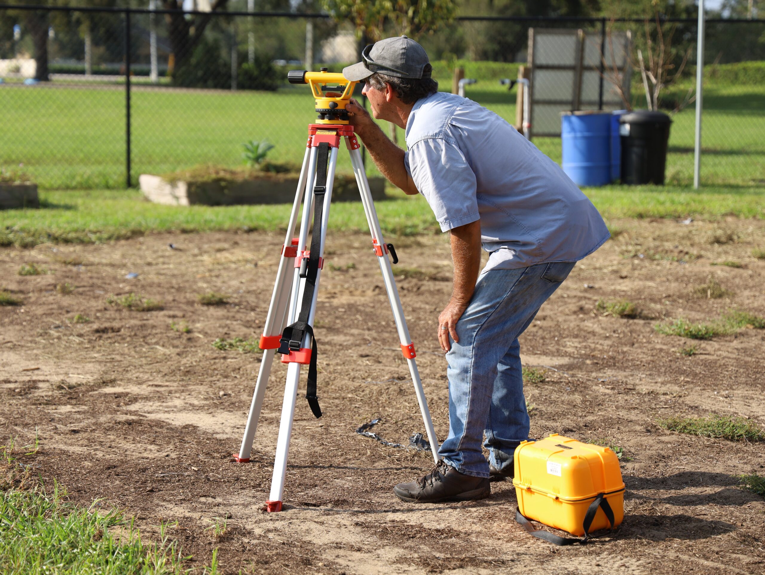
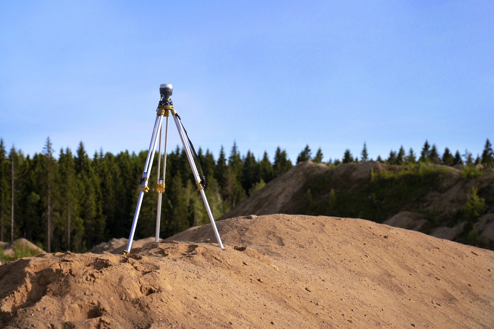
Comprehensive Guide to Land Surveying Services by Will’s Service Group

land surveying

Land surveying is a critical aspect of property management, ensuring accurate information is gathered and used in various decision-making processes. With an industry as complex and diverse as land surveying, it’s essential to acknowledge the various services offered and understand their importance in property management. In this comprehensive guide, we will dive deep into the land surveying services provided by Will’s Service Group, a company committed to delivering high-quality and affordable services for both residential and commercial clients.

From navigating property boundaries to ensuring property developments adhere to local regulations, land surveying services play a crucial role in the successful management of your property. Join us as we explore various land surveying services, their applications, and the value they bring to effective property management. Make sure to stay informed, confident, and empowered when dealing with land surveying matters on your property.

Boundary Surveys: Establishing Property Lines

A fundamental service offered by Will’s Service Group is boundary surveys. This type of survey determines the exact location of a property’s boundaries, helping property owners make informed decisions regarding land acquisitions, construction projects, and boundary disputes. Boundary surveys also ensure compliance with local zoning laws and regulations, providing legal documentation of property lines.

In addition to establishing property lines, Will’s Service Group also verifies previous surveys, identifies potential encroachments, and addresses any discrepancies in boundary information. By providing accurate and up-to-date property line information, boundary surveys play a vital role in property development and overall management.

Topographic Surveys: Mapping the Terrain

Topographic surveys are an essential service for any property owner or developer. These surveys identify and map the natural and man-made features of a property, including elevations, contours, vegetation, and existing structures. Topographic surveys enable architects, engineers, and other professionals to make informed design decisions for proposed construction projects and site development.

Will’s Service Group conducts thorough topographic surveys using advanced technology and proven methodologies, providing accurate and detailed representation of the site’s conditions. With reliable and current topographic data, clients can effectively plan and execute construction projects, ensuring minimal environmental impact and optimal use of the land.

Construction Staking: Guiding the Building Process

Construction staking, also known as construction layout, is a critical land surveying service that establishes points on a property for the accurate placement of structures or improvements. These points, based on the property’s legal boundaries and the site’s topographic data, act as a guide for construction crews during the building process.

Will’s Service Group’s construction staking services ensure structures are built in the correct locations while adhering to local regulations and setbacks. As a result, potential issues such as encroaching on neighboring properties or violating zoning laws can be avoided. Investing in construction staking helps maintain a smooth construction timeline and mitigates the risk of costly mistakes.

Subdivision Surveys: Creating New Parcels of Land

Subdivision surveys are utilized when dividing a piece of land into smaller parcels for separate sale, development, or use. Will’s Service Group’s team of expert land surveyors not only ensures that each newly created lot meets local zoning codes, ordinances, and land-use regulations but also helps in preparing legal documentation associated with the parcel subdivision.

By partnering with Will’s Service Group for subdivision survey services, property owners can seamlessly divide their property with confidence, knowing that all legal and regulatory requirements are thoroughly addressed.

ALTA/NSPS Land Title Surveys: Meeting Industry Standards

American Land Title Association (ALTA) and National Society of Professional Surveyors (NSPS) Land Title Surveys are a specialized type of survey that adheres to strict national standards set forth by both ALTA and NSPS. These high-level surveys are often required for commercial property transactions, title insurance purposes, and property development or redevelopment projects.

As a comprehensive survey, an ALTA/NSPS Land Title Survey provides in-depth information about the property, including boundary measurements, encroachments, easements, zoning classifications, and existing structures. With their extensive experience navigating these industry standards, Will’s Service Group skillfully executes ALTA/NSPS Land Title Surveys, equipping clients with the necessary information for successful property transactions and development.

Flood Risk Assessment: Protecting Your Property

In areas prone to flooding, a flood risk assessment is an invaluable service that provides insight into property vulnerabilities and potential mitigation measures. Will’s Service Group’s professional land surveyors can evaluate a property’s flood zone designation, helping property owners understand insurance requirements and potential risks associated with flooding events.

By conducting flood risk assessments, property owners can make better-informed decisions regarding property development, insurance coverage, and flood prevention strategies.

Additional Land Surveying Services

Beyond the services mentioned above, Will’s Service Group offers an array of specialized land surveying solutions. Examples include Lot Split Surveys, Condominium Plats, Mortgage Surveys, and Route Surveys. Specific services are available for clients with unique needs in residential, commercial, or industrial projects.

Experience and Expertise: The Foundation of Quality Land Surveying

The success of any land surveying project relies heavily on the skills, knowledge, and experience of the land surveyors involved. With over ten years of industry experience, Will’s Service Group maintains a team of expert land surveyors committed to delivering accurate and efficient results. Through their collaboration with local organizations, including Target Surveying and Benchmark Land Services, their continued dedication to lowering prices in the surveying industry ensures clients receive top-quality services at the best possible value.

As you venture into the world of property management and development, remember that partnering with an experienced land surveying service provider like Will’s Service Group guarantees precise outcomes, paving the way for successful and seamless projects.

Make Informed Decisions with Professional Land Surveying Services

With an extensive portfolio of land surveying services, Will’s Service Group caters to a diverse range of property management and development needs. By investing in accurate and reliable land surveying services, property owners and developers can make informed decisions that contribute to the success of their projects, mitigate potential risks, and ensure compliance with local regulations.

Are you ready to embark on your property journey with confidence? Partner with Will’s Service Group for professional surveying services. Our commitment to lowering prices in the surveying industry guarantees transparent, affordable, and professional services delivered by a team of experienced land surveyors. Contact Will’s Service Group today, and let us help you navigate the land surveying process for the optimal outcome in your property management and development ventures.

The Ultimate Guide to Land Surveying: Importance & Process

land

Land surveying is an essential component of property development, construction, and real estate transactions, providing accurate measurements and valuable insights.

Land surveyors, like Will’s Service Group, are equipped with extensive experience and state-of-the-art technology to effectively and accurately map and measure diverse properties. This expertise ensures your project runs smoothly from start to finish, avoiding potential legal issues or boundary disputes.

In this guide, we’ll discuss the importance of land surveying, touching on the various types of surveys available and explaining the step-by-step process involved in conducting a land survey. Whether you’re a homeowner, business owner, or just curious about the world of land surveying, our comprehensive guide is tailored to provide the knowledge you need.

So, let’s dive in and discover the fascinating world of land surveying and its integral role in property management.

Types of Land Surveys and Their Purpose

Land surveys can be categorized into numerous types, each serving a specific purpose based on project requirements. Understanding these different types will help you identify which survey is most suitable for your needs.

  • Boundary Surveys: These surveys determine the precise location of property lines by locating and verifying boundaries. Property owners often use boundary surveys before selling or purchasing land, or during fencing and landscaping projects.
  • Topographic Surveys: Topographic surveys involve measuring the elevation of various points on a piece of land to create a 3D representation. This information is critical for engineers and architects when designing and planning infrastructure projects such as roads, bridges, and buildings.
  • Construction Surveys: These surveys help construction crews by establishing markers and reference points, indicating where to place structures and other components. Construction surveys also assist in monitoring the progress of a project and ensuring everything is built according to precise specifications.
  • ALTA/NSPS Surveys: The American Land Title Association (ALTA) and the National Society of Professional Surveyors (NSPS) have jointly established a set of stringent standards for land surveys performed during real estate transactions. These surveys provide a comprehensive analysis of the property, including boundary lines, easements, and encroachments.

Essential Steps in the Land Surveying Process

Regardless of the type of land survey being conducted, there are fundamental steps professionals follow to ensure accurate results.

1. Research and Preparation

Before physically evaluating the land, surveyors commence extensive background research. This entails reviewing historical records, deeds and maps, land registry documents, and any previous survey plans to gather as much knowledge as possible about the property and its boundaries.

2. Field Work and Data Collection

Once all necessary documentation has been collected, surveyors head to the property site to conduct the survey. Using advanced technology such as GPS and total stations, surveyors measure distances, angles, and elevations to collect exact spatial data. This step can take anywhere from a few hours to several days, depending on the size and complexity of the property. 

3. Data Analysis

After obtaining the required measurements, surveyors return to their offices and perform a thorough analysis of the collected data. This process involves comparing the collected data with historical records and other relevant documents to ensure all measurements align with the land’s legal and physical specifications.

4. Preparing the Final Map or Report

Once analysis is complete, surveyors create a comprehensive map, report, or plan that accurately represents the land’s boundaries, features, and any relevant information specific to the survey’s purpose. This final product will be used by engineers, architects, or property owners as a reliable reference and legal document. 

Key Benefits Land Surveying Provides to Property Owners

Undertaking a land survey delivers numerous advantages that can safeguard property investments, streamline project development, and resolve disputes.

1. Accurate Boundary Determination

Land surveys provide accurate information regarding property boundaries. This not only prevents potential disputes with neighbors or other parties but also establishes legal requirements, ensuring you adhere to zoning and building laws. 

2. Identifying Encroachments

If an encroachment, such as a neighbor’s fence or garage, exists on your property, a land survey will identify such instances. Resolving encroachments early can save time, money, and legal complications in the future.

3. Risk Mitigation

Obtaining a land survey safeguards your investment by revealing potential issues, such as easements, zoning restrictions, or environmental concerns, which may impact property value or limit future plans. A survey also protects you from future legal disputes or potential issues during property transactions.

4. Proper Planning and Design

A land survey provides the necessary data for architects and engineers to design infrastructural projects such as home additions, septic systems, irrigation installations, and more. Precise information from a land survey ultimately results in better decision-making and the successful completion of projects without any costly mistakes. 

How Will’s Service Group Ensures Excellence in Land Surveying

Will’s Service Group has over ten years of experience in the land surveying industry, offering clients accurate, reliable, and affordable survey services. Through a commitment to leveraging cutting-edge technology, such as GPS equipment and laser scanners, Will’s Service Group delivers the highest quality results with fast turnaround times. This unwavering dedication to excellence makes them a top choice for land surveying services in the United States.

Their professional team undergoes rigorous training to master various surveys and provide tailored solutions to meet unique client requirements. By prioritizing client satisfaction and ensuring transparency in pricing, Will’s Service Group stands out as a leader in delivering high-quality and affordable land surveying services.

Trust the Expertise of Will’s Service Group for Your Land Surveying Needs

Land surveying is vital in property ownership, development, and planning. A professional land survey provides accurate data about the property, enables effective decision-making, and helps avoid legal complications associated with inaccuracies or discrepancies.

Will’s Service Group delivers exceptional land surveying services thanks to their knowledgeable team, commitment to accuracy, affordability, and deployment of advanced technology. Their expertise ensures clients receive reliable results tailored to meet their individual needs.

Choose Will’s Service Group for your land surveying project today, and experience the peace of mind from working with a trusted team of professionals dedicated to excellence. Contact us for a consultation, and let us provide you with the exceptional land surveying services you deserve!

Eco-Friendly Land Surveying Practices with Will’s Service

land surveying

Land surveying is pivotal in property development and construction projects, providing the data necessary for informed decision-making and site planning. However, traditional surveying methods can potentially impact the environment, necessitating the adoption of eco-friendly practices by responsible surveying companies. In this article, we’ll discuss the environmental considerations of land surveying and explore how Will’s Service Group strives to conduct surveys in an eco-friendly manner, minimizing ecological disruptions while maintaining accuracy and efficiency.

From leveraging advanced technologies to implementing best practices in the field, Will’s Service Group is dedicated to reducing its environmental footprint without sacrificing the quality of its land surveying services. Read on to understand the importance of environmentally responsible land surveying and how our team at Will’s Service Group prioritizes protecting our shared environment.

The Environmental Impact of Traditional Land Surveying Methods

Traditional land surveying methods can lead to negative environmental effects, such as the disruption of local ecosystems, soil erosion, and damage to vegetation. These impacts arise due to human intrusion, the use of heavy equipment, and the construction of temporary access routes in sensitive environments. Additionally, the improper disposal of waste materials from surveying activities can lead to pollution, affecting local habitats and water sources.

Acknowledging these concerns and adopting eco-friendly surveying practices to minimize environmental harm is crucial. By taking a proactive approach to environmental preservation, professional land surveyors can continue providing essential services while reducing negative environmental impacts.

Advanced Technologies for Eco-Friendly Surveying

Will’s Service Group understands the importance of environmental sustainability, incorporating advanced technologies to minimize ecological disruptions while maintaining the highest level of accuracy in land surveying. Some key advancements include:

1. GPS and GIS Technologies

Global Positioning System (GPS) and Geographic Information System (GIS) technologies allow surveyors to locate precise positions on Earth’s surface with minimal environmental impact. GPS devices help surveyors avoid damaging critical habitats or disturbing local ecosystems by accessing accurate geographic coordinates without having to perform intrusive techniques.

GIS technology aids in analyzing and understanding the spatial relationships between different environmental features to inform eco-conscious decision-making. For example, GIS can help identify environmentally sensitive areas or potential hazards, ensuring that surveying activities proceed in a manner that respects and conserves the surrounding environment.

2. Drone Surveying

Will’s Service Group employs drone surveying techniques to collect topographical data with minimal disturbance to local ecosystems. Drones, or unmanned aerial vehicles (UAVs), are capable of capturing high-resolution imagery and 3D data remotely, preventing the need for human intrusion in sensitive areas. This method significantly reduces ground disturbances, vegetation damage, and soil erosion associated with traditional surveying methods.

In addition, drone surveying often requires less time and resources, reducing the environmental footprint of a land survey project while improving efficiency and accuracy.

3. 3D Laser Scanning

3D laser scanning technology captures detailed information about the environment quickly and accurately, providing necessary data for decision-making without negatively impacting the surroundings. 3D laser scanners generate accurate 3D representations of the environment by emitting laser beams that reflect off surfaces and return to the scanner.

By using 3D laser scanning technology, Will’s Service Group can collect high-resolution data with minimal impact on the environment. This method significantly decreases the need for heavy equipment or human intrusion in delicate ecosystems, lessening the potential for damage and disruption.

Environmentally Responsible Surveying Best Practices

Will’s Service Group is committed to environmentally responsible surveying practices, ensuring minimal environmental disruption while delivering accurate and useful data. Some of these best practices include:

1. Environmental Health and Safety Training

All team members at Will’s Service Group undergo extensive environmental health and safety training, gaining essential knowledge to minimize ecological harm while working in the field. This training ensures that surveyors are equipped to identify and mitigate potential environmental hazards, ensuring compliance with relevant environmental regulations and adhering to best practices for sustainable land surveying.

2. Planning and Coordination

Effective planning and coordination play a significant role in reducing the environmental impact of land surveying projects. Will’s Service Group conducts thorough site evaluations to identify environmentally sensitive areas and assess potential risks. Surveyors can then establish clearly defined work zones, carefully designed access routes, and necessary precautions to minimize ecological disruptions.

By prioritizing open communication and collaboration with clients, stakeholders, and environmental professionals, Will’s Service Group ensures a well-coordinated approach to minimize potential harm during the surveying process.

3. Waste Reduction and Management

In line with environmentally responsible practices, Will’s Service Group minimizes waste generation during surveying activities, carefully managing the disposal of any waste materials to prevent pollution. This commitment to waste reduction and responsible management lessens the environmental footprint of land surveying projects and contributes to a cleaner and healthier environment for all.

Public Awareness and Education

Promoting public awareness and education on the importance of environmental sustainability is vital. Will’s Service Group actively engages with clients, stakeholders, and local communities regarding the benefits of eco-friendly land surveying practices. By fostering a deeper understanding of the environmental impact of land surveying and the benefits of adopting more sustainable methods, Will’s Service Group hopes to contribute to a more environmentally responsible surveying industry.

By investing in advanced technologies, implementing environmentally responsible best practices, and promoting public awareness, Will’s Service Group demonstrates its commitment to minimizing the environmental impact of land surveying. Furthermore, adopting eco-friendly surveying practices contributes to the success and sustainability of property development, ensuring a greener future for both people and the environment.

Choose Sustainability with Will’s Service Group

Embracing environmentally responsible land surveying practices is essential for preserving our shared environment and ensuring sustainable development. At Will’s Service Group, we prioritize eco-friendly methods, leveraging advanced technologies and adhering to best practices to minimize the environmental impact of our land surveying services. By investing in innovations like GPS, GIS, drone surveying, and 3D laser scanning, we reduce ecological disruptions without compromising accuracy and efficiency.

Partner with a land surveyor who shares your commitment to sustainability. Contact Will’s Service Group today to discuss your land surveying needs and learn how our environmentally responsible approach can benefit your project. Trust our expertise in delivering accurate, reliable, and eco-friendly land surveying services for the success of your property or development project, today and for generations to come.

Topographic Surveys: A Vital Tool for Land Development and Planning

land

Planning and developing any piece of land, whether it’s a small residential lot or a large-scale commercial site, requires an in-depth understanding of more than just its legal boundaries. To design and execute successful development projects, architects, engineers, and planners rely on accurate topographic data to inform their decision-making processes and ensure efficient land use. At Will’s Service Group, our dedicated team of expert land surveyors is committed to providing comprehensive topographic survey services, delivering detailed and reliable information about your land’s physical features and elevations, to inform your project design, meet regulatory requirements, and maximize land potential.

A topographic survey is an extensive land surveying service that focuses on identifying and mapping the natural and artificial features, elevations, and contours of a piece of land, creating a detailed and accurate three-dimensional representation of the site. This valuable information can be leveraged for various purposes, from designing drainage systems and grading plans to constructing building foundations and roadways. By investing in a topographic survey, developers and planners can make well-informed decisions that bolster the success of their land development projects while minimizing risks.

In this blog post, we will explore the importance of topographic surveys in land development and planning, the methodology utilized by the land surveyors at Will’s Service Group, and the benefits of entrusting your topographic survey needs to our experienced professionals. Whether you are planning a new construction, subdivision, or environmental assessment, understanding the vital role of topographic surveys in land development is essential to ensuring project success and informed decision-making. Learn more about the capabilities and services of our skilled land surveyors and discover how our dedication to accuracy and excellence can help make your vision a reality.

Topographic Survey Applications: From Design to Implementation

Topographic surveys serve a wide variety of applications within the realm of land development and planning. Some of the most common uses for these detailed, precise surveys include:

1. Site Planning and Design: Architects, engineers, and planners rely on topographic surveys to create site plans and designs that accurately and effectively utilize the land’s unique features and elevations, allowing for efficient land usage and cost-effective construction.

2. Infrastructure Development: Topographic surveys are instrumental in designing and constructing essential infrastructure components, such as roadways, bridges, and utility systems. By providing detailed elevation and feature data, these surveys enable the accurate placement and design of these critical infrastructure elements.

3. Grading and Drainage Planning: Accurate topographic data is crucial for designing and implementing effective grading and drainage plans, ensuring proper erosion control, stormwater management, and site stabilization.

4. Environmental Assessments and Permitting: Environmental regulations often necessitate topographic surveys to determine potential impacts on sensitive ecosystems, floodplains, and crucial habitat areas, helping to meet permitting requirements and protect natural resources.

In these diverse applications, topographic surveys act as a critical tool for informed decision-making and successful land development.

The Precision Process: How Land Surveyors Conduct Topographic Surveys

Topographic surveys require a finely tuned combination of advanced technology, skilled professionals, and a rigorous methodology. The streamlined process employed by expert land surveyors from Will’s Service Group includes the following key steps:

1. Research and Data Gathering: The survey process begins with the collection of relevant site information, including historical surveys, property boundaries, and any existing design plans or blueprints.

2. Field Measurements: Surveyors visit the site to measure its features and elevations, using advanced surveying techniques, such as GPS, total stations, and laser scanning technology, to gather highly accurate data.

3. Data Processing and Analysis: Collected data is processed by survey software, which generates topographic maps and other visuals to represent the site’s features and elevations clearly and accurately.

4. Reporting: Surveyors compile their findings into comprehensive reports and illustrations, which can be presented in various formats, including digital models, contour maps, or even interactive virtual environments.

Through this meticulous process and a dedication to precision, land surveyors from Will’s Service Group ensure that their topographic surveys provide accurate, actionable data to guide your land development projects.

Reaping the Benefits: How Topographic Surveys Promote Project Success

Investing in a topographic survey has numerous benefits that can contribute to your project’s success. Some of these benefits include:

1. Informed Decision Making: By providing detailed data on land features and elevations, topographic surveys empower developers and decision-makers to make well-informed choices about design, site layout, and construction techniques.

2. Regulatory Compliance: A topographic survey can help identify potential environmental impacts, floodplain and wetland boundaries, and other factors that may trigger regulatory concerns, ensuring that land development projects meet local, state, and federal regulations and avoid potential roadblocks.

3. Cost Efficiency: Topographic survey data can help prevent costly design changes and construction delays, enabling developers to allocate resources and plan budgets more effectively.

4. Risk Mitigation: By identifying potential challenges and issues in the early stages of project planning, topographic surveys can help minimize risks and protect the long-term viability of your land development investments.

Conclusion

In the competitive and complex world of land development and planning, topographic surveys stand out as a vital asset for achieving project success, streamlining decision-making processes, and maximizing the potential of your land investments. When you choose to work with the skilled land surveyors at Will’s Service Group, you can rest assured that you are investing in comprehensive topographic survey services that will provide the reliable, detailed information you need to make informed decisions about your land development projects.

From initial planning and design to permitting, construction, and even long-term maintenance and management, topographical surveys play a central role in supporting the successful execution of your land development vision. To learn more about the expert topographic survey services provided by Will’s Service Group and how our experienced land surveyors can support your land development journey, reach out to our team today.

Navigating the Future: How Drones Are Revolutionizing Land Surveying Services

drone view of a land property with trees

As the field of land surveying evolves, professionals must stay current with emerging technologies and innovations to provide exceptional service and maintain a competitive edge in the industry. One of the most transformative advancements in recent years is the integration of drone technology into land surveying practices. Combining the benefits of aerial photography, remote sensing, and advanced software capabilities, drones offer land surveyors from Will’s Service Group the tools to revolutionize their services and deliver unparalleled accuracy, efficiency, and flexibility to their clients.

Incorporating drone technology into their arsenal, land surveyors from Will’s Service Group can undertake a wide array of surveying projects with increased speed, reduced costs, and minimized environmental disruption. Drones, also known as unmanned aerial vehicles (UAVs), have proven to be a game-changer for various land development projects, from small-scale residential surveys to expansive commercial and industrial developments.

In this blog post, we will delve into the numerous ways in which Will’s Service Group’s land surveyors are harnessing the power of drone technology to elevate their services and bring innovative, cutting-edge solutions to their valued clients. We will explore how drones are used for topographic surveys, site inspections, volume calculations, and more, offering efficient, precise, and comprehensive data collection. Join us as we navigate the future of land surveying and unveil the remarkable benefits that drone technology brings to the industry, further solidifying the land surveyor’s vital role in the realm of land development.

Quick and Accurate Topographic Surveys

Drone technology empowers land surveyors to conduct highly accurate topographic surveys with unprecedented speed and efficiency. By capturing high-resolution aerial imagery, UAVs provide land surveyors with the necessary data to generate detailed, accurate topographic maps without the need for labor-intensive traditional surveying methods. These advancements offer numerous benefits to clients:

1. Time Savings: Conducting topographic surveys using drones is significantly faster compared to traditional surveying methods, as a vast area can be covered in just a few hours, leading to quicker project turnaround times.

2. Cost Reduction: The rapid data collection capabilities of drones help reduce overall project costs by streamlining the labor and time required to complete the survey.

3. Enhanced Safety: By eliminating the need for surveyors to traverse challenging terrain or enter hazardous environments, drones help minimize the risk of accidents and improve the overall safety of land surveying operations.

Conducting Comprehensive Site Inspections

Drones offer a more comprehensive and accessible means of conducting site inspections, allowing land surveyors to evaluate large properties or hard-to-reach areas with ease. Some of the primary benefits of using drone technology for site inspections include:

1. Improved Accessibility: Drones can quickly and safely access areas that may be difficult or dangerous to reach on foot, ensuring a complete and thorough inspection.

2. Detailed Visual Documentation: High-resolution aerial photography and video captured by drones provide clients with a clear visual record of their property, making it easier to identify potential issues or concerns.

3. Streamlined Communication: By sharing drone footage with architects, engineers, and other project stakeholders, land surveyors can facilitate seamless communication and foster informed decision-making throughout the planning and development process.

Efficient Volume Calculations and Earthwork Planning

For construction projects requiring large-scale excavation or earth movement, accurate volume calculations are crucial for planning and cost estimates. Drones offer a highly efficient method for capturing the necessary data to determine these volumes:

1. High-resolution 3D Mapping: By capturing a series of overlapping aerial images, drones enable land surveyors to create high-resolution 3D models of the project site, which can be used to compute accurate volume calculations.

2. Real-time Data Access: The ability to process drone imagery quickly allows surveyors to provide clients with near real-time volume calculations, streamlining the planning and budgeting processes.

3. Minimized Environmental Impact: Drones can calculate land volumes and generate 3D models with minimal disruption to the environment, reducing the need for on-site disturbance and protecting sensitive ecosystems.

Monitoring and Documenting Construction Progress

One crucial aspect of construction project management is effectively monitoring and documenting the progress of on-site work. Drones have emerged as a powerful tool for tracking construction activity, offering several advantages over traditional methods:

1. Efficient Progress Assessment: Regular drone flyovers provide surveyors, developers, and project stakeholders with an up-to-date visual record of construction progress, making it easier to identify potential delays or issues.

2. Quality Control: High-resolution aerial imagery and video captured by drones allow land surveyors to identify any quality control concerns, ensuring that construction work aligns with design specifications and building codes.

3. Enhanced Marketing and Communication: Drone photography and videography can be utilized to create engaging marketing materials and effectively showcase the project to investors, prospective tenants, and the general public.

Conclusion

The integration of drone technology into the land surveying industry has ushered in a new era of efficiency, accuracy, and innovation for land development professionals. Will’s Service Group’s land surveyors remain at the forefront of this technological revolution, harnessing the power of UAVs to elevate their services and offer clients unparalleled solutions for their land surveying needs.

From topographic surveys and site inspections to volume calculations and construction progress monitoring, drone technology has fundamentally transformed the land surveying landscape. By embracing this cutting-edge approach, land surveyors continue to prove their commitment to excellence, providing clients with services that are not only highly accurate and efficient but also environmentally responsible.

Partner with the progressive team of land surveyors at Will’s Service Group to experience the numerous benefits that drone technology can bring to your land development projects. Contact us today to discuss how our innovative and professional professional surveying services can support your project’s success and pave the way for a brighter, more sustainable future in land development.

Flood Zone Surveys: The Importance of Accurate Land Surveying for Safe Property Development

land survey

As property developers and landowners seek opportunities for construction and development, it is crucial to understand a property’s susceptibility to flooding, and the role of accurate land surveying in determining flood risk. Flood zone surveys are not only essential for the safety of property occupants and minimizing the potential for catastrophic property damage, but also for adhering to regulatory requirements and insurance obligations. At Will’s Service Group, we recognize the importance of conducting thorough, reliable flood zone surveys, and our team of expert land surveyors is dedicated to providing invaluable information on flood-prone areas, enabling informed decisions and sustainable development.

Flood zone surveys determine a property’s flood risk classification according to the Federal Emergency Management Agency’s (FEMA) flood mapping system. Properties located within designated high-risk flood zones may be subject to mandatory flood insurance requirements and building code regulations to withstand potential flood conditions. On the other hand, properties situated outside high-risk areas but may still experience localized flooding could benefit from a flood zone survey to inform appropriate design measures and risk mitigation strategies.

In this blog post, we will explore the significance of flood zone surveys in property development and the ways land surveyors can help support safe, sustainable, and compliant construction projects. By partnering with Will’s Service Group, you will benefit from our team of experienced land surveyors, who are prepared to provide the necessary insights and advice needed to navigate the often complex world of flood zone regulations and risk management.

Join us as we uncover the critical importance of flood zone surveys in property development and learn how our expert land surveyors at Will’s Service Group can guide you in making informed decisions for long-term safety and success in your development projects.

Understanding Flood Zone Classifications and Regulations

To protect lives, properties, and the environment, the Federal Emergency Management Agency (FEMA) has developed a comprehensive system of flood zone classifications based on the level of flood risk associated with a particular area. By understanding the different flood zone designations, property owners and developers can anticipate potential risks, comply with applicable regulations, and design and construct buildings with adequate resilience to withstand flood events. Some common flood zone designations include:

1. Zone A: Areas with a 1% annual chance of flooding (commonly known as the 100-year floodplain). These flood zones are subject to mandatory flood insurance requirements for properties with a federally backed mortgage.

2. Zone AE: Areas with a 1% annual chance of flooding, including the base flood elevation (BFE), which is the elevation at which there is a 1% chance of flooding in any given year.

3. Zone X: Areas outside the 1% annual chance flood (shaded Zone X) have a 0.2% annual chance of flooding, while those outside of both the 1% and 0.2% chance zones are designated as unshaded Zone X.

4. Zone V: Coastal areas subject to a 1% annual chance of flooding, combined with the additional hazard of storm-induced waves – these high-risk zones require stricter building codes and designs to account for the potential impact of severe coastal flooding.

By being aware of your property’s flood zone classification, you can identify the specific regulations, insurance requirements, and design considerations that apply to your development project.

The Role of Land Surveyors in Flood Zone Surveys

Conducting a flood zone survey is a crucial step towards understanding the potential risks to your property and ensuring compliance with FEMA and local regulations. This is where the expertise of experienced land surveyors like those at Will’s Service Group comes into play. Their key responsibilities include:

1. Identifying the property’s flood zone classification based on FEMA’s Flood Insurance Rate Maps (FIRMs).

2. Confirming the precise elevation of the land and structures, which is critical in determining whether the property meets the required Base Flood Elevation (BFE) standards.

3. Providing detailed documentation and expert analysis on any potential flood hazards or risks associated with the property.

4. Assisting with the submission of necessary documentation to local authorities for building permits, construction approvals, and insurance requirements.

By enlisting the services of a qualified land surveyor, you can be confident that your property development project will be accurately assessed for flood risks and compliant with all relevant regulations.

Strategies for Minimizing Flood Risks in Property Development

Having obtained a flood zone survey for your property, it is then vital to consider strategies for minimizing the identified flood risks during the design, construction, and ongoing management of your development project. Some recommended strategies include:

1. Flood-resistant design: Constructing buildings above the Base Flood Elevation (BFE), using materials that are resistant to flood damage, and designing proper drainage systems.

2. Green infrastructure: Implementing green spaces and sustainable stormwater management techniques to absorb and redirect excess water, reducing the risk of localized flooding.

3. Flood insurance: Securing an appropriate level of flood insurance for your property, providing protection in the event of a flood-related incident.

4. Ongoing maintenance and monitoring: Regular inspections and maintenance of flood protection systems, as well as monitoring changes in flood zone classifications or regulations, ensure continued awareness of potential risks and regulatory compliance.

Conclusion

Understanding the importance of accurate land surveying, particularly when it comes to flood zone surveys, is essential for property developers seeking to create safe, compliant, and sustainable projects. By partnering with experienced land surveyors like Will’s Service Group, you can ensure that your property development project is well-informed, prepared, and equipped to handle potential flood risks and challenges.

As you embark on your property development journey, trust the team at Will’s Service Group to provide unparalleled expertise and support in assessing and mitigating flood-related risks. From initial flood zone surveys to ongoing risk management and regulatory compliance, our land survey company will ensure that your development project is built on a solid foundation of safety, resilience, and long-term success.

ALTA/NSPS Land Title Surveys: The Ultimate Guide for Commercial Property Transactions

land survey

Navigating the world of commercial property transactions can be complex, particularly when it comes to understanding the array of surveying requirements involved. One essential factor in commercial property dealings is the ALTA/NSPS Land Title Survey, a specialized survey created to provide crucial information for lenders, title companies, and buyers participating in commercial real estate transactions. At Will’s Service Group, we understand the importance of a thorough, accurate, and compliant ALTA/NSPS survey for all parties involved, and our team of experienced land surveyors is dedicated to assisting our clients in navigating the intricacies of commercial property surveys and transactions.

The ALTA/NSPS Land Title Survey is a collaborative effort between the American Land Title Association (ALTA) and the National Society of Professional Surveyors (NSPS), which establishes standardized nationwide requirements for these surveys. This ensures that both buyers and sellers can be confident in the accuracy and quality of the information presented, covering all essential details of the property and its boundaries, ownership history, easements, encroachments, and zoning restrictions. By obtaining an ALTA/NSPS Land Title Survey, all parties involved in the transaction can better understand the property’s unique features, potential risks, and legal conditions before committing to the deal.

In this comprehensive guide, we will explore the benefits and components of an ALTA/NSPS Land Title Survey and the invaluable role of land surveyors in ensuring a seamless experience in commercial property transactions. With expert insights and advice from our dedicated team at Will’s Service Group, you will be well-equipped to make informed decisions and protect your investment in the ever-evolving and competitive world of real estate.

Components and Requirements of an ALTA/NSPS Land Title Survey

An ALTA/NSPS Land Title Survey is a comprehensive property survey that adheres to strict standards set forth by the American Land Title Association and the National Society of Professional Surveyors. These guidelines serve to ensure uniformity and accuracy across all ALTA/NSPS surveys. Some key components and requirements of these surveys include:

1. Accurate boundary measurements: Land surveyors must perform precise measurements of the property boundaries, establishing the exact limits of the parcel.

2. Identification of easements and rights-of-way: The survey must disclose all existing easements and rights-of-way that affect the property, such as access rights for utilities or neighboring properties.

3. Depiction of improvements: All buildings, structures, and other improvements on the property must be clearly shown on the survey, with their dimensions and distances from the property boundaries.

4. Encroachments and setbacks: The survey should identify any encroachments onto the property or neighboring properties, as well as any violations of setback requirements set by local zoning regulations.

5. Legal descriptions: A clear and accurate legal description of the property’s boundaries is essential, along with a depiction of any easements, rights-of-way, or restrictive covenants.

By adhering to these standards, land surveyors provide a reliable, detailed, and standardized representation of the property that allows all parties involved in the transaction to make informed decisions.

The Value of an ALTA/NSPS Land Title Survey in Commercial Property Transactions

An ALTA/NSPS Land Title Survey provides indispensable information for both buyers and sellers in a commercial property transaction. Some of the key benefits of obtaining an ALTA/NSPS survey include:

1. Risk management: By disclosing all potential issues and concerns related to the property, an ALTA/NSPS survey helps buyers and sellers manage risks and address any legal or financial challenges before they escalate.

2. Title insurance: Lenders and title insurance companies often require an ALTA/NSPS survey for commercial transactions, ensuring that the title is clear and insurable.

3. Zoning compliance: An ALTA/NSPS survey can help confirm that the property complies with local zoning regulations, avoiding potential fines or legal issues.

4. Informed negotiation: With the thorough information provided by an ALTA/NSPS survey, buyers and sellers can negotiate pricing, terms, and conditions based on all relevant factors concerning the property.

5. Due diligence: Performing an ALTA/NSPS survey is part of the due diligence process, which helps protect parties involved in the transaction from undiscovered liabilities.

Choosing a Qualified Land Surveyor

Selecting a qualified land surveyor to perform your ALTA/NSPS Land Title Survey is essential for achieving accurate and reliable results. When choosing a land surveyor, consider the following factors:

1. Experience: Select a land surveyor with extensive experience performing ALTA/NSPS surveys, as they will be familiar with the stringent standards and deliverables required.

2. Licensing: Ensure the land surveyor is licensed to practice in the state where the property is located.

3. Reputation: Look for a land surveyor with a strong reputation for accuracy, professionalism, and client satisfaction, as demonstrated by client testimonials or references.

4. Communication: Choose a land surveyor who communicates effectively, explaining the process and findings in clear, understandable terms and providing timely responses to questions or concerns.

Using these criteria, you can be confident in selecting a land surveyor who will provide an accurate and comprehensive ALTA/NSPS Land Title Survey for your commercial property transaction.

Conclusion

Obtaining an ALTA/NSPS Land Title Survey is a vital step in any commercial property transaction, providing essential information for buyers, sellers, lenders, and title insurers. With expert guidance and support from a reliable land surveyor like those at Will’s Service Group, you can navigate the complexities of commercial property transactions with confidence. By understanding the importance and benefits of an ALTA/NSPS survey and making an informed choice when selecting your land surveyor, you ensure the success of your commercial property investment.

As you venture into the world of commercial real estate, trust the knowledgeable team at Will’s Service Group to provide the expertise and support you need. Our experienced land surveyors will guide you through the ALTA/NSPS Land Title Survey process, helping you secure a solid foundation on which to build your commercial property endeavors. With our unwavering commitment to accuracy, professionalism, and client satisfaction, you can be confident in your choice to partner with us for all your land surveying needs. Reach out to our commercial survey services today!

Top 5 Reasons Why Homeowners Need Land Surveying Services

Land Surveying

As a homeowner, you may take pride in maintaining your property and making your residence a warm, welcoming, and secure place to live. However, what many homeowners might overlook is the range of benefits that land surveying services can provide in protecting property investments and ensuring peace of mind. Land surveyors are more than just mapmakers; they are skilled professionals who analyze and interpret data to provide comprehensive guidance on the legal, physical, and environmental aspects of your property. At Will’s Service Group, we understand the importance of safeguarding your home investments and the many ways our land surveying services can contribute to that goal.

While it may not immediately come to mind when thinking about routine property care and maintenance, land surveying services can be valuable to homeowners in various situations. From property disputes to landscaping endeavors, land surveyors possess the knowledge and skills required to ensure a smooth and hassle-free experience for homeowners facing diverse challenges or projects. If you are considering construction or improvements on your property or need clarity regarding your property lines, land surveyors like the team at Will’s Service Group can provide the accurate information and support you need.

In this blog post, we will outline the top five reasons why homeowners may require land surveying services, delving into each scenario and how a land surveyor can play a vital role in providing guidance, preventing potential issues, and safeguarding your property. Through exploring these instances and discussing the ways in which land surveyors can help, you will be better equipped and informed to handle any property challenges or endeavors that come your way.

Join us as we examine the top five reasons that homeowners might need land surveying services and shed light on the importance of these professionals in ensuring a secure and well-maintained property.

Top 5 Reasons Why Homeowners Need Land Surveying Services

1. Resolving Property Disputes

One common reason homeowners may require land surveying services is to resolve property disputes. Conflicting claims over property boundaries can arise for various reasons, from fence installations to tree plantings. Inaccurate deed descriptions and incomplete historical records can make determining property lines difficult. Hiring a professional land surveyor to perform a boundary survey can quickly and objectively resolve these issues. By examining historical records, deeds, and previous surveys and then conducting precise measurements on the property, land surveyors can accurately establish boundaries, provide certified documentation, and put an end to any property disputes.

2. Fencing or Landscaping Projects

Another reason homeowners may need land surveying services is for fencing or large-scale landscaping projects. Before starting any such project, it’s crucial to understand the property boundaries to avoid any legal issues or disputes with neighbors. A land surveyor can identify the precise limits of your property, ensuring that your improvements remain within your land’s confines. Having an up-to-date survey to guide your landscaping or fencing project can save you time, money, and potential conflict with neighboring property owners.

3. Home Additions or Renovations

Planning a home addition or major renovation is an exciting time, but it is crucial to ensure any modifications comply with your local zoning regulations. Most municipalities require you to submit an updated survey as part of the permitting process to verify the proposed construction meets setback, floor area ratio, and height restrictions. In these instances, hiring a land surveyor to perform a site plan survey is necessary. This type of survey maps the existing conditions of your property, including structures, utilities, and topography, and displays the proposed improvements. Providing your local municipality with accurate and detailed site plans streamlines the permit process and helps avoid any delays or costly mistakes.

4. Flood Zone Designations

For homeowners at risk of flooding, a land surveyor can play a crucial role in mitigating risks and ensuring proper insurance coverage. Whether you believe your home has been incorrectly classified in a flood hazard area, or you need to obtain an elevation certificate for flood insurance, a land surveyor can help. They can conduct an elevation survey, accurately measuring your property’s height above sea level and other key elevations, providing the necessary information to your insurance provider. This information can result in potential flood insurance premium savings, or help avoid the costly consequences of being underinsured in a flood event.

5. Purchasing or Selling a Property

When buying or selling a property, you want to ensure a smooth transaction without unforeseen legal or financial complications. In these cases, a land survey can be invaluable. A survey conducted by a professional land surveyor can identify any encroachments, boundary issues, easements, rights-of-way, or zoning discrepancies that could impact the transaction. Armed with this knowledge, potential buyers can avoid purchasing a property with hidden problems, while sellers can address any issues beforehand to present a clean, marketable property. In some cases, obtaining a mortgage may even require a property survey, making it all the more essential to include in your real estate transaction.

Conclusion

Professional land surveying services can provide invaluable support to homeowners in a variety of situations. From resolving property disputes to guiding home improvements, a skilled land surveyor can assist you in protecting your property and ensuring a hassle-free experience. The accurate data and expertise provided by land surveyors like the team at Will’s Service Group can make all the difference in safeguarding your investment and maintaining peace of mind.

If you require reliable and affordable land survey services, look no further than Will’s Service Group. With over a decade of experience and a commitment to fair pricing, we are the go-to choice for many local companies. Contact us today to schedule your survey and experience the difference that Will’s Service Group can make for you.

The Essential Guide to Land Surveying for New Property Development Projects

aerial view of land

Entering the world of property development can be both exciting and daunting, with numerous intricate details and processes that require your attention and resources. As you embark on this journey, it is imperative to understand the essential roles played by various professionals, including land surveyors, in ensuring the successful completion of your new property development project.

Land surveyors wield the power to drive the property development process to success by providing essential information on various factors like boundaries, topography, utility placement, and regulatory compliance. Their services and expertise lay the foundation on which architects, engineers, and construction teams can collaborate and bring forth a successful development project.

For property developers, understanding the role of land surveyors in the development process is paramount to optimizing efficiency, minimizing delays, and ensuring your project stands the test of time, both legally and structurally.

At Will’s Service Group, we appreciate the value that land surveyors and their diverse range of services bring to property development, transforming your concept into reality through accurate data, mapping, and professional insights.

This blog post will delve into the invaluable contribution of land surveyors to property development projects, revealing how their expertise can give you the confidence to move forward in developing your dream property. We will explore how surveying services like boundary surveys, topographic surveys, construction staking, and regulatory compliance can help you avoid costly mistakes, streamline the development process, and add value to your real estate investment.

Join us as we shed light on the importance of land surveying in property development and the essential role it plays in helping you achieve your goals, as well as the crucial reasons why investing in land surveying services through a reputable company like Will’s Service Group will pay dividends in the long run.

Boundary Surveys: Laying Down the Legal Framework

At the very beginning of a property development project, land surveyors provide the foundation by conducting boundary surveys. A boundary survey establishes the legal boundaries of the property, marking out exact property lines and identifying easements, right-of-ways, and encroachments. This information is critical to ensure that your development project doesn’t infringe upon neighboring properties or violate any legal restrictions. By understanding and adhering to the legal framework established by a boundary survey, property developers can avoid time-consuming and expensive legal issues or disputes that may arise later during the development process.

Topographic Surveys: Blueprint for Design and Development

After establishing the property’s legal boundaries, land surveyors continue to add value to the development process through topographic surveys. These surveys provide a detailed representation of the land’s natural and manmade features, including terrain elevation, slopes, watercourses, and existing structures. Armed with this comprehensive understanding of the land’s characteristics, architects and engineers can devise optimal designs that make the best use of the existing landscape and minimize the need for extensive site alterations.

By identifying challenges and opportunities presented by the land, property developers can make informed decisions about the project’s design, feasibility, and potential profitability. Additionally, topographic surveys can highlight any environmental factors that may impact the project, such as potential flood zones or areas at risk of soil erosion.

Construction Staking: Bringing Designs to Life

Once the project’s designs are complete and approved, land surveyors play a further critical role in guiding the construction process with construction staking services. Construction staking is the essential link between design plans and actual construction, translating design specifications into tangible references on the construction site. Land surveyors place stakes or markers to indicate precisely where various elements of the project, such as foundations, walls, and utility connections, should be built.

This accurate guidance ensures that the construction process remains true to the approved design and meets all required zoning regulations, building codes, and safety standards. Ultimately, construction staking reduces the likelihood of costly mistakes and delays during construction, enabling property developers to proceed with confidence in their project’s execution.

Compliance Surveys: Ensuring the Future of Your Investment

Throughout the property development process, land surveyors are invaluable in helping property developers adhere to various regulations and requirements imposed by local, state, and federal authorities. From obtaining building permits to final inspections, land surveyors provide the expertise needed to navigate regulatory complexities and fulfill all mandatory obligations.

One such example is the ALTA/NSPS Land Title Survey, which is often required for commercial property transactions. These surveys provide vital information on boundary lines, easements, encroachments, and more, ensuring the parcel meets the rigorous standards set by the American Land Title Association (ALTA) and the National Society of Professional Surveyors (NSPS). This documentation plays a vital role in securing title insurance, providing lenders and other interested parties with the assurance that the investment is legally sound and free of surprises.

By partnering with experienced land surveyors throughout the development process, property developers can rest assured that they’re operating within the laws and regulations governing their project. As a result, they can enjoy peace of mind knowing that their investment is safeguarded against potential risks that could arise from noncompliance.

Final Thoughts

Land surveying is undeniably an essential aspect of successful property development projects. By providing accurate information and insights about property boundaries, topography, construction planning, and regulatory compliance, land surveyors equip property developers with the tools to develop projects that stand the test of time.

There’s no question that investing in land surveying services is a strategic move that benefits both the property developer and their future tenants, ensuring that the development project seamlessly transitions from concept to reality.

By engaging the services of a reputable and experienced land surveying company like Will’s Service Group, property developers can focus on their vision while expert land surveyors handle the intricate details that lay the groundwork for a successful project. Contact us today for land survey services!

The Evolution of Land Surveying Technologies: A Look into the Past, Present, and Future

land survey

From its earliest beginnings in ancient civilizations, such as Egypt and Babylonia, to the progressive technologies employed in modern-day practices, the field of land surveying has come a long way. Throughout history, land surveying has played an essential role in human progress, helping individuals and societies define, allocate, and manage land resources and infrastructure. 

The origins of land surveying date back thousands of years, with evidence of surveying practices and instruments uncovered in ancient Egyptian and Babylonian ruins. It was during these early civilizations that the fundamental principles of land surveying emerged, such as the concept of cadastral systems, which served to record land ownership, trade, and taxation. From these rudimentary beginnings, land surveying practices evolved and spread across the globe, with famous historical figures like George Washington and Abraham Lincoln attributing their land surveying skills to their success in various endeavors.

Over the centuries, land surveying has undergone significant changes in response to technological advancements, shaping its methodologies and capabilities. From traditional instruments, such as compasses, chains, and theodolites, to innovative technologies like GPS, GIS, and LiDAR, the field of land surveying has dramatically progressed. Nowadays, professionals like those at Will’s Service Group are equipped with cutting-edge tools that allow us to deliver thorough, accurate, and efficient services to our clients, ensuring precise measurements and optimal project outcomes.

Despite its long history and the impressive progress made thus far, land surveying is not a static discipline. The industry constantly adapts to emerging technologies, ensuring that professionals stay attuned to novel techniques that can enhance the services they provide. This blog post will not only delve into the past and present of land surveying but also the exciting future innovations that will further transform the industry.

Join us as we embark on a fascinating exploration of land surveying’s progression, equipping ourselves with an understanding of its past, arming ourselves with knowledge of its present, and preparing ourselves for its future. By appreciating the importance of land surveying and its impact on human development, we can better comprehend the significance of the work we do at Will’s Service Group and the value we bring to our clients.

Land Surveying in Ancient Times

The history of land surveying spans thousands of years, with early evidence found in the ancient civilizations of Egypt and Babylon. These early land surveyors used simple instruments and techniques to measure and record property boundaries, map terrains, and plan infrastructure projects. In Ancient Egypt, the “rope stretcher” was used to establish property boundaries following the annual flooding of the Nile River, which wiped away previous markings. In Babylon, clay tablets inscribed with land measurements and ownership details provided early evidence of cadastral systems for recording property transactions and taxation.

Although primitive by today’s standards, these early land surveying practices formed the foundation for modern land surveying techniques and instilled a deep understanding of the importance of accurate land measurements in property ownership and societal development.

Traditional Land Surveying Instruments

The centuries that followed the early civilizations saw significant advances in land surveying techniques and instruments. Devices such as compasses, chains, and theodolites enabled surveyors to make more accurate measurements and perform increasingly complex calculations. Some of the most notable traditional land surveying instruments include:

1. Compass: Introduced in the 12th century, the compass allowed surveyors to determine property boundaries and cardinal directions with enhanced accuracy, leading to improved land management and development.

2. Chain: Also known as Gunter’s chain, this measuring device was developed in the 17th century and became the standard land surveying instrument for measuring distance and determining property boundaries for several centuries.

3. Theodolite: Invented in the 16th century, the theodolite is an instrument that measures horizontal and vertical angles, enabling surveyors to perform precise measurements and calculations for various applications, including land surveys, boundary determination, and construction projects.

Modern Surveying Technologies

The advent of modern surveying technologies has greatly improved the accuracy, efficiency, and versatility of land surveying practices. Some of the most transformative advancements in land surveying technology include:

1. Global Positioning System (GPS): Since its introduction in the late 20th century, GPS technology has revolutionized land surveying by enabling surveyors to obtain precise geographic coordinates using satellite signals. This technology has vastly improved the accuracy and speed of land surveys, allowing professionals to conduct measurements in a fraction of the time and with greater precision than traditional methods.

2. Geographic Information System (GIS): GIS technology enables the digital representation, storage, analysis, and display of geospatial data. This powerful tool allows land surveyors to visualize, analyze and interpret large amounts of geographic data, leading to more accurate and efficient land management, planning, and development practices.

3. LiDAR (Light Detection and Ranging): This remote sensing technology uses laser light to measure distances and generate detailed, three-dimensional representations of terrain, buildings, and other features. LiDAR has become an essential tool for land surveyors in the realm of topographic surveying, allowing for the rapid collection of accurate, high-resolution data.

The Future of Land Surveying Technologies

The continuous advancement of technology will undoubtedly play a critical role in shaping the future of land surveying. Some emerging innovations that hold the potential to transform the industry include:

1. Unmanned Aerial Vehicles (UAVs) or Drones: Drones are already being used in land surveying for aerial photography, topographic mapping, and monitoring of construction projects. As drone technology continues to evolve, surveyors will likely rely on these devices for an even broader range of applications, such as property inspections, environmental monitoring, and damage assessments.

2. Augmented Reality (AR) and Virtual Reality (VR): The integration of AR and VR technologies into land surveying presents an exciting opportunity to enhance the visualization, analysis, and presentation of geospatial data. By immersing users in a simulated environment, these technologies allow for a more intuitive and interactive exploration of survey data, improving communication between surveyors, clients, and stakeholders.

3. Artificial Intelligence (AI) and Machine Learning: The rapid growth of AI and machine learning technologies has significant implications for land surveying, particularly in the areas of data processing, pattern recognition, and analysis. By automating and optimizing these processes, these technologies hold the potential to further enhance the accuracy, efficiency, and efficacy of land surveying practices.

Conclusion

The field of land surveying has come a long way since its ancient beginnings, with technological advancements playing a pivotal role in shaping the industry. Today, land surveyors like the team at Will’s Service Group have access to powerful, cutting-edge tools that enable us to deliver accurate, efficient, and comprehensive services to our clients. As we move forward, we eagerly anticipate the innovations that will further revolutionize the world of land surveying, always staying at the forefront of these advancements to continue providing top-quality services to our clients.

By appreciating history, understanding the present, and embracing the future of land surveying technologies, we ensure that our work is grounded in a tradition of excellence and poised to adapt to the challenges and opportunities that lie ahead.

At Will’s Service Group, we take pride in continuing this legacy by providing top-quality land survey services that utilize advanced technologies, ensuring that our clients receive the most accurate and efficient results. With over ten years of experience in the industry and a track record of working with top companies like Target Surveying and Benchmark Land Services Inc., we have the knowledge and expertise to handle all of your land surveying needs.

And best of all, we are committed to keeping our prices affordable for our clients. Unlike other surveying companies that tack on extra fees and charges, Will’s Service Group believes in transparency and fairness. We will never charge you more than what is necessary to get the job done right. Contact us today, and let us help you with your land surveying needs. Whether you’re a homeowner, developer, or business owner, we have the skills and experience to help you achieve your goals.